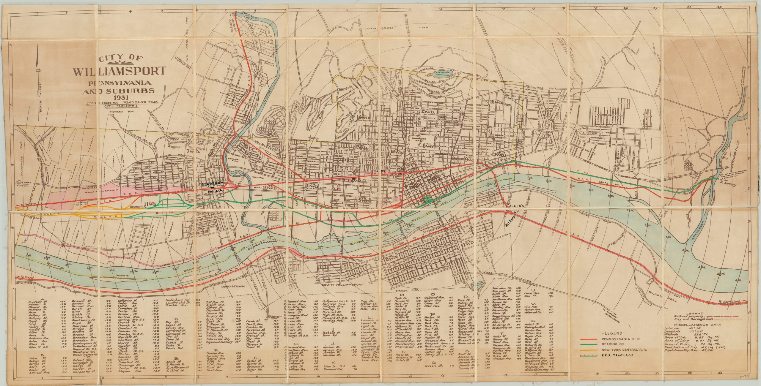
City of Williamsport Pennsylvania and Suburbs
City plan and street index of Williamsport, PA with bright color added by hand.
Out of stock
Description
This map of Williamsport, Pennsylvania was designed by city engineer Lyon Mussina in 1935 and shows a detailed overview of the city on the banks of the Susquehanna River in the prewar period. Streets, large property owners, parks, local industries and other places of interest are individually labeled and a comprehensive street index has been provided in the lower left, which corresponds to the grid system found within the map’s borders. Contemporary statistics such as population, elevation, and geographic coordinates can be seen in the lower right.
This particular example of the map has been customized for use by the Central Engineering Department of the Pennsylvania Railroad. The map has been dissected and mounted on linen, while bright color (applied by hand) denotes railroad property and track ownership across the city as of the early 1950’s. A custom legend has been added to the lower right to identify the lines of the primary operators; the Penn, Reading, and New York Central Railroads. Additional notes in manuscript identify the locations of freight stations, passenger stations, and connecting destinations.
Map Details
Publication Date: 1935
Author: Lyon S. Mussina
Sheet Width (in): 34.50
Sheet Height (in): 17.50
Condition: B
Condition Description: Dissected into 24 panels and mounted on linen with original black covers. Moderate toning visible in the upper right and left panels, as well as a 2" strip along the bottom of the sheet. This is likely from offsetting due to the adhesive used to affix the panels to the linen. A few panels show some waviness, but otherwise the wear is minimal.
Out of stock

