City of San Bernardino Zoning Map
$300.00
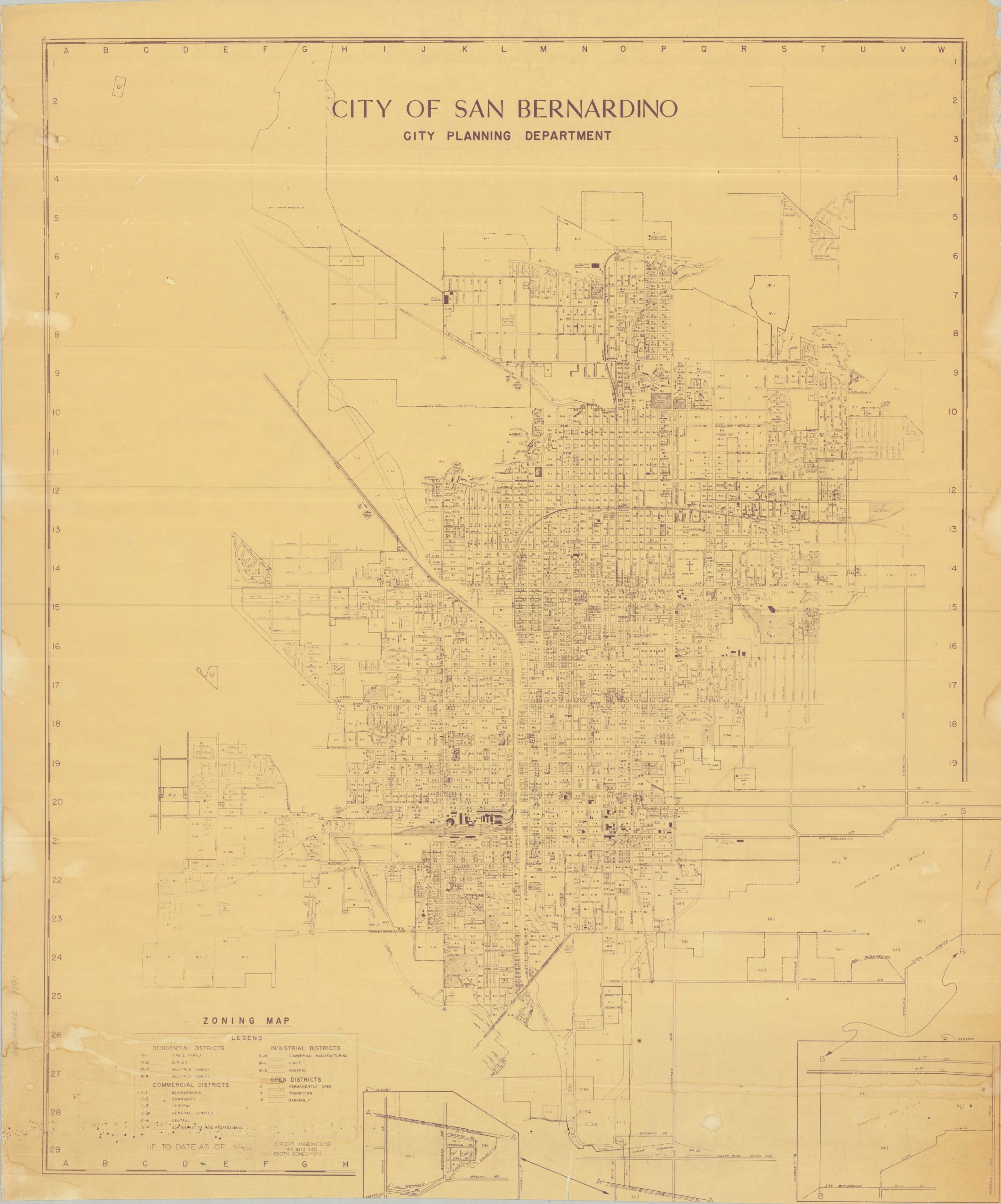
An uncommon zoning map of San Bernardino, prior to the Fair Housing Act of 1968.
1 in stock
Description
This finely detailed zoning map of San Bernardino was published by the City Planning Department in 1963. Various levels of residential, industrial, commercial, and open districts are noted throughout the image. Dozens of buildings are labeled throughout. Features of interest include Norton Air Base, large ATSF railway yards, expanding suburbs, and the first McDonald’s (unlabeled, but located at 1398 North E Street).
In the second half of the 20th century, San Bernardino utilized exclusionary zoning and redlining to concentrate minority populations in the city’s Westside, effectively separating them from the white, middle-class developments to the north and east. Industrial zoning was frequently placed adjacent to Black and Latino neighborhoods, which depressed property values and exposed residents to environmental hazards while protecting the residential character of predominantly white neighborhoods. These policies were reinforced by restrictive covenants and the construction of interstates, which physically bisected minority communities and limited their access to the city’s expanding economic hubs.
Map Details
Publication Date: 1963
Author: San Bernardino City Planning Department
Sheet Width (in): 28.50
Sheet Height (in): 34.00
Condition: B-
Condition Description: Heavily worn blueprint-style plan, with moderate damp staining in the margins, scattered wrinkling, and a 2" closed tear in the lower center (repaired on verso). Scatted spotting and small marginal tears, but the image remains legible and in between fair and good condition.
$300.00
1 in stock