City of New York Office of Civil Defense Highway Map Civil Defense Routes
$195.00
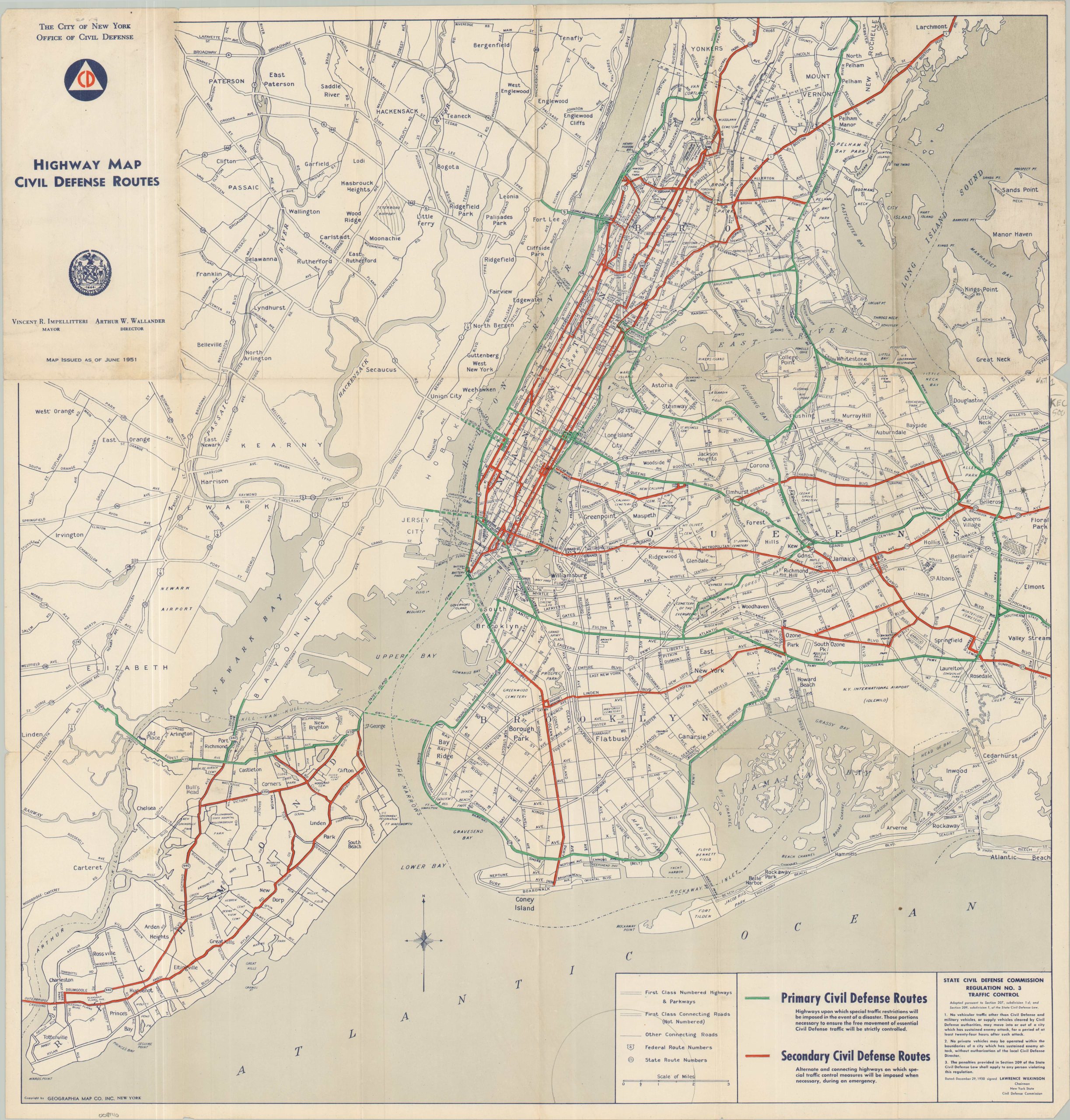
Mapping a worst case scenario during the Cold War.
1 in stock
Description
In the late 1940s and early 1950s, the United States populace underwent a substantial psychological change. The pride and feelings of invincibility from victory in World War II gradually eroded to a ‘duck and cover’ state of readiness for nuclear conflict with the Soviet Union. The Federal Civil Defense Act of 1950 created a framework for national defense, establishing warning systems, evacuation plans, and tools for public education via joint responsibilities of federal, state, and local governments.
This map of Civil Defense Routes in New York City, published in June 1951, is an excellent example of the work of the Civil Defense Commission. Primary and secondary routes are highlighted in green and red, respectively. Rather than evacuation paths, these protected passages reflect avenues of restricted traffic so that medical supplies and military support can efficiently reach affected areas. Essentially, as outlined via text in the lower right, there was no mechanism for mass civilian evacuation in the event of an attack on Manhattan (at least for the first 24 hours). Also of note is the evident lack of coordination with New Jersey.
Map Details
Publication Date: 1951
Author: Geographia Map Company
Sheet Width (in): 23.75
Sheet Height (in): 24.75
Condition: B+
Condition Description: Single-sided folding map with moderate wear and small spots of separation at fold joints. Minor marginal wear, including some light toning and a few small tears. Good condition overall.
$195.00
1 in stock