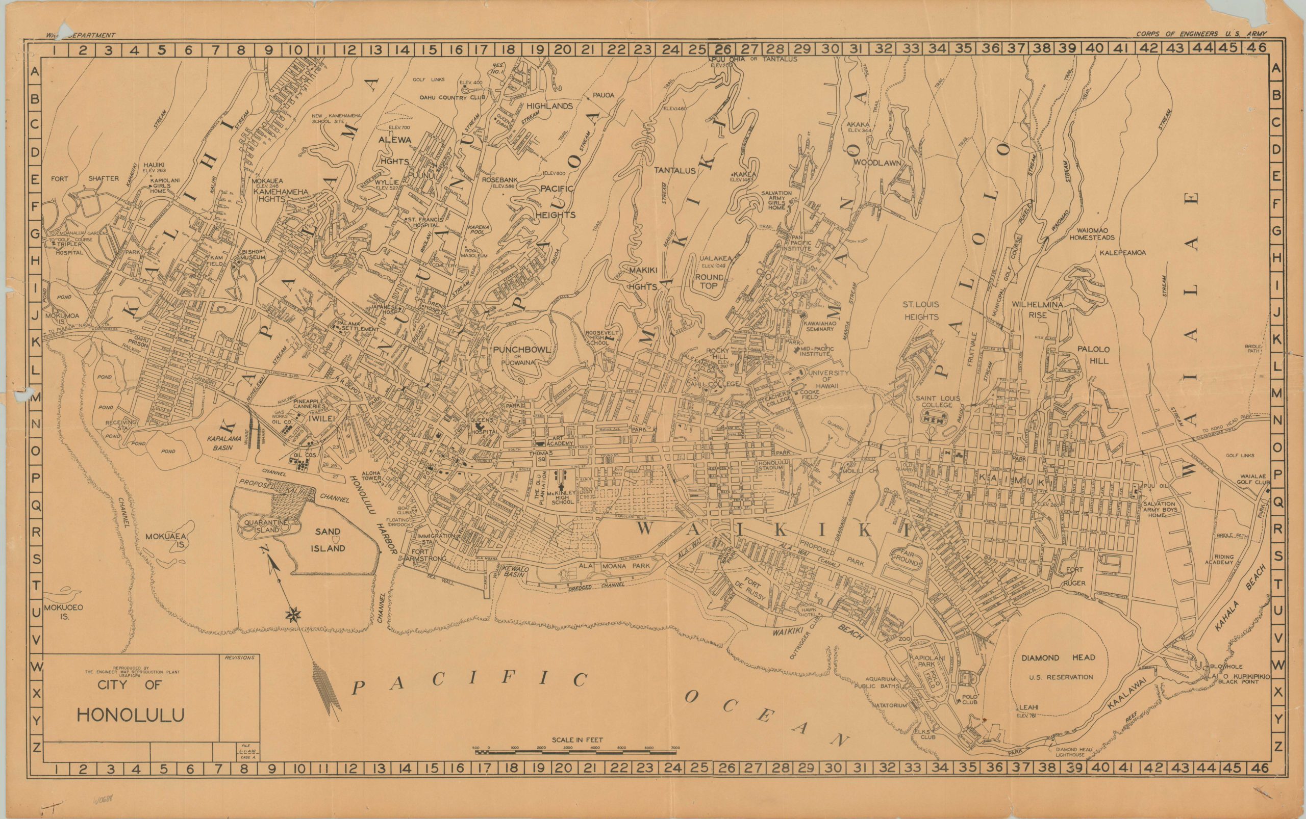
City of Honolulu
$145.00
Prewar map of Honolulu issued after the attack on Pearl Harbor.
1 in stock
Description
This detailed city plan of Honolulu, Hawaii was published around 1943 by the Map Reproduction Plant operated by engineers of the U.S. Army Forces in Central Pacific Area (USAFICPA). A base map, likely drafted in 1938 or 1939 based on the proposed Kalihi Channel, labels numerous streets, military installations, and important structures across the capital. Notable locations include the Japanese Hospital (renamed Kuakini Medical Center), Quarantine/Sand Island (used as an internment camp), and the Y.M.C.A. (converted into a USO center).
Map Details
Publication Date: c. 1944
Author: USAFICPA Map Reproduction Plant
Sheet Width (in): 28.1
Sheet Height (in): 17.6
Condition: B+
Condition Description: Several small chips, holes, and tears around the outer edges of the sheet, with minor loss of text on the left side of the page. Light creasing and some wrinkling along old fold lines. Good to very good overall. Blank on verso.
$145.00
1 in stock

