
City of Des Plaines
$75.00
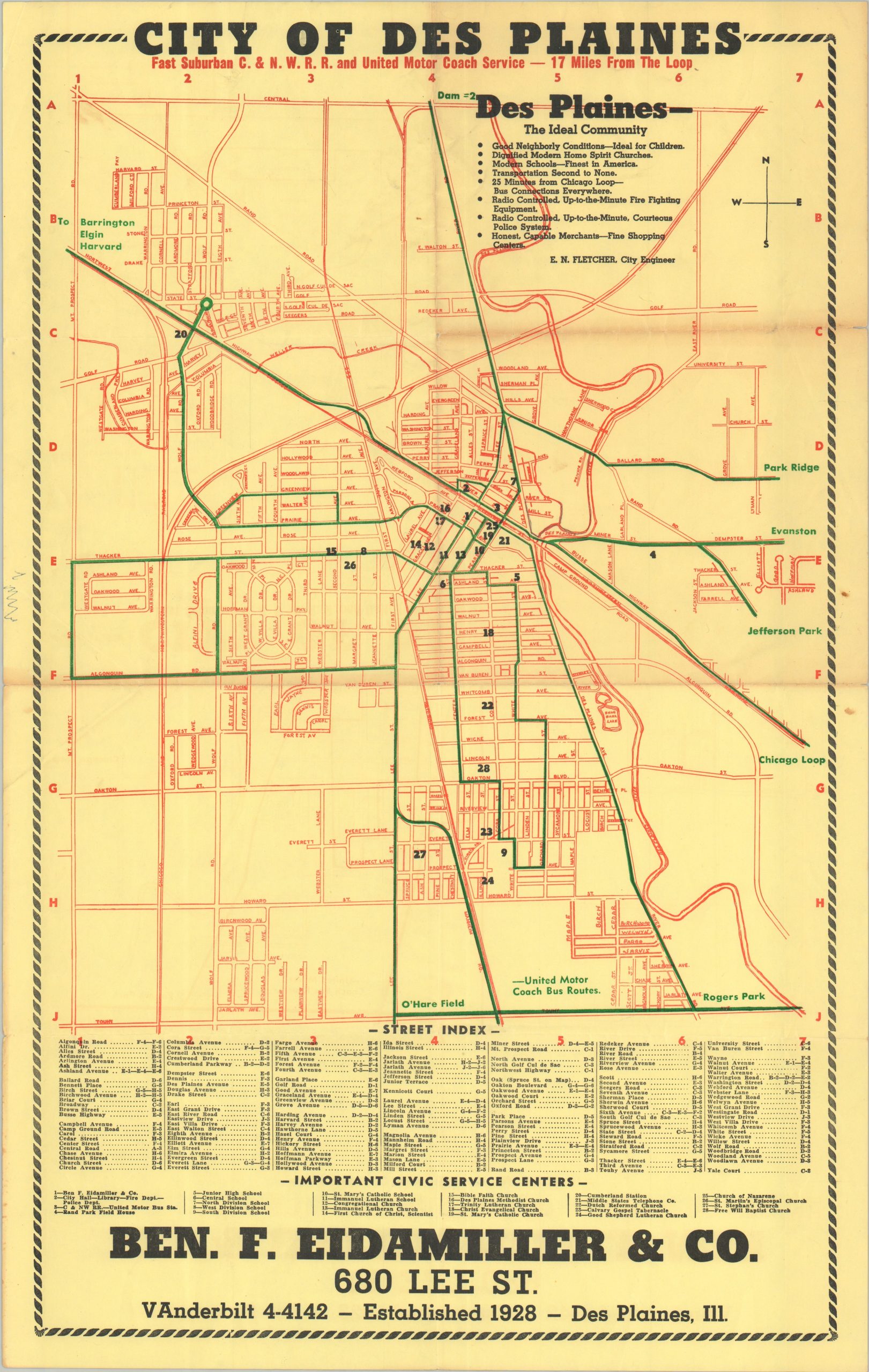
An interesting mid-century city plan of Des Plaines, Illinois.
1 in stock
Description
This straightforward street plan of Des Plaines, Illinois (billed as ‘The Ideal Community’) reflects the growth of Chicago’s suburbs in the years following World War II. Nearly 30 different locations of interest (schools, churches, public buildings, etc.) are numbered throughout the image and identified near the bottom of the sheet. Immediately above is an alphabetical street index. Dark Green lines emphasize the primary routes into and out of the city, with labels indicating nearby destinations around northwest Chicago.
Undated, but a 1946 city director identifies E.M. Fletcher as the City Engineer and O’Hare Field is mentioned (renamed in 1949), so a publication date of c. 1950 seems probable. Sponsored by Ben F. Eidamiller & Company, a local real estate brokerage.
Map Details
Publication Date: c. 1950
Author: E.N. Fletcher
Sheet Width (in): 14.00
Sheet Height (in): 21.90
Condition: B+
Condition Description: Single-sided map printed on yellow paper with color overprinting. Moderate wear along old folds, including evident toning in the upper right corner. Good condition overall.
$75.00
1 in stock