
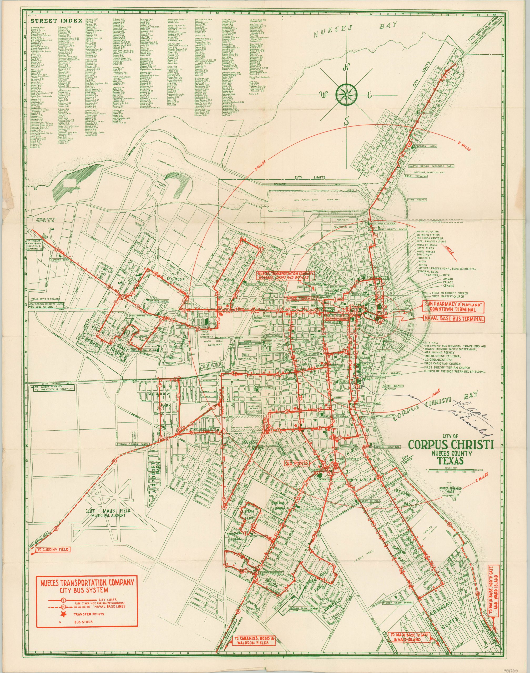
City of Corpus Christi Nueces County Texas
Postwar transportation map of Corpus Christi, Texas highlighting the wartime growth of the city.
Out of stock
Description
This colorful city plan of Corpus Christi, Texas, shows the various transportation routes available to residents and cadets of the nearby naval base. Stops, transport lines, and route numbers are also helpfully provided, where applicable. The underlying base map shows a detailed street grid where important buildings, public spaces, schools, churches and other locations of interest are individually labeled. An accompanying street index is provided in the upper right.
The verso features numerous paragraphs of text and photographs praising the city and its amenities. “It led all Texas cities in percentage of war-time growth, and according to census authorities, is one of six American cities with ‘the best chances’ to retain, and continue, war-time gains.”
The map was designed and published locally by Porter Regenold Maps and was issued on behalf of the Nueces Transportation Company, a predecessor to the Corpus Christi Regional Transportation Authority.
Map Details
Publication Date: c. 1948
Author: Porter Regenold
Sheet Width (in): 16.90
Sheet Height (in): 21.50
Condition: A-
Condition Description: Originally issued folded into 12 panels. Minor wear and creasing along fold lines, consistent with age, and old ink writing just above the title. Some discoloration and additional manuscript ink on the verso. Remains in very good condition overall.
Out of stock