China Regnum
Original price was: $225.00.$175.00Current price is: $175.00.
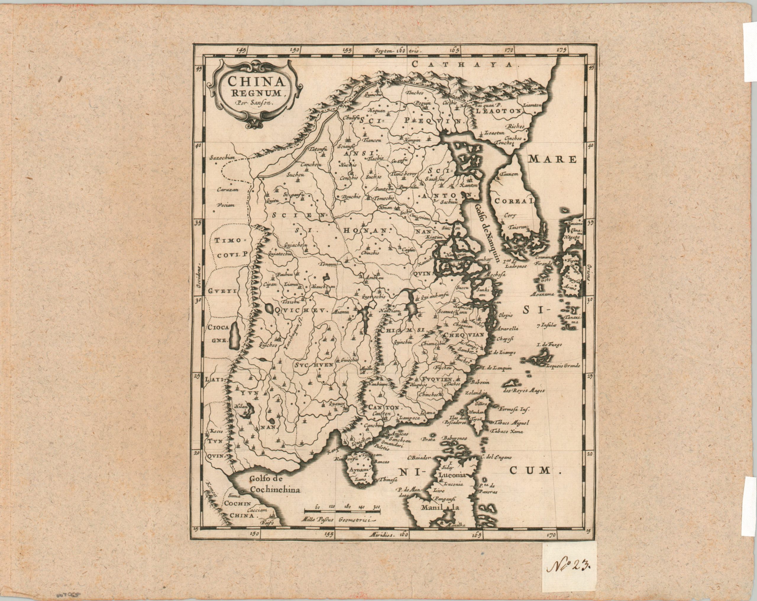
An uncommon 17th century map of China that shows Korea as a peninsula.
1 in stock
Description
This fascinating and scarce map of China was published, probably in 1679, in an atlas by Guillaume Sanson, using the cartographic basis established by his father over two decades earlier. The image shows a largely insular China under the Qing Emperor, protected by mountains and the Great Wall along the northern border. European interaction was limited largely to the port of Canton, visible in the lower center, though regional markets at Macao and Manila flourished. Various geographic features and settlements are labeled, based largely on Jesuit sources. Of particular interest is the depiction of Korea as an island.
Map Details
Publication Date: c. 1679
Author: Nicholas Sanson
Sheet Width (in): 7.75
Sheet Height (in): 9.4
Condition: B+
Condition Description: Single copperplate engraved sheet with trimmed margins and mounted onto an old sheet of thick laid paper. Manuscript page number in the lower right indicates it was formerly part of a composite atlas. A few marginal tears and some light wear, consistent with age. Good condition overall.
Original price was: $225.00.$175.00Current price is: $175.00.
1 in stock