Chicagoland Before 1850
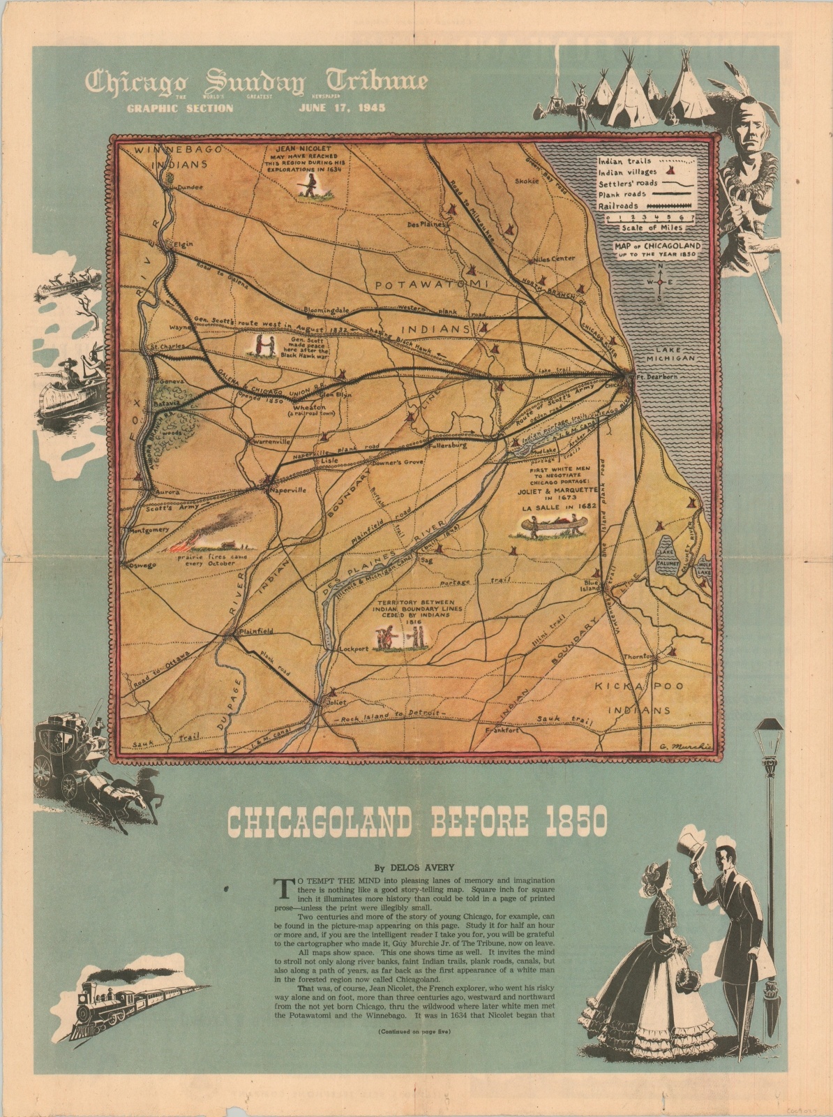
“Two centuries and more of the story of young Chicago, for example, can be found in the picture-map of Chicago appearing on this page.”
Out of stock
Description
This charming pictorial map of Chicago was issued in the June 17, 1945 issue of the Chicago Sunday Tribune, with an accompanying article by Delos Avery. His prose, from which the quote above was taken, outlines the idealized early history of the Second City on Lake Michigan’s shore. Commentary on local transportation, the cost of living, and real estate speculation references the map on numerous occasions.
It was drawn by Guy Murchie, Jr. a talented author, pilot, and war correspondent – one of the first Americans in that role to be wounded in World War II. He joined the Tribune in 1934, and although he left in 1942, the accompanying text describes him as ‘on leave.’ His map is drawn in a relatively amateurish style, likely earlier in his career, and includes Native American villages, transportation routes, and several illustrated vignettes highlighting major historic events.
Map Details
Publication Date: 1945
Author: Guy Murchie
Sheet Width (in): 15.5
Sheet Height (in): 20.8
Condition: A-
Condition Description: Horizontal and vertical creases and two holes in the bottom margin. Very good overall.
Out of stock