Chicago
$100.00
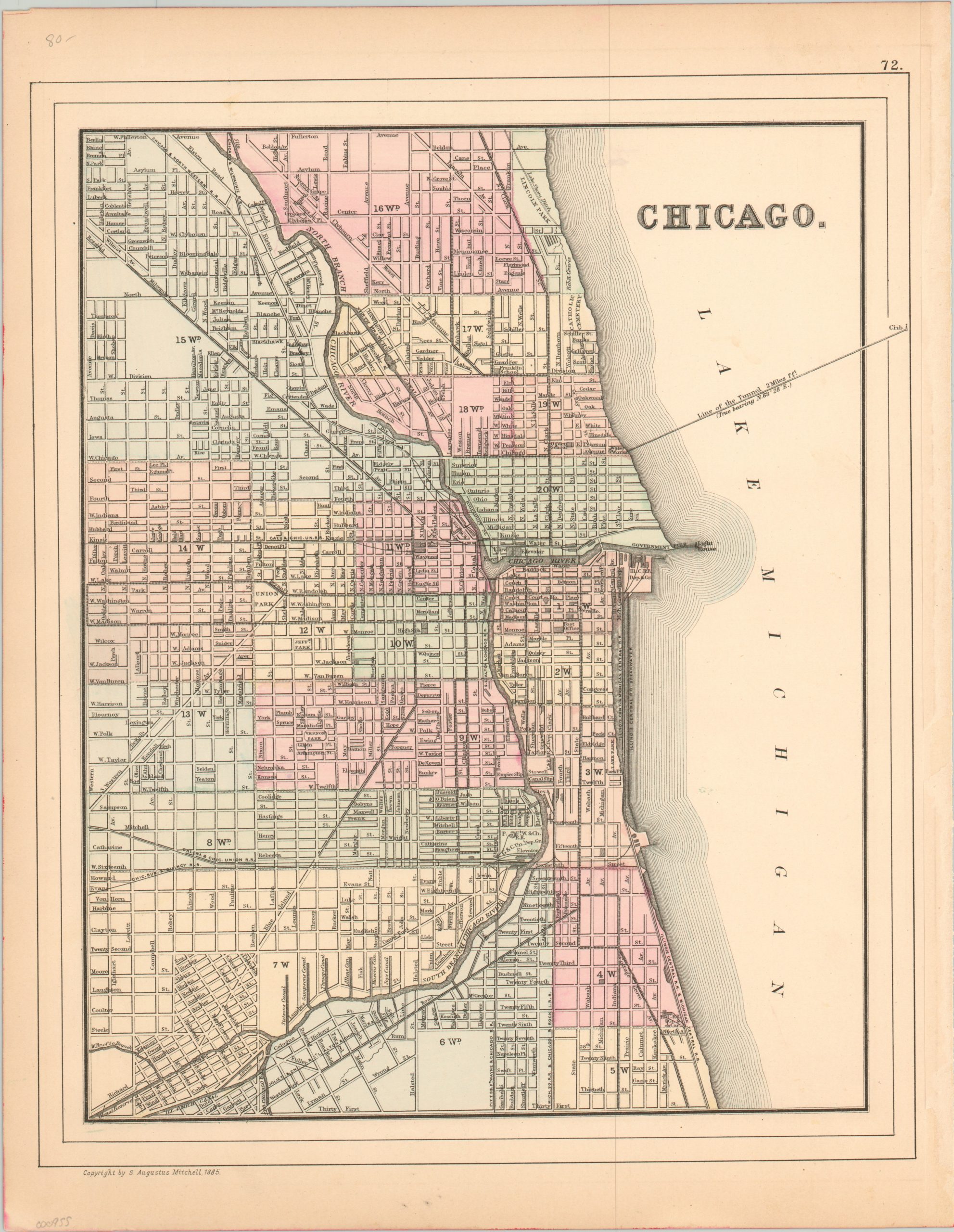
Lovely example of Mitchell’s 1885 map of Chicago.
Description
This is a detailed city plan of Chicago, Illinois, published by Samuel Augustus Mitchell in 1885. It’s colored by wards and shows the city just a little over a decade since the fire that devastated much of the downtown and north side.
The breakwater and trellis track of the Illinois Central Railroad, along with the two mile water crib can be seen along the shores of Lake Michigan. Railroad depots and gigantic grain elevators can be seen adjacent to the Chicago River, which extends south to connect to the Illinois & Michigan Canal.
The harmony between water and rail transportation visible within the map propelled Chicago to the fastest growing city of the 19th century.
Map Details
Publication Date: 1885
Author: Samuel Augustus Mitchell
Sheet Width (in): 11.90
Sheet Height (in): 15.00
Condition: A-
Condition Description: Minor toning around the edges and a few small faint spots in the margins and Lake Michigan. Otherwise near fine, with lovely hand color.
$100.00

