Chicago World’s Fair Bigger, Better, Newer 1934
Bold map of the Century of Progress Fairgrounds promoting travel along the Illinois Central Railroad.
Out of stock

Description
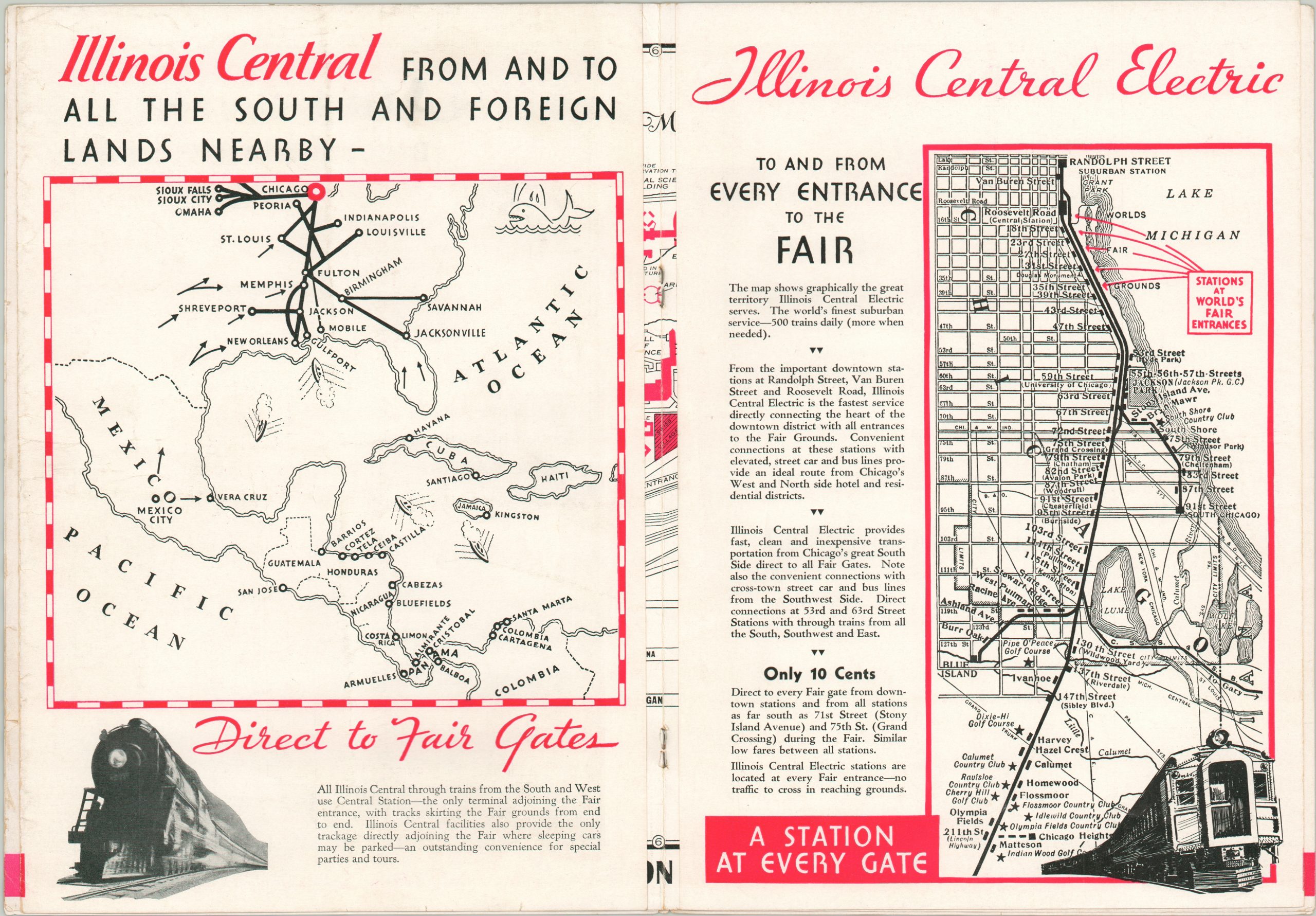
The Illinois Central Railroad has enjoyed a significant presence in Chicago ever since the city granted right of way to build a trestle bridge along Lake Michigan in 1852. The huge warehouses and grain elevators served by the line would be a staple of the Chicago riverfront for decades to follow.
As Chicago’s physical footprint grew into Lake Michigan, the tracks that were formerly running over the water became landlocked, where they remain in operation to this day. The fortuitous location of the tracks allowed the IC to operate as one of the primary transportation providers for visitors to the 1933 World’s Fair held along Chicago’s Lakefront, between Grant Park and 35th Street.
Red ink is used to bold effect on this map of the grounds, which highlights the convenience of the numerous Illinois Central stations as well as the primary buildings and exhibits of the fair. The success of the Century of Progress Exposition was such that organizers extended it into 1934, when this map was published; advertising for a “Bigger, Better, [and] Newer” fair, compared to the year prior.
Map Details
Publication Date: 1934
Author: Rand McNally
Sheet Width (in): 30.90
Sheet Height (in): 11.00
Condition: B+
Condition Description: The map was issued as a centerfold in a six page promotional pamphlet to the World's Fair. There is slight wear around the edges and creasing along the fold lines. The covers of the booklet are worn and faded, but the stapled binding is strong and intact. A bit of offsetting present from the red ink, but it does not affect the map.
Out of stock