Chicago & West Towns Railways Inc
$95.00
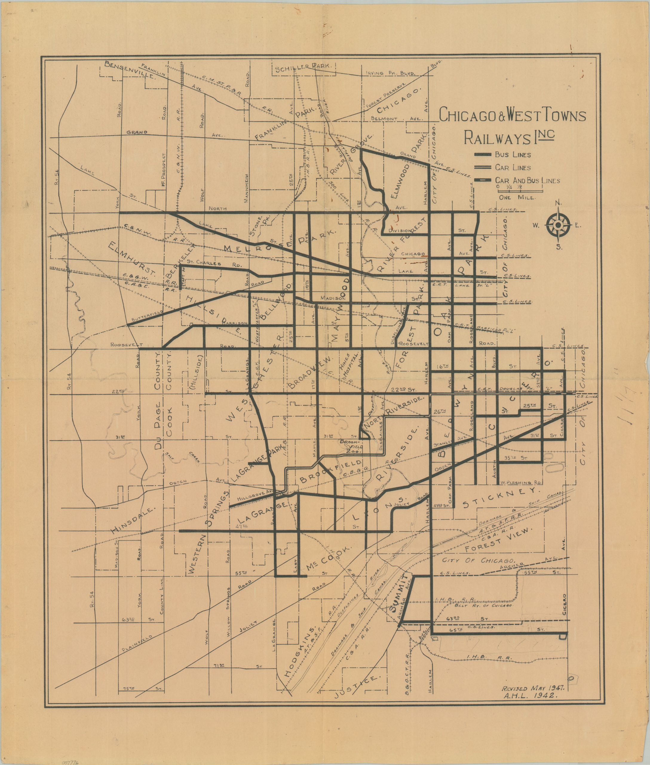
The death of the streetcar in the western Chicago suburbs.
1 in stock
Description
This interesting map of the western Chicago suburbs outlines the various operational lines of the Chicago & West Towns Railway, Inc. in the years following World War II. Bus and streetcar routes are noted according to the legend in the upper right, though the latter would be totally phased out the year after publication (1948). Accessible features of interest include the Brookfield Zoo, Riverside, Chicago & Sanitary Ship Canal, Hawthorne Race Track, and much of the Cook County Forest Preserves.
Map Details
Publication Date: 1947
Author: Chicago and West Towns Railway Co.
Sheet Width (in): 19.75
Sheet Height (in): 23.00
Condition: B+
Condition Description: Blueprint-style printed map with moderate ink smudging visible in several areas around the outer edges of the sheet and in the upper right corner. A few rusty staple marks visible in the upper center of the image. Creased along old folds and in the corners. Good condition overall.
$95.00
1 in stock