Chicago Tribune Maps
How did we get here (in 1965)?
Out of stock


Description
“The first portion of this supplement is atlas-like, in the whole world is covered before “problem areas” are shown. The news maps that make up the second portion have been revised to keep abreast of the times. This special section will be a valuable adjunct to The Weekly Report, which features news maps as an essential part of explaining current events.” – pg 5.
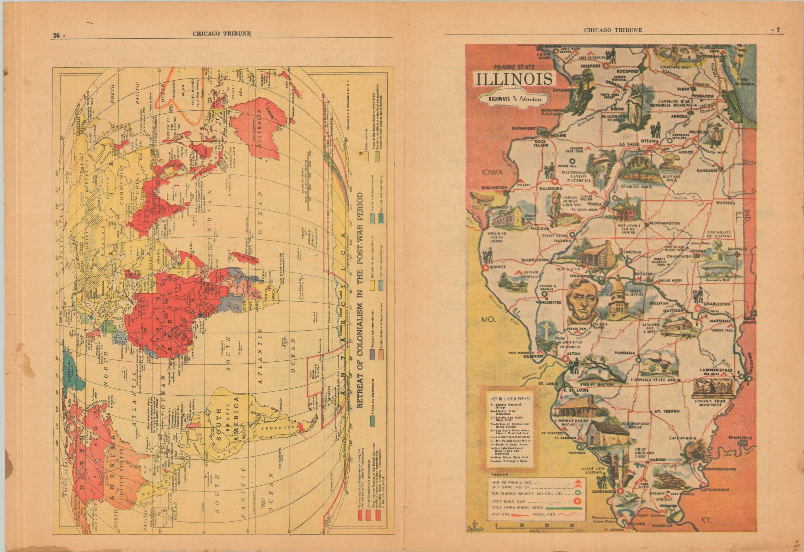
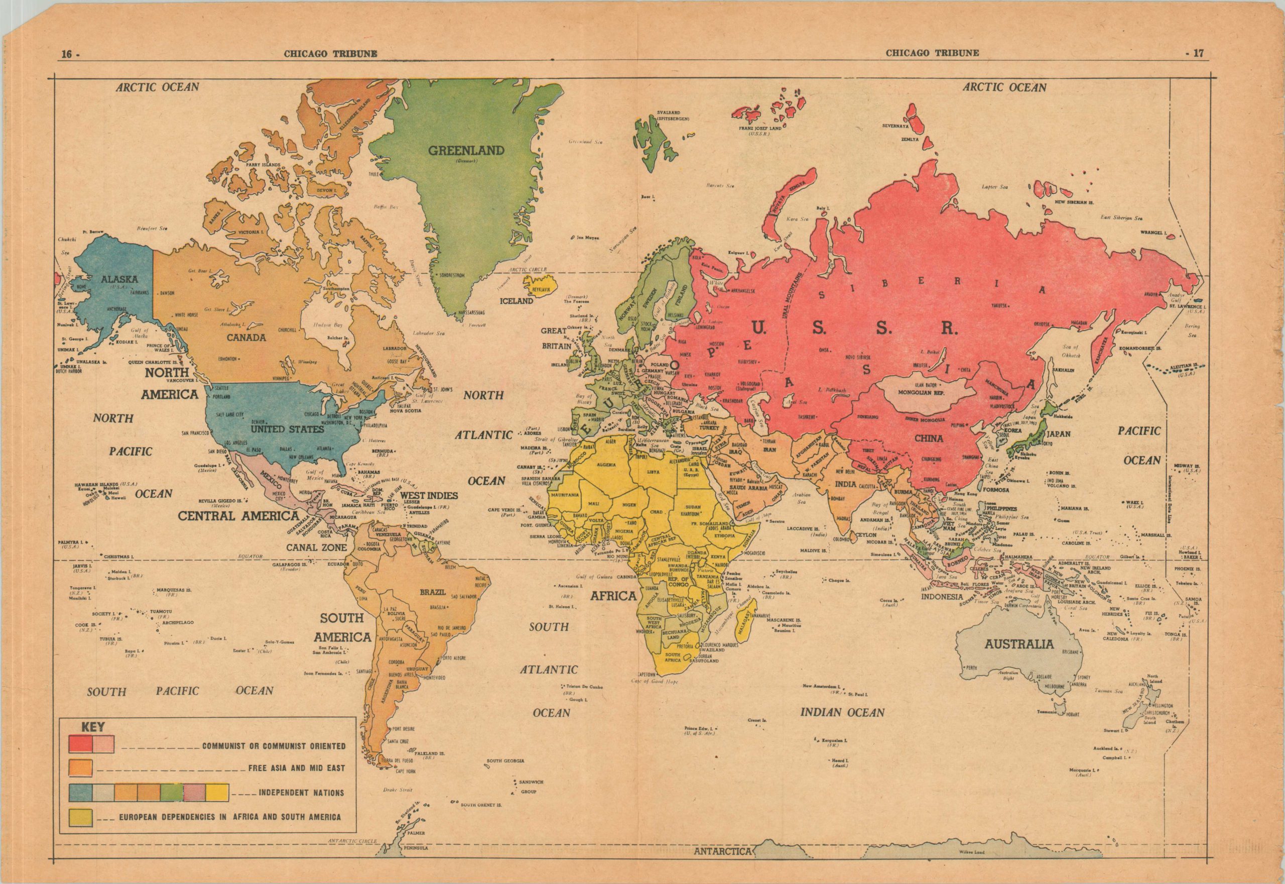
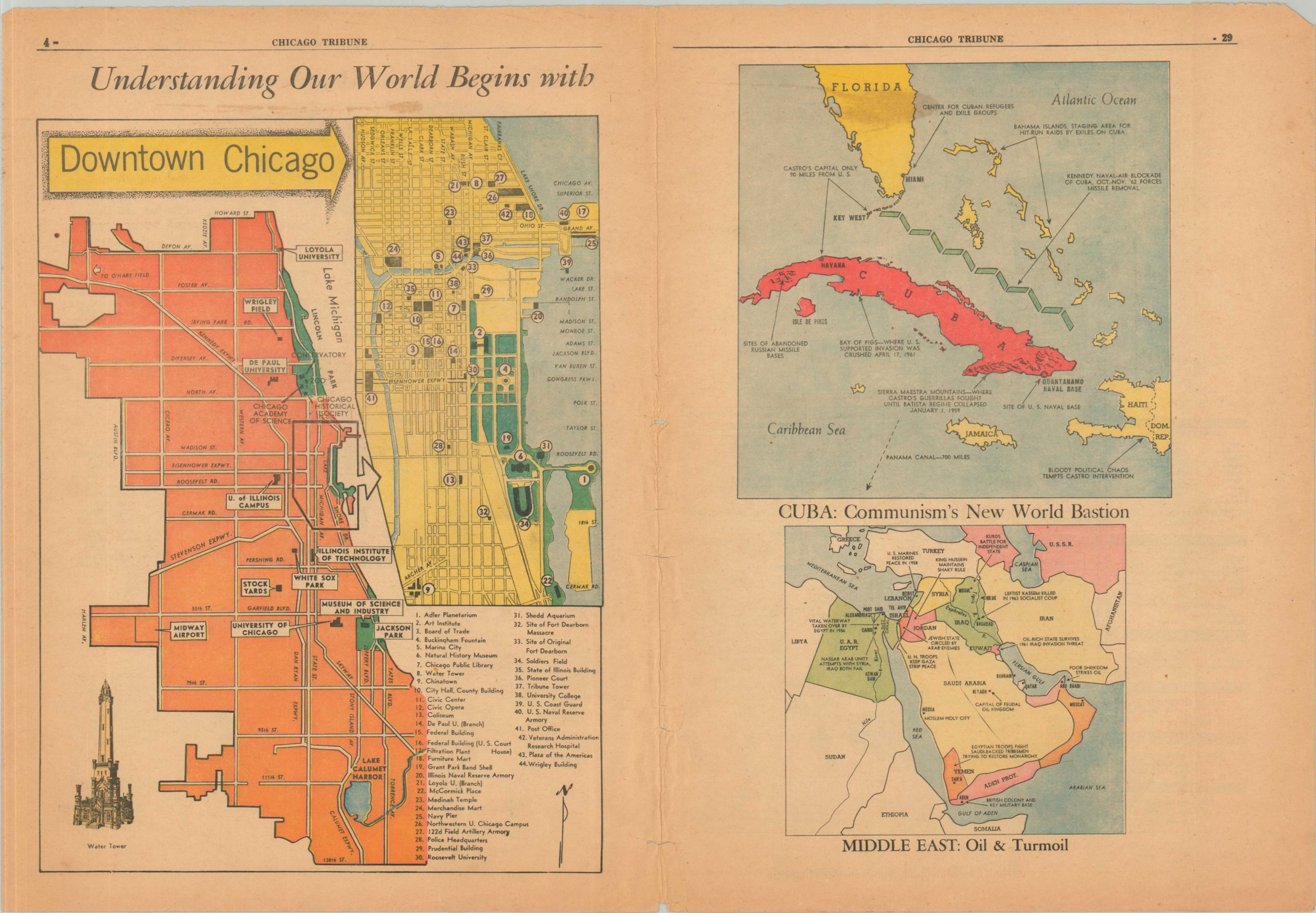
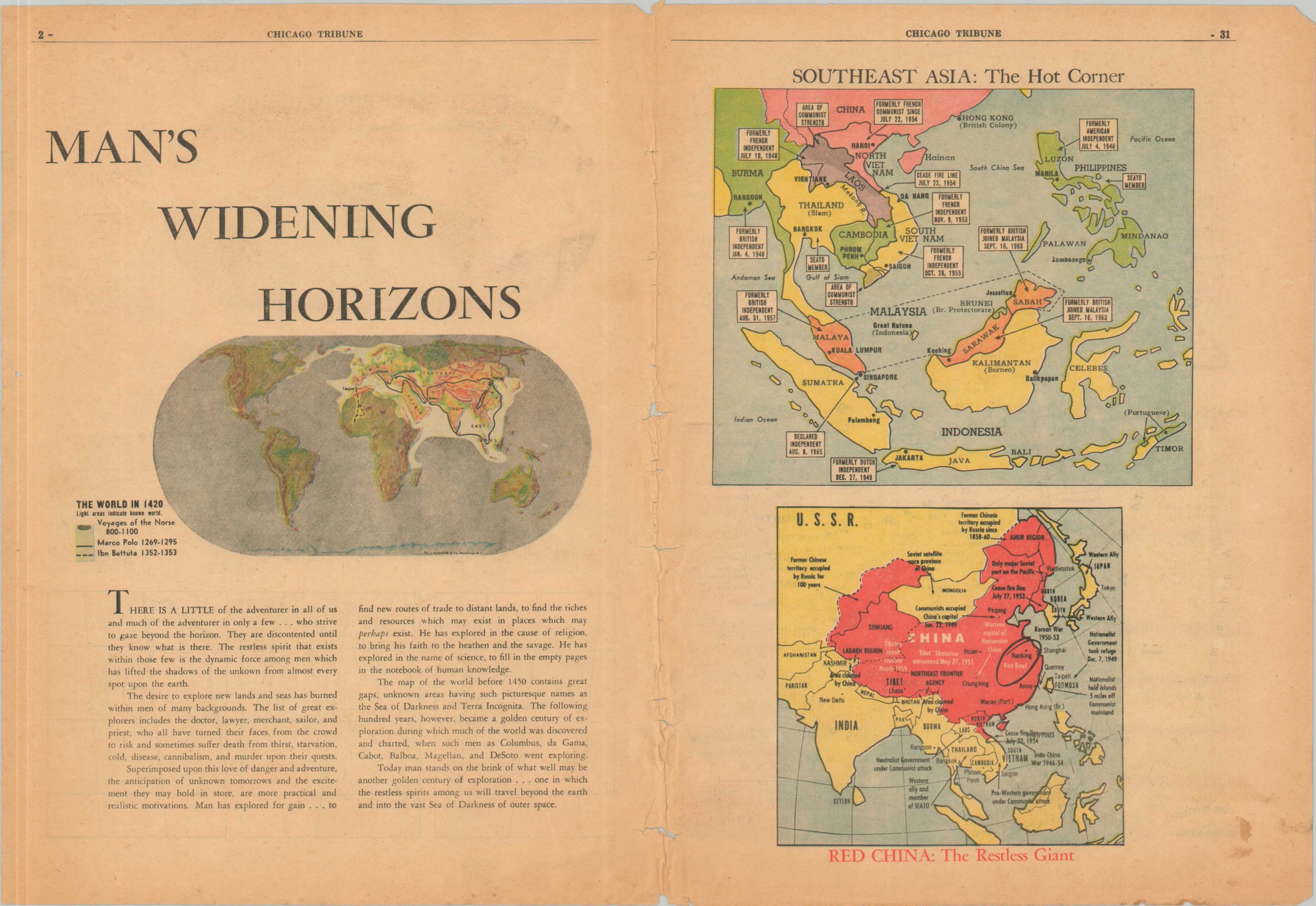
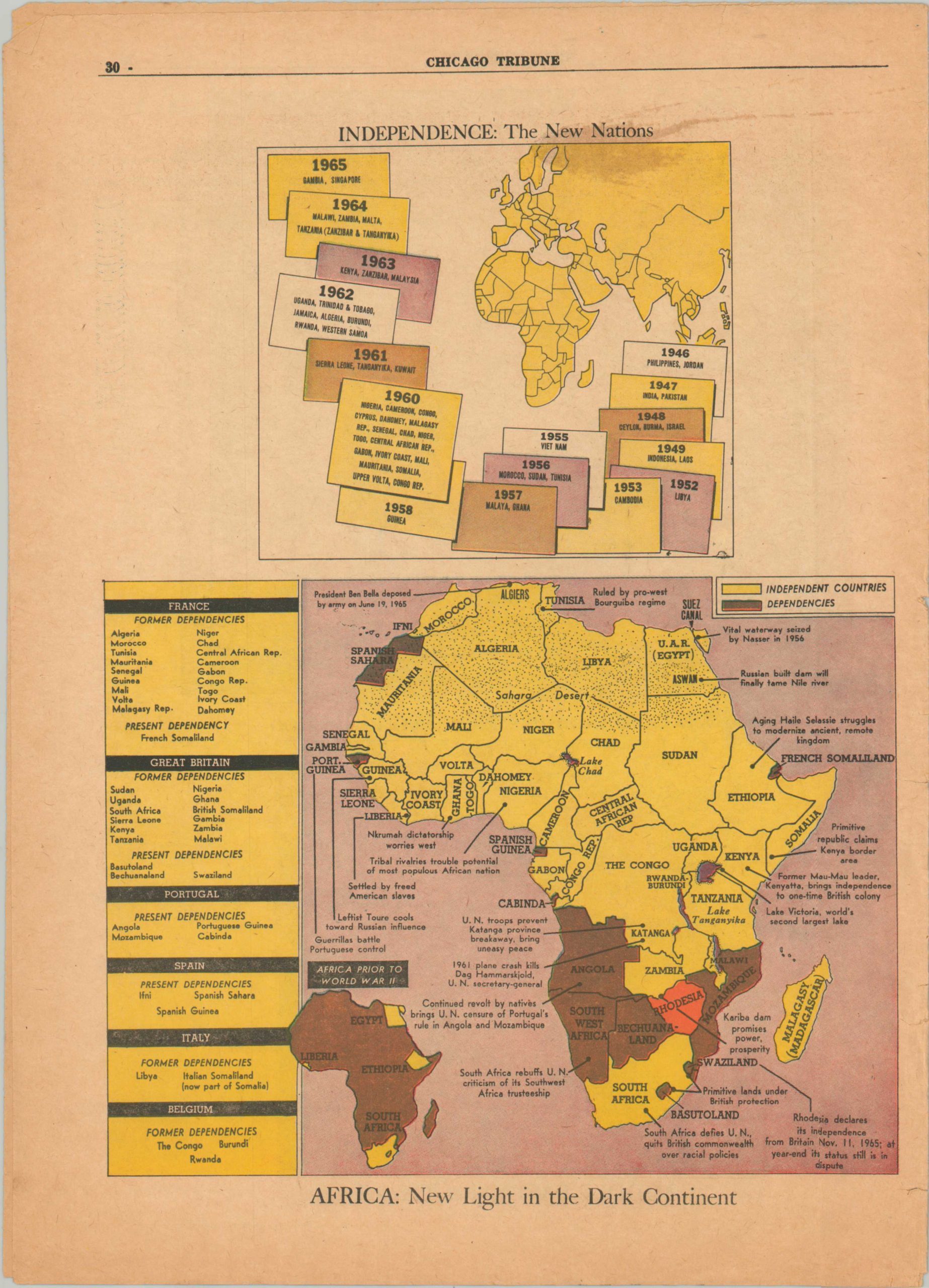
This interesting cultural/historical/political atlas was prepared by the Educational Services Department of the Chicago Tribune and published as a Special Section in 1965. Over two dozen different maps across 32 pages present a snapshot of contemporary interests ranging from the local (plans of Chicago) to the global (maps of India, Vietnam, and world trade).
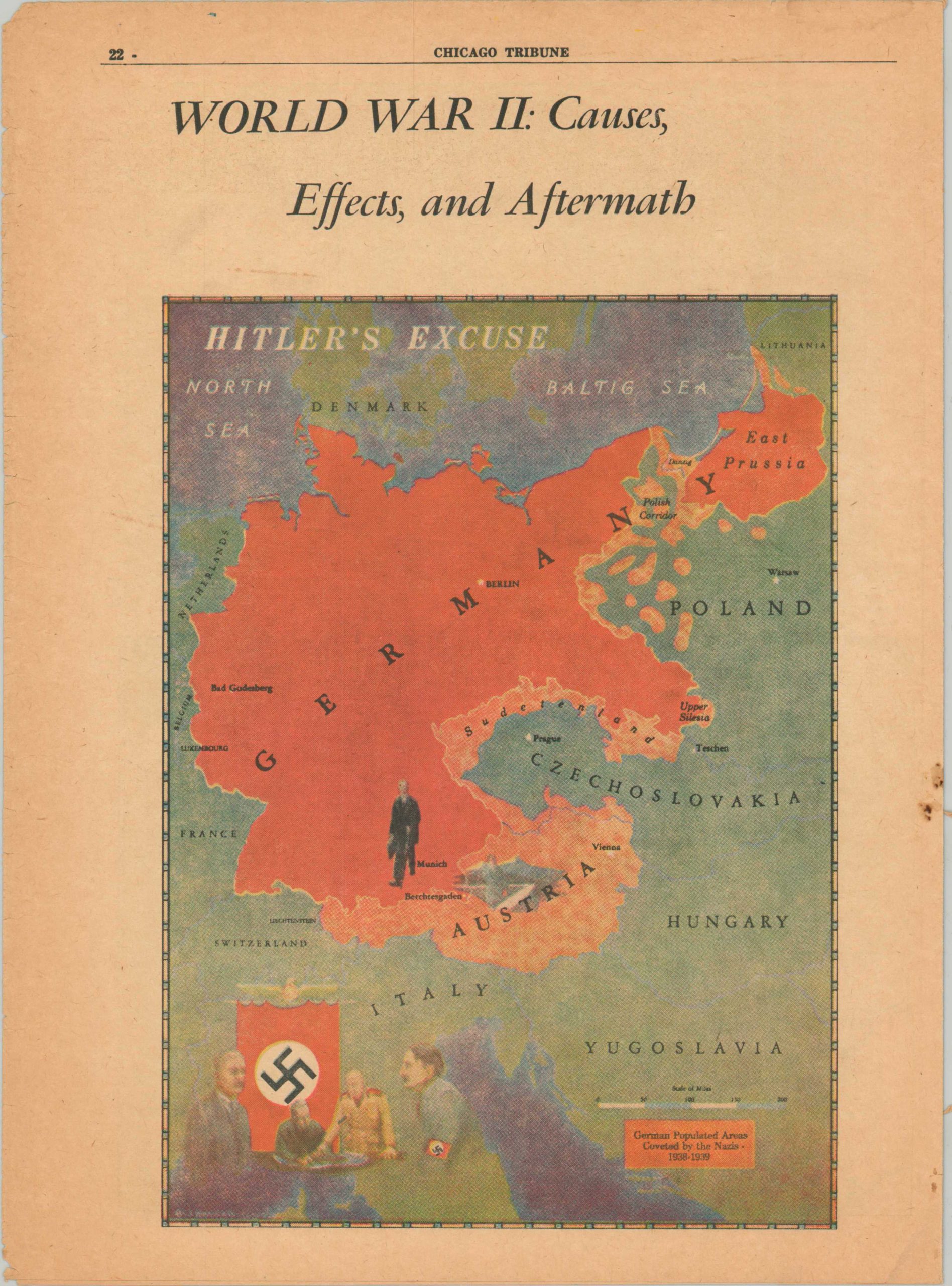
The contents begin with ‘Man’s Widening Horizons’ and the Age of Exploration and conclude with Red China: The Restless Giant and a physical map of the Indochinese Peninsula. Of notable interest is the inclusion of Race & Religion: The Divisions of Man – a nonsensical chart promoting scientific racism during the Civil Rights movement.
Map Details
Publication Date: 1965
Author: Chicago Tribune Educational Services Department
Sheet Width (in): 10.5
Sheet Height (in): 14.25
Condition: B
Condition Description: 32 page color atlas printed on news sheet. Misfolded along the spine, resulting in heavy wear and toning along the vertical centerfold. Some minor paper loss, though the effect to the maps is minimal. Several edge tears and spots of wear as a result of age, use, and fragile paper. Better than fair, but not quite good condition overall.
Out of stock