Chicago Transit Map
One of the first maps of the CTA ever published.
Out of stock
Description
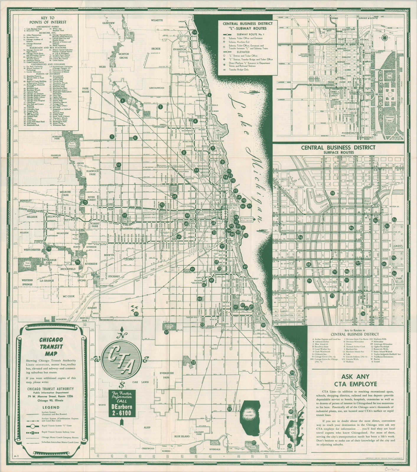
Organized in 1945, the Chicago Transit Authority was tasked with acquiring and overhauling the city’s disparate system of surface lines and elevated rails. Numerous operators had become mired in bankruptcy as a result of the Great Depression, and corruption, inefficiencies, and redundancy plagued the system. The organization really took off after it acquired the property of the Chicago Rapid Transit and Chicago Surface Lines in 1947.
This map was published the following year and highlights how rapidly the CTA was able to coalesce the haphazard network into a (relatively) unified transit system. Despite their best efforts, the map still presents a myriad of transportation options stretching to nearly every corner of the city. Dozens of locations of interest are identified and numbered within the image, while text in the lower right and on the verso attempts to make the audience comfortable with the new role of the CTA.
Map Details
Publication Date: 1948
Author: Chicago Transit Authority
Sheet Width (in): 17.5
Sheet Height (in): 19.9
Condition: A-
Condition Description: Light creasing and faint discoloration along former fold lines, with the latter most visible across a horizontal fold near the top third of the sheet. Very good overall.
Out of stock