
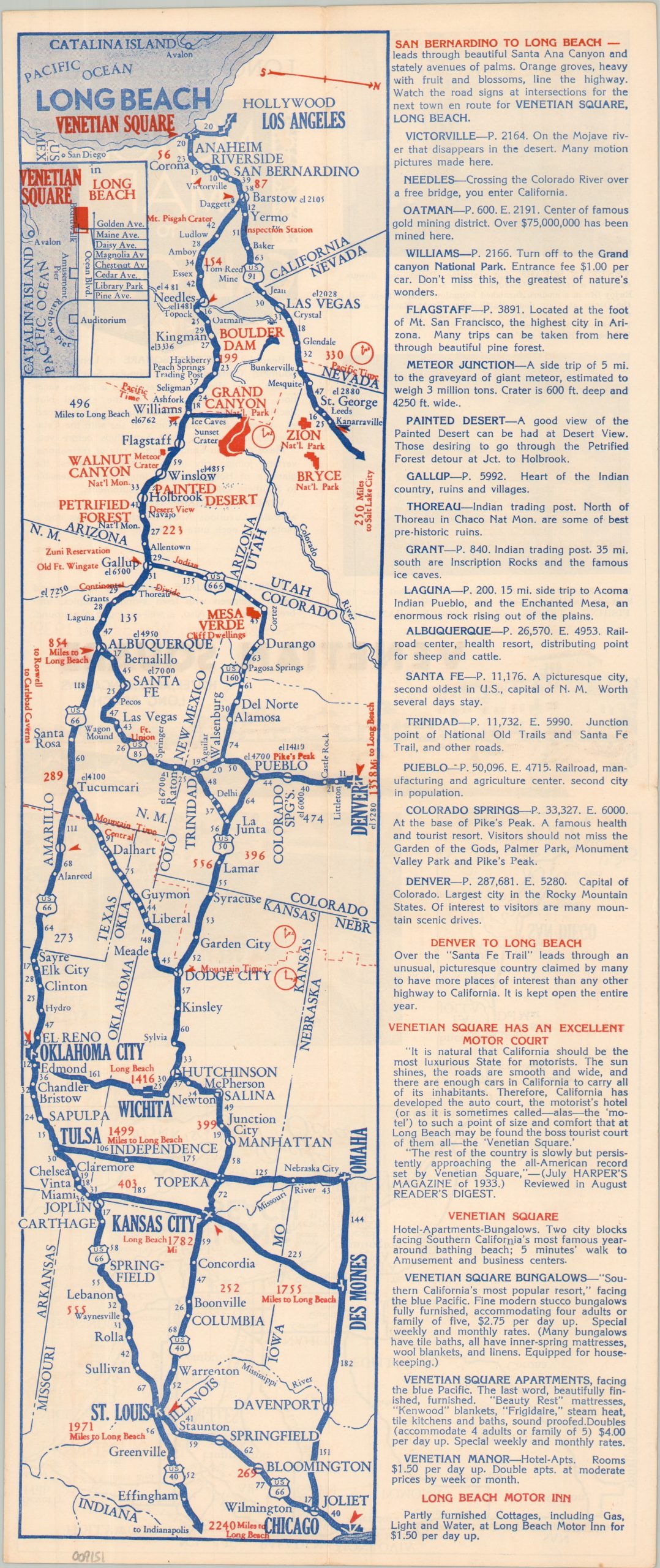
Chicago, St. Louis, Kansas City, Denver to Long Beach, Calif. Motor Map to California
$225.00
Take Main Street USA to Treasure Island for the 1939 World’s Fair!
1 in stock

Description
This rather intriguing map highlights the primary highways connecting Chicago and St. Louis with Southern California. Route 66 was likely the most popular, but by no means the only option, as portions of U.S. 40, 50, and 91 are also shown as viable thoroughfares to the Pacific Coast. Distances between points are noted and accompanying text summarizes a handful of the western towns within the image. The map was published in 1938 by the Venetian Square of Long Beach, the location of which is identified in an inset in the upper left corner.
The verso of the sheet offers two photos and additional information on the mix of hotels, apartments, and bungalows available, particularly to those interested in attending the upcoming 1939 World’s Fair in San Francisco. A simple road map of Southern California promises Gloriously Cool Summers and Delightful Tropical Winters.
Map Details
Publication Date: 1938
Author: Venetian Square
Sheet Width (in): 7.40
Sheet Height (in): 17.50
Condition: B+
Condition Description: Double-sided map brochure, folded into quarters with some moderate toning and wear along seams and the outer edges of the sheet. Good to very good condition overall.
$225.00
1 in stock