
[Chicago Motor Club Tour Packet – Chicago to New York]
$200.00
A 1930 road trip between America’s two largest cities.
1 in stock
![[Chicago Motor Club Tour Packet - Chicago to New York] - Image 2](https://curtiswrightmaps.com/wp-content/uploads/map_28.18x38.01_10-06-25_inv007659c-scaled.jpg)
![[Chicago Motor Club Tour Packet - Chicago to New York] - Image 3](https://curtiswrightmaps.com/wp-content/uploads/map_4.12x9.12_10-06-25_inv007659c-scaled.jpg)
![[Chicago Motor Club Tour Packet - Chicago to New York] - Image 4](https://curtiswrightmaps.com/wp-content/uploads/map_4.15x9.09_10-06-25_inv007659c-scaled.jpg)
![[Chicago Motor Club Tour Packet - Chicago to New York] - Image 5](https://curtiswrightmaps.com/wp-content/uploads/map_5.47x9.12_10-06-25_inv007659c-scaled.jpg)
![[Chicago Motor Club Tour Packet - Chicago to New York] - Image 6](https://curtiswrightmaps.com/wp-content/uploads/map_5.91x9.15_10-06-25_inv007659c-scaled.jpg)
![[Chicago Motor Club Tour Packet - Chicago to New York] - Image 7](https://curtiswrightmaps.com/wp-content/uploads/map_7.34x9.87_10-06-25_inv007659c-scaled.jpg)
Description
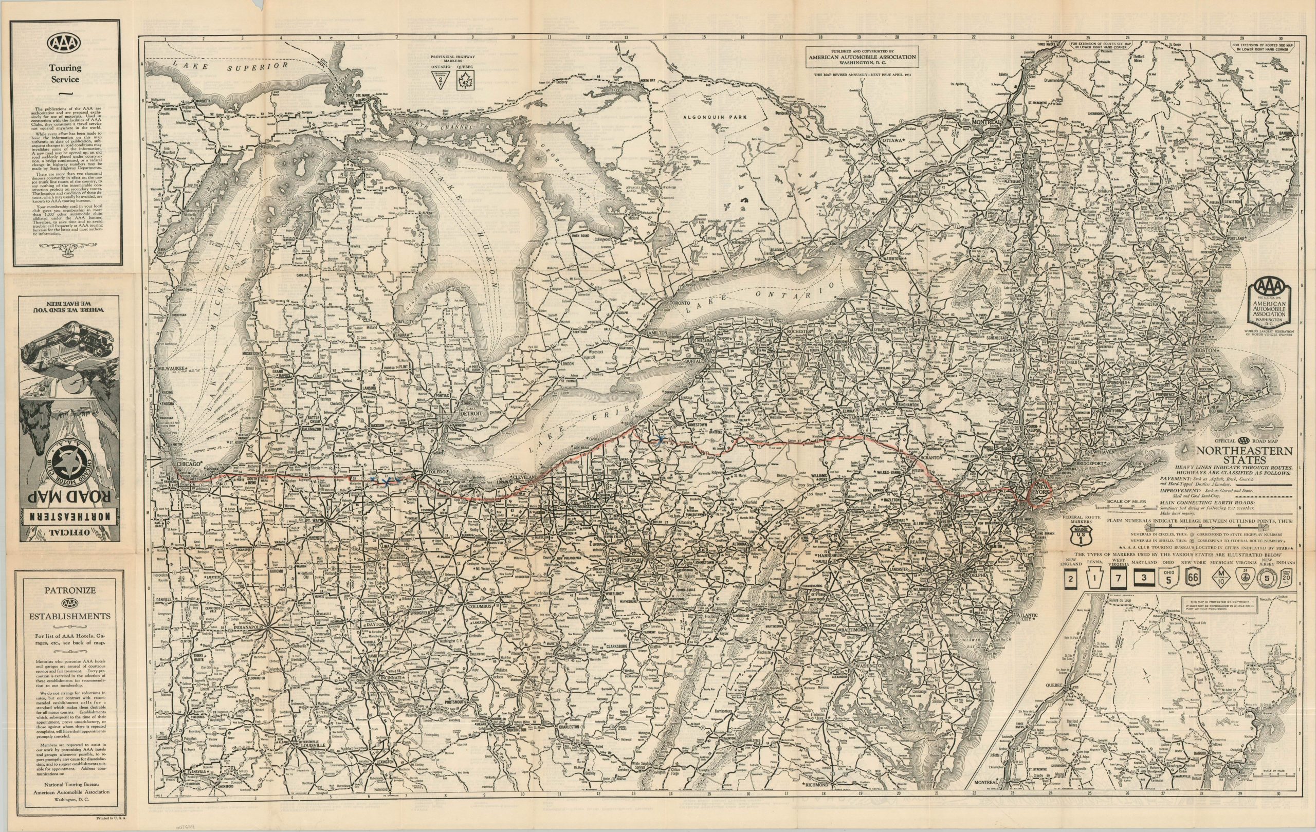
This collection of printed cartographic material was published in 1930 by the Chicago Motor Club (an affiliate of AAA) to direct its members on the most efficient route between Chicago and New York. Five double-sided route cards offer turn-by-turn directions, with distances between turns, cities, and landmarks noted. Two small-scale strip maps show portions of the route between Chicago and South Bend, and from Cleveland to Erie (though the entirety of the Chicago-New York is covered by the text).
The original brown paper envelope also includes a double-sided road map of the upper Midwest and the Northeastern United States. The customized route is highlighted in red pencil, with three blue X’s in northern Ohio. The verso provides a detailed list of recommended AAA hotels, a comprehensive index of towns and villages, and a small strip map of the Atlantic Yellowstone Pacific Highway.
Map Details
Publication Date: 1930
Author: Chicago Motor Club
Sheet Width (in): See Description
Sheet Height (in): See Description
Condition: A
Condition Description: Large double-sided folding map and six cardboard route cards (one duplicate) in original brown paper envelope. The covers show light wear and the route cards are moderately toned along the outer edges, consistent with age. Very good to near fine condition overall.
$200.00
1 in stock