Chicago Junction Railway The Chicago River & Indiana Railroad
$225.00
Moving freight through Chicago in the mid-20th century.
1 in stock
Description
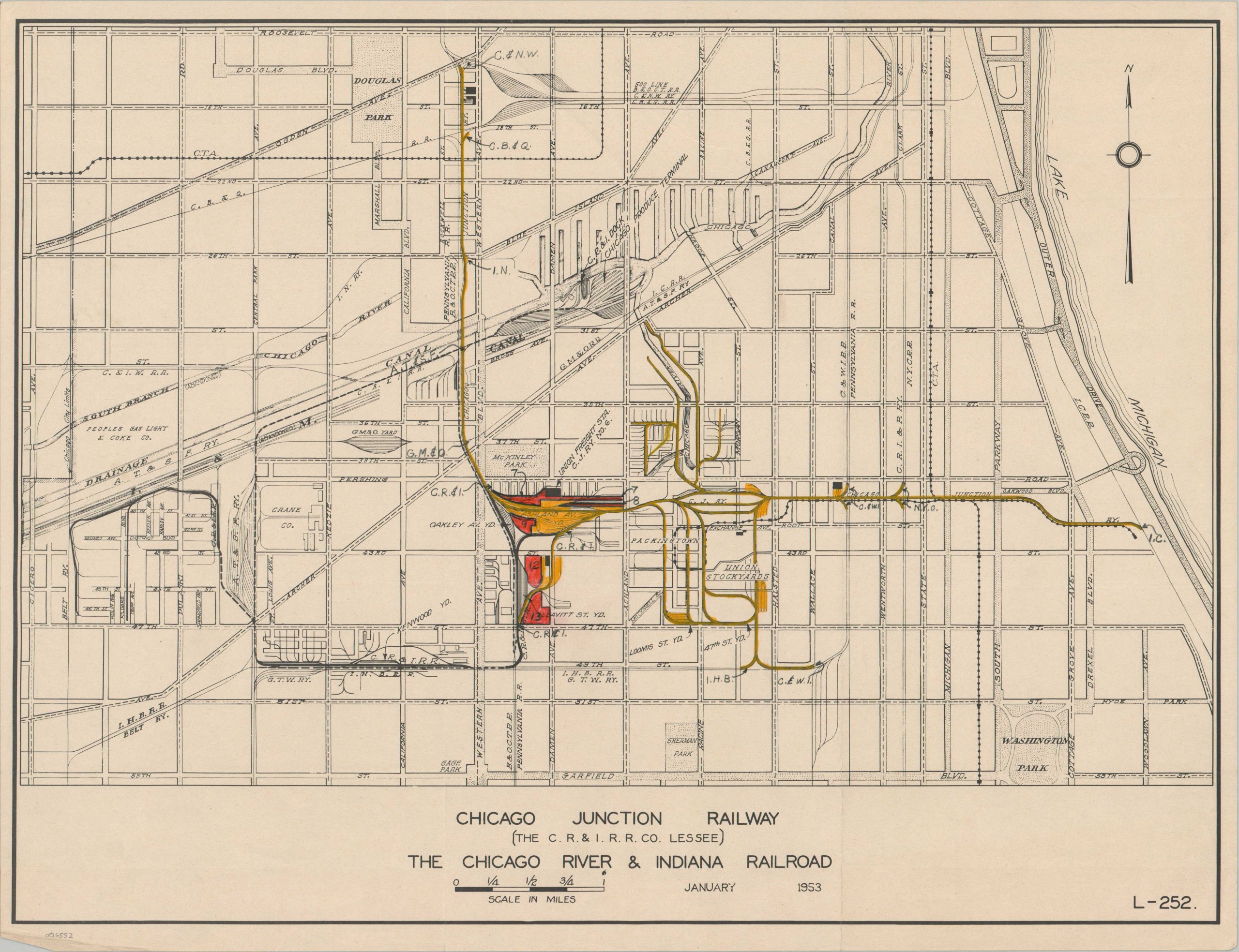
This fascinating map covering part of Chicago’s South Side highlights the operational lines of the Chicago Junction Railway in early 1953. As part of the New York Central Railroad system since 1922, the route was leased to a subsidiary called the Chicago River and Indiana Railroad and was part of the larger complex system of switching and terminal railroads in operation across the city and its outskirts.
As shown by the large-scale plan, the rail lines provided access to the Central Manufacturing District, the Union Stockyards, other rail yards, and numerous port facilities along the I&M Canal and Chicago River. Manuscript annotations note the numerous different companies in operation, while property ownership/right of way is highlighted in yellow and red.
Map Details
Publication Date: 1953
Author: Chicago River and Indiana Railroad
Sheet Width (in): 22
Sheet Height (in): 17
Condition: A-
Condition Description: Lightly creased along old fold lines and some faint wrinkling where previously rolled. Features numerous manuscript annotations in black, yellow, and red pencil. Very good condition overall. Blank on verso.
$225.00
1 in stock