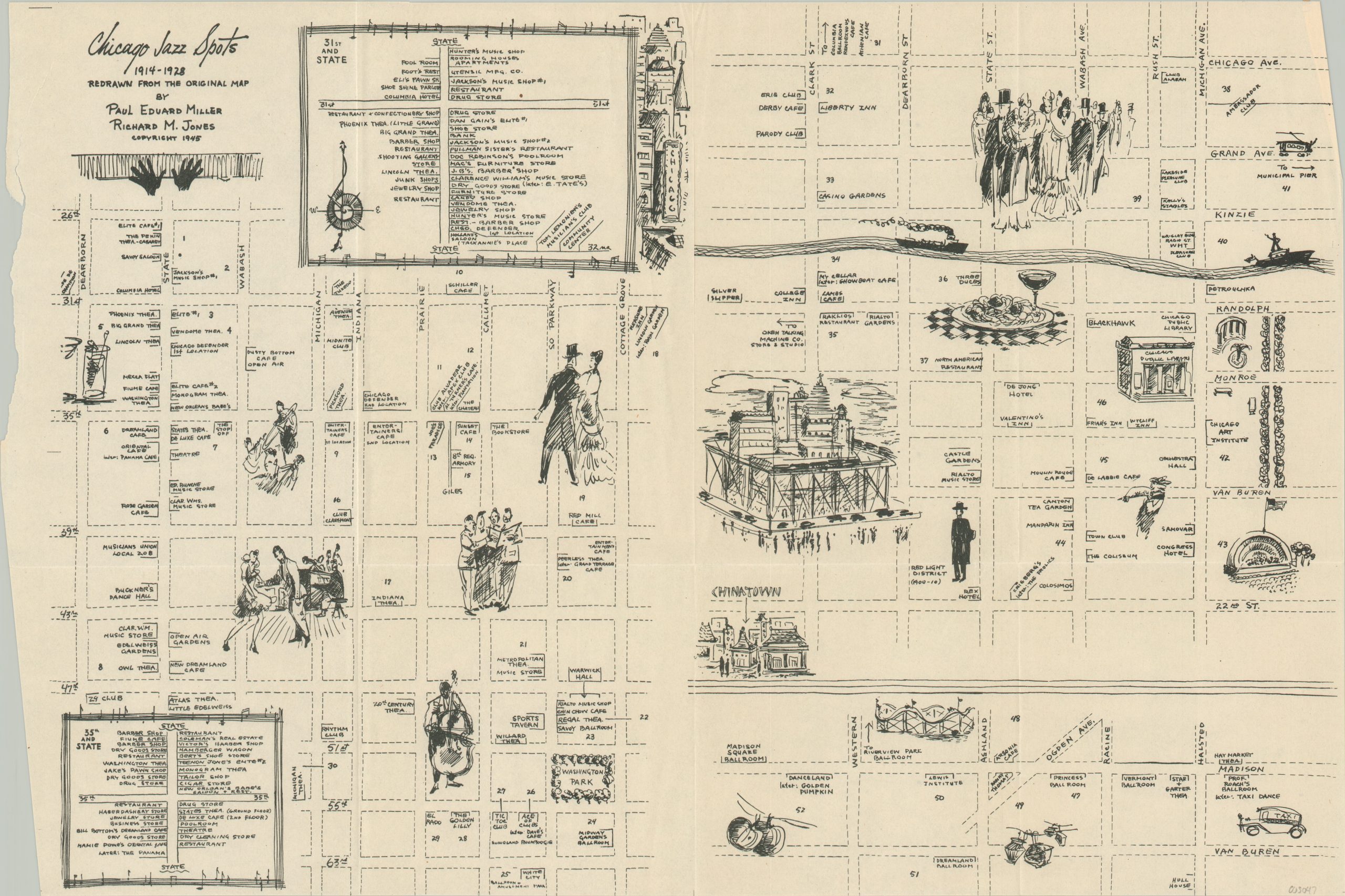
Chicago Jazz Spots 1914 – 1928
$250.00
An abstract map of Chicago’s jazz spots published during the genre’s height across the city.
1 in stock
Description
“White jazzmen spent plenty of time in the Black Belt, listening to their favorite music as played by the Negroes – the influence of the latter on the former is immeasurable.” [pg. 30, Esquire’s 1946 Jazz Book].
This fascinating and somewhat abstract map of Chicago highlights the myriad of jazz spots available across the city in approximately the first quarter of the 20th century. Dozens of spots are imprecisely shown at their respective corners, though only prominent streets are haphazardly labeled.
Sketchy illustrations provide a snapshot of the contemporary attitude regarding the jazz scene across Chicago. Food, drink, and decorations from local joints, crowds dancing and singing, and views of iconic landmarks are all included. Inset maps of the South Side show further details for two intersections known especially for their concentration of music venues; the corners of 31st and State and 35th and State.
The map, created by jazz scholar Paul Miller and composer Richard Jones, was originally issued in the 1946 Esquire Jazz book.
Source: University of Chicago Library
Map Details
Publication Date: 1946
Author: Paul Miller and Richard Jones
Sheet Width (in): 23.75
Sheet Height (in): 16.75
Condition: A-
Condition Description: Ragged left edge, where previously bound, including a 2" closed tear that approaches the title. Creased and light wrinkling along originally issued fold lines. Good to very good overall.
$250.00
1 in stock