Chicago Community Settlement Maps
Mapping Chicago’s ethnic communities across more than a century.
Out of stock


Description
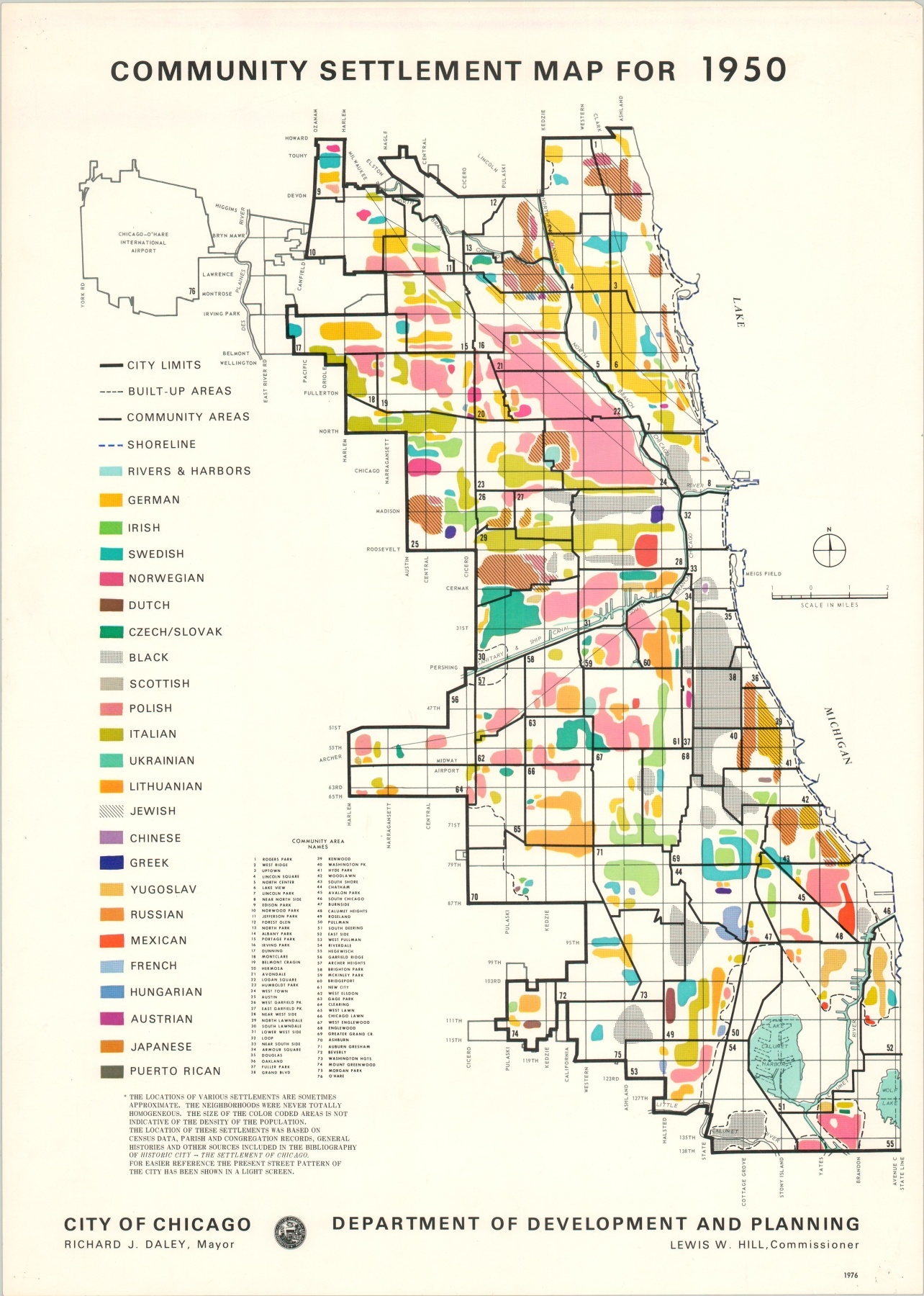
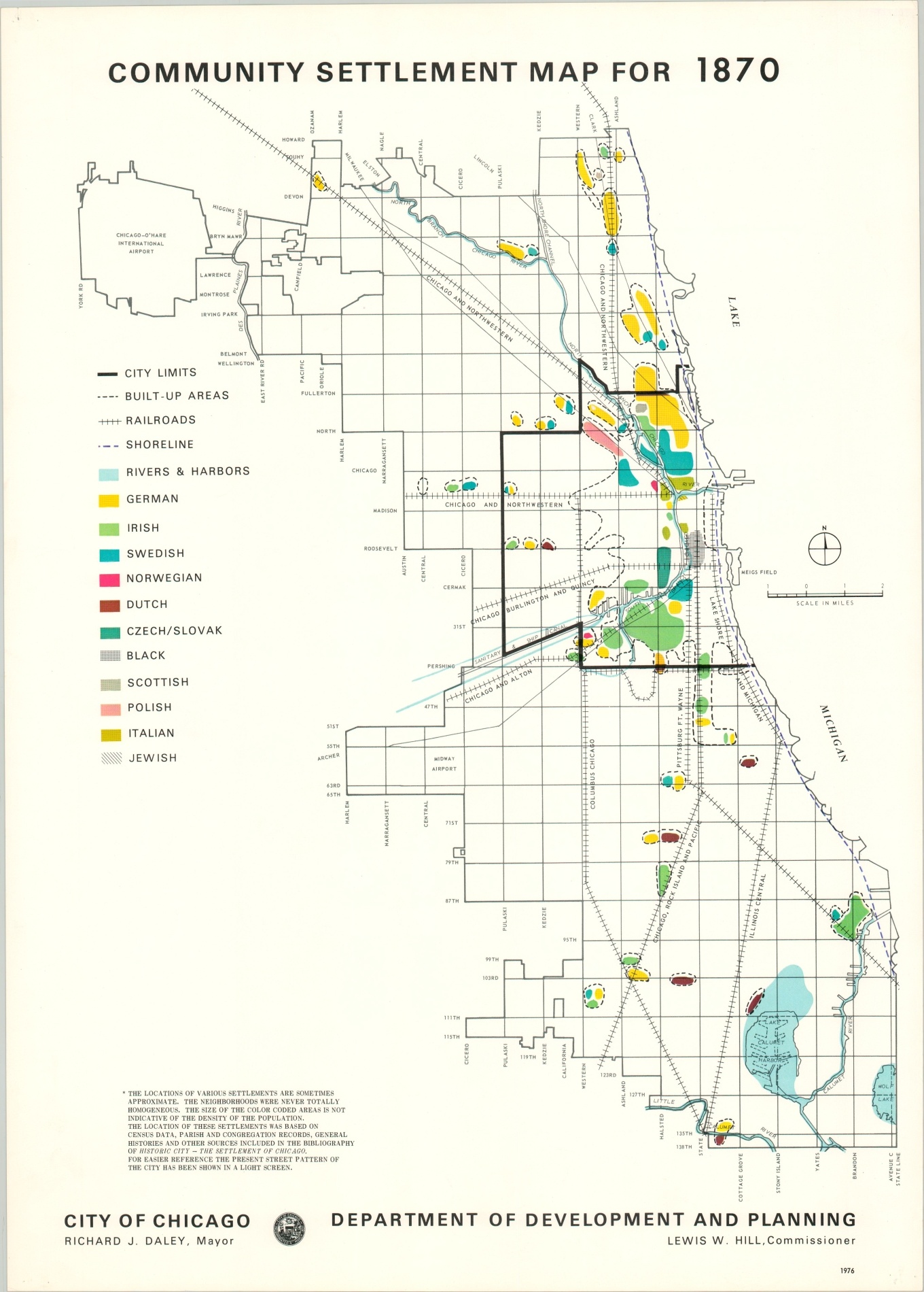
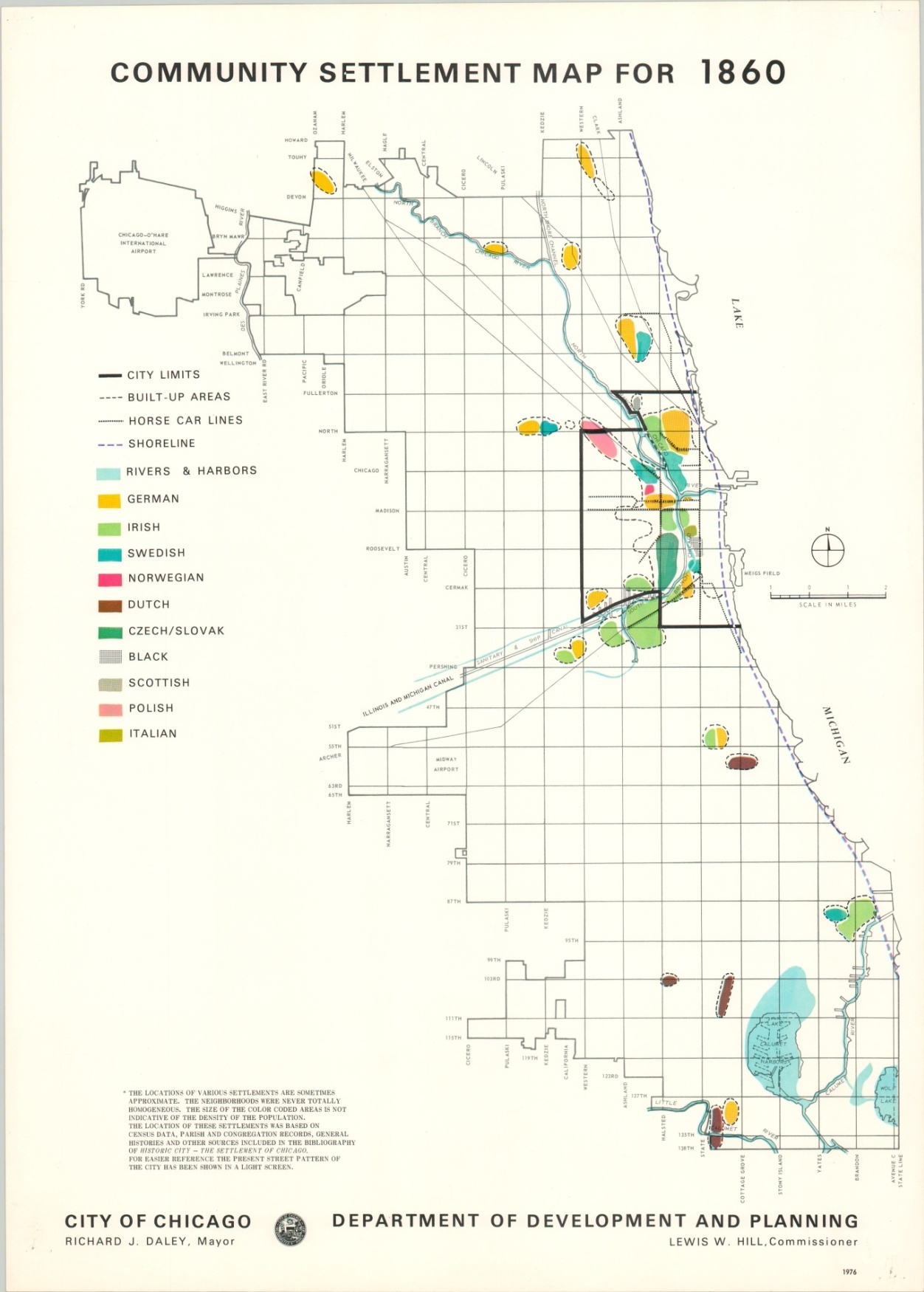
This group of six maps provides a rough visual approximation of the growth and movement of Chicago’s various ethnic communities between 1840 and 1950. A few caveats on the first sheet note that the neighborhoods were never totally homogenous, and population density is overlooked.
Categories range from two in total (German/Irish in 1840) to twenty-six different nationalities by 1950. The modern city plan used as a base map is provided as a reference for the reader, though it also provides some interesting context to the city’s rapid growth throughout the second half of the 19th century.
The maps were prepared by Chicago’s Department of Development and Planning under Commissioner Lewis Hill while Richard Daley was mayor of the city. His constituents in the historically Irish neighborhood of Bridgeport would have undoubtedly been happy to see their claims extended along the river during Chicago’s early days.
Map Details
Publication Date: 1976
Author: Lewis W. Hill
Sheet Width (in): 17.75
Sheet Height (in): 24.9
Condition: A-
Condition Description: Group of six single sided sheets. Faint discoloration along the top of each sheet and wear in the corners, varying from pinholes to 1" chips. The set remains in good to very good condition overall.
Out of stock