
Chicago and North Western System
$125.00
An interesting railroad freight density chart from the late 1980s.
1 in stock
Description
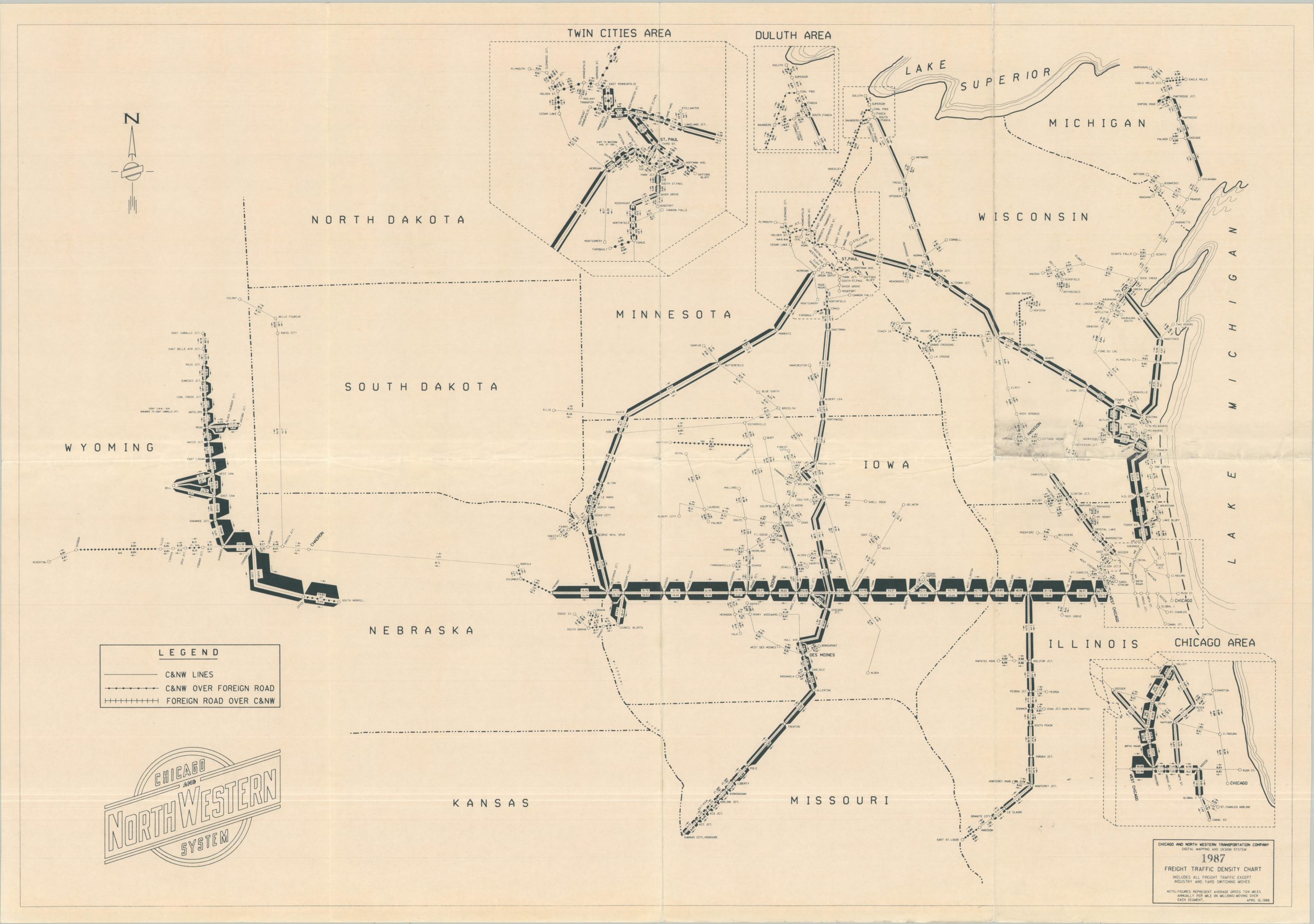
This detailed railroad traffic chart highlights the freight density across the operational lines of the Chicago and North Western System in 1987. The thickness of the route and related numbers represent the average annual gross tonnage across that particular section of track. Iowa grain and Wyoming coal made up a significant portion of the total freight operations. Insets show the important urban centers of Chicago, Duluth, and the Twin Cities.
This example of the map is accompanied by a five-page report comparing freight densities for various segments between 1983 and 1987. Results were mixed, though there were marked increases in the WRPI segment from Crandall, WY, to Joyce, NE.
Map Details
Publication Date: 1987
Author: Chicago and North Western Transportation Company
Sheet Width (in): 34.00
Sheet Height (in): 24.00
Condition: B+
Condition Description: Single-sided map (size given) creased along old folds and showing minor wear and soiling, consistent with age. About 1" of weathering on the verso has resulted in some visible lightening of the sheet in the center right (see scan). Includes a five page printed report, stapled upper left and moderately worn.
$125.00
1 in stock