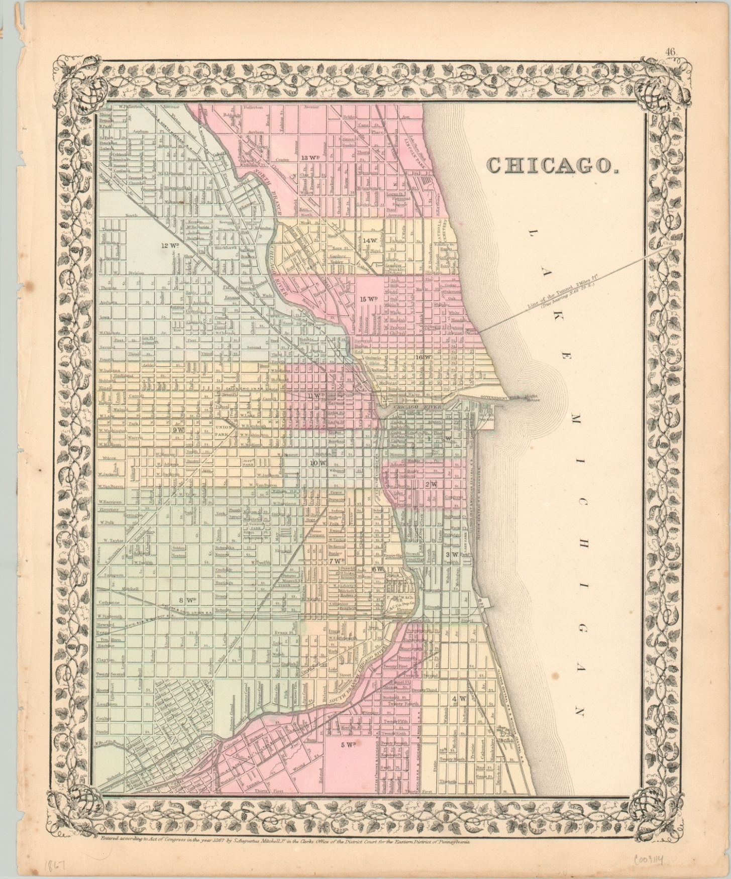
Chicago.
Original price was: $150.00.$110.00Current price is: $110.00.
Detailed plan of Chicago issued just a few years before the Great Fire of 1871.
1 in stock
Description
Samuel Augustus Mitchell was one of the most popular and prolific American cartographers of the 19th century. Originally a schoolteacher, Mitchell was disappointed in the quality of regularly available educational material and sought out to remedy the situation by creating accurate, reasonably priced maps, atlases, and geographic textbooks.
This map of Chicago was published in one of his atlases from 1867, and it shows a wealth of interesting detail from the Windy City just a few years before much of it would be engulfed by flames. Transportation routes are noted and include railroads, streetcar lines, and horse-drawn trolleys.
Important public buildings, schools, riverside canals, and major depots are outlined and individually labeled. Attractive hand color divides the city into its various wards, bounded by Western Avenue, Fullerton Avenue, Thirty-First Street, and Lake Michigan.
Map Details
Publication Date: 1867
Author: Samuel Augustus Mitchell
Sheet Width (in): 12.4
Sheet Height (in): 15.1
Condition: B+
Condition Description: Moderate wear, spotting, ragged left side, and a few small tears along the outer edges of the sheet. Two small spots visible in Lake Michigan and a few other lighter spots within the image. Remains in good condition overall and features attractive original hand color.
Original price was: $150.00.$110.00Current price is: $110.00.
1 in stock

