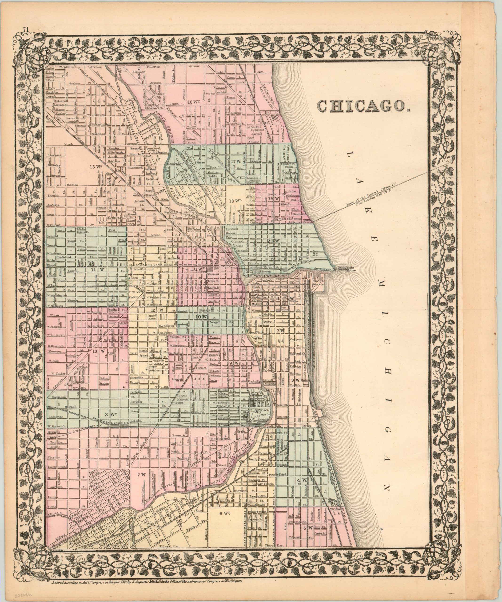
Chicago.
$125.00
City plan of Chicago published six years after the Great Fire.
1 in stock
Description
This is a lovely map of the city of Chicago, Illinois, issued by Samuel Augustus Mitchell in 1877. It shows the city between 31st Street and Fullerton Avenue at the height of its rapid expansion and growth in the years immediately following the 1871 fire that devastated much of the downtown district.
Railroads, the driving factor behind the spectacular growth experienced in the 19th century, can be seen traveling in every direction (except east, naturally). Important buildings are labeled and wards are organized by color. In addition, Mitchell has clearly identified several of the enormous engineering projects undertaken by the city, including the Illinois & Michigan Canal, Illinois Central trellis bridge, and the Two Mile Water crib, which brought in clean drinking water from Lake Michigan.
Map Details
Publication Date: 1877
Author: Samuel Augustus Mitchell
Sheet Width (in): 12.50
Sheet Height (in): 15.10
Condition: A-
Condition Description: Map is in very good condition to excellent condition. A few small ink spots and one small spot of foxing in Lake Michigan. Binding strip is present on the right side of the page, but it does not affect the image.
$125.00
1 in stock

