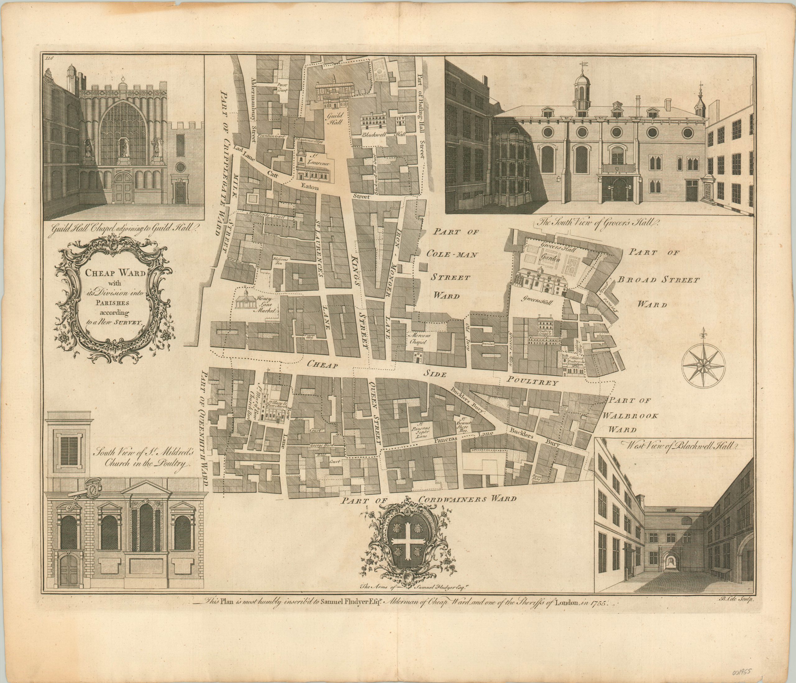
Cheap Ward with its Divisions into Parishes according to a New Survey
$125.00
Detailed street plan of London’s Cheap Ward (derived from the Old English word for ‘market’).
1 in stock
Description
London’s Cheap Ward is shown in large scale detail on this map, designed by Benjamin Cole in 1755 and published in William Maitland’s History of London From its Foundation to the Present Time. Streets, lanes, and alleys are labeled and major landmarks are illustrated in profile view.
Surrounding the map are additional illustrations showing further perspectives of local landmarks like St. Mildred’s Church, Blackwell Hall, and Grocer’s Hall. The Coat of Arms of Samuel Fludyer, Alderman of Cheap Ward, can be found at the bottom of the image, along with a dedicatory inscription.
Map Details
Publication Date: 1755
Author: Benjamin Cole
Sheet Width (in): 20.6
Sheet Height (in): 17.6
Condition: A-
Condition Description: Faint discoloration seen in the upper third, concentrated most visibly along the centerfold. Minor edge wear and soiling. Issued on thick, watermarked paper.
$125.00
1 in stock

