Chart Showing the Principal Constituent Elements of the Population of Each State
$60.00
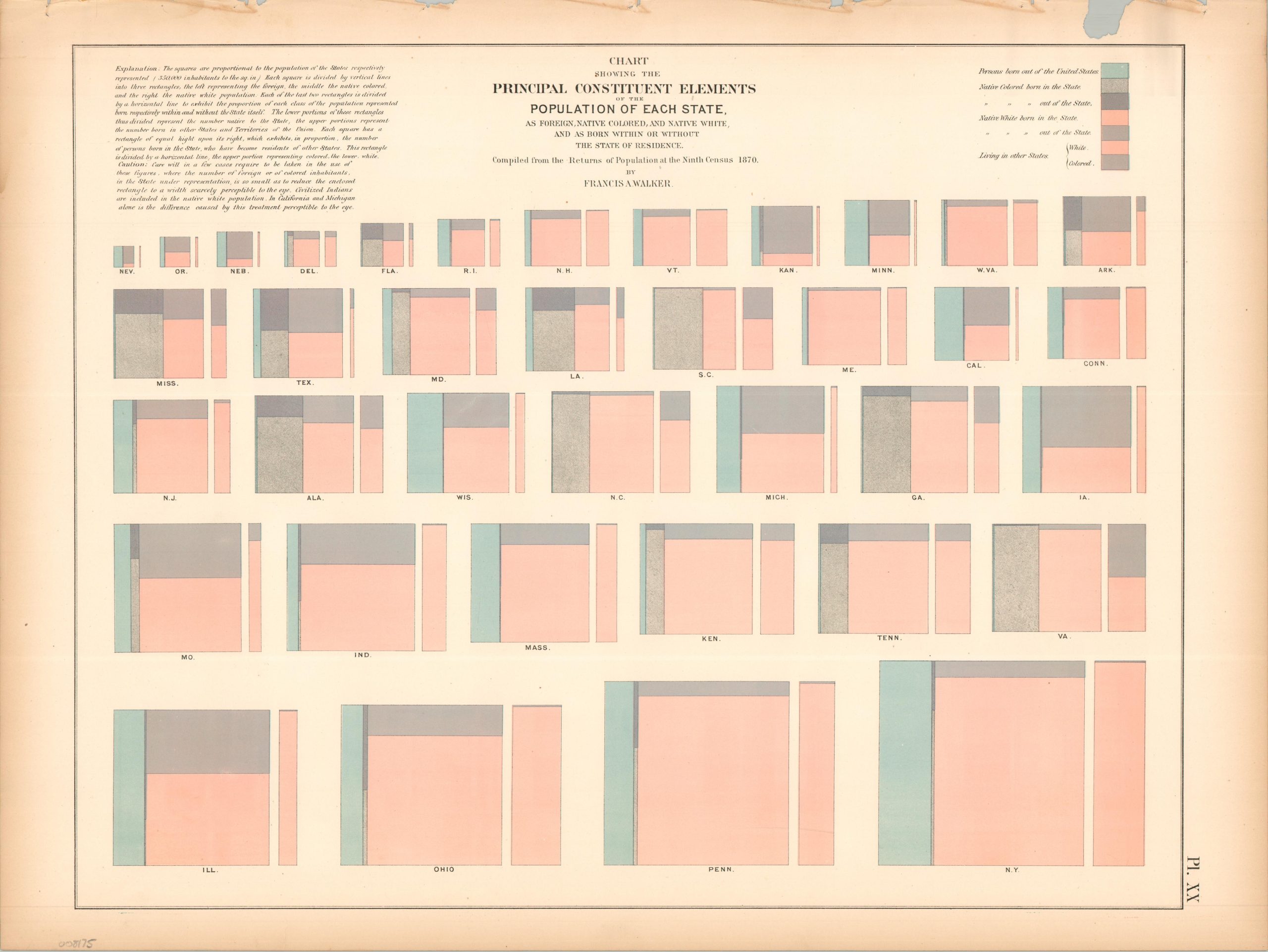
The composition of the Union during the Reconstruction Era.
1 in stock
Description
This intriguing collection of charts presents the distribution of foreign-born, white, and non-white residents living in (and out of) each state. The squares are proportional to the overall population, with each rectangle within referring to a different group.
The chart was originally issued as part of The Statistical Atlas of the United States Based on the Results of the Ninth Census, 1870, compiled by Census Superintendent Francis A. Walker. Lithographed by Julius Bien and published in 1874.
Map Details
Publication Date: 1874
Author: Francis A. Walker
Sheet Width (in): 21.75
Sheet Height (in): 16.25
Condition: B
Condition Description: Lithographed sheet with moderate marginal wear, including toning, a ragged upper edge, and a few small repaired tears and chips.
$60.00
1 in stock