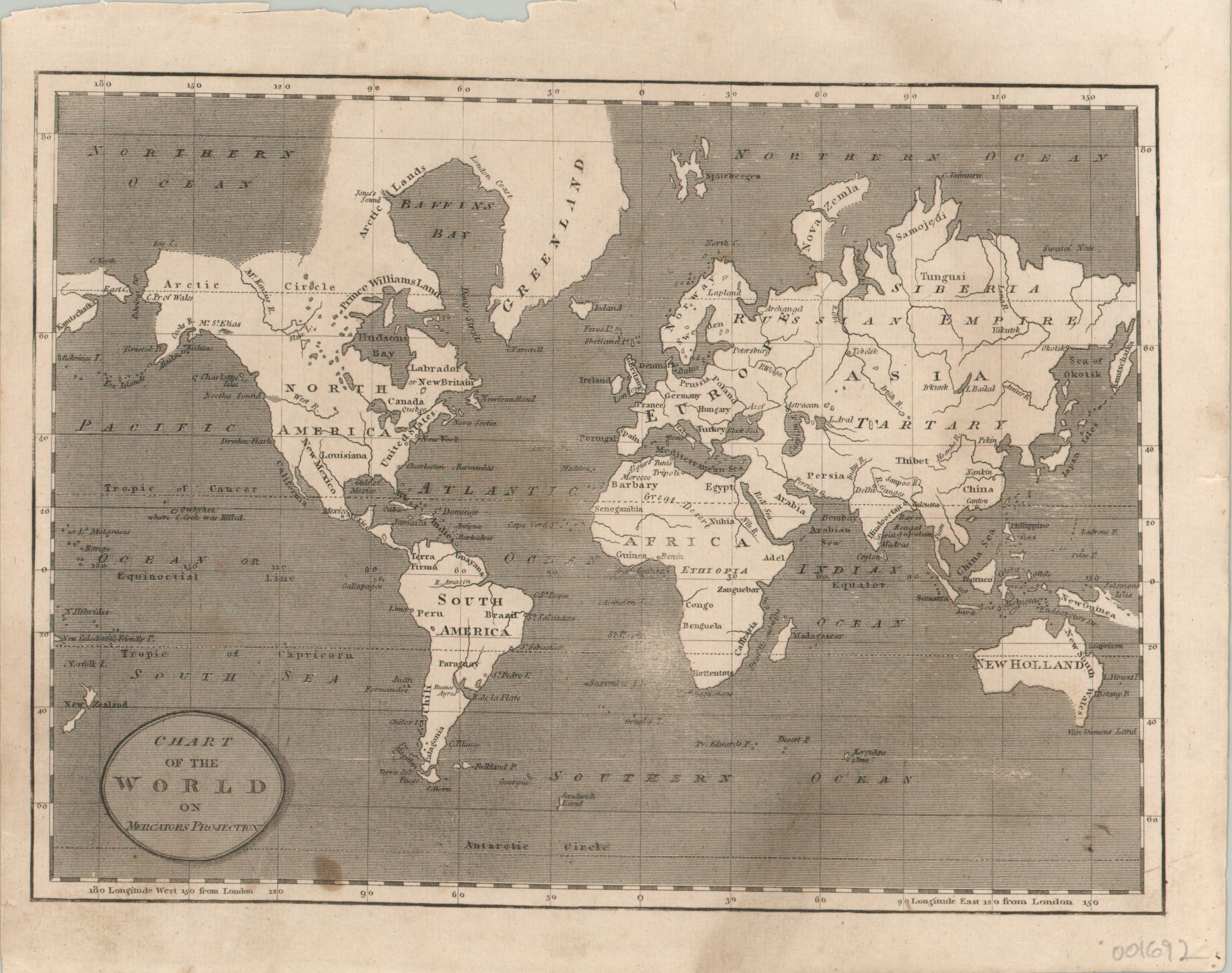
Chart of the World on Mercator’s Projection
$150.00
Simplified world map showing exaggerated geographic features.
1 in stock
Description
By 1820, when this map was published, the majority of the world was known and the poles represented the last great bastion of geographic mystery on the planet. There remained hope that, somewhere within the Arctic Circle, a navigable Northeast or Northwest Passage remained undiscovered.
Such possibilities are clearly presented on this map, which shows a relatively small strip of land separating Baffin Bay and the Northern Ocean. Above Russia, the Nova Zemyla peninsula is featured prominently – it was the temporary home of Willem Barentsz during his explorations of the 16th century. But it wasn’t until the 19th century that the western shore was mapped during an expedition that began the year following publication.
Other items of interest within the image include the fictitious River of the West flowing into Nootka Sound, an update to Africa’s river systems reflecting the explorations of Mungo Park, the location of Cook’s death in Hawaii, and the outdated connection between Tasmania (Van Diemen’s Land) and New Holland (Australia).
Published in Philadelphia in 1820 by Benjamin Warner and Matthew Carey, for inclusion in A General Atlas: Being a Collection of Maps of the World and Quarters…
Map Details
Publication Date: 1820
Author: Matthew Carey
Sheet Width (in): 10.10
Sheet Height (in): 8.25
Condition: B
Condition Description: Several dark spots within the image, concentrated in the south Pacific and off the west coast of Africa. One area of abrasion near South Africa, and a large spot to the lower right of the title cartouche. The sheet has been expertly cleaned and remains in good condition.
$150.00
1 in stock

