Chart of the Mississippi River from the Ohio River to the Gulf of Mexico
$75.00
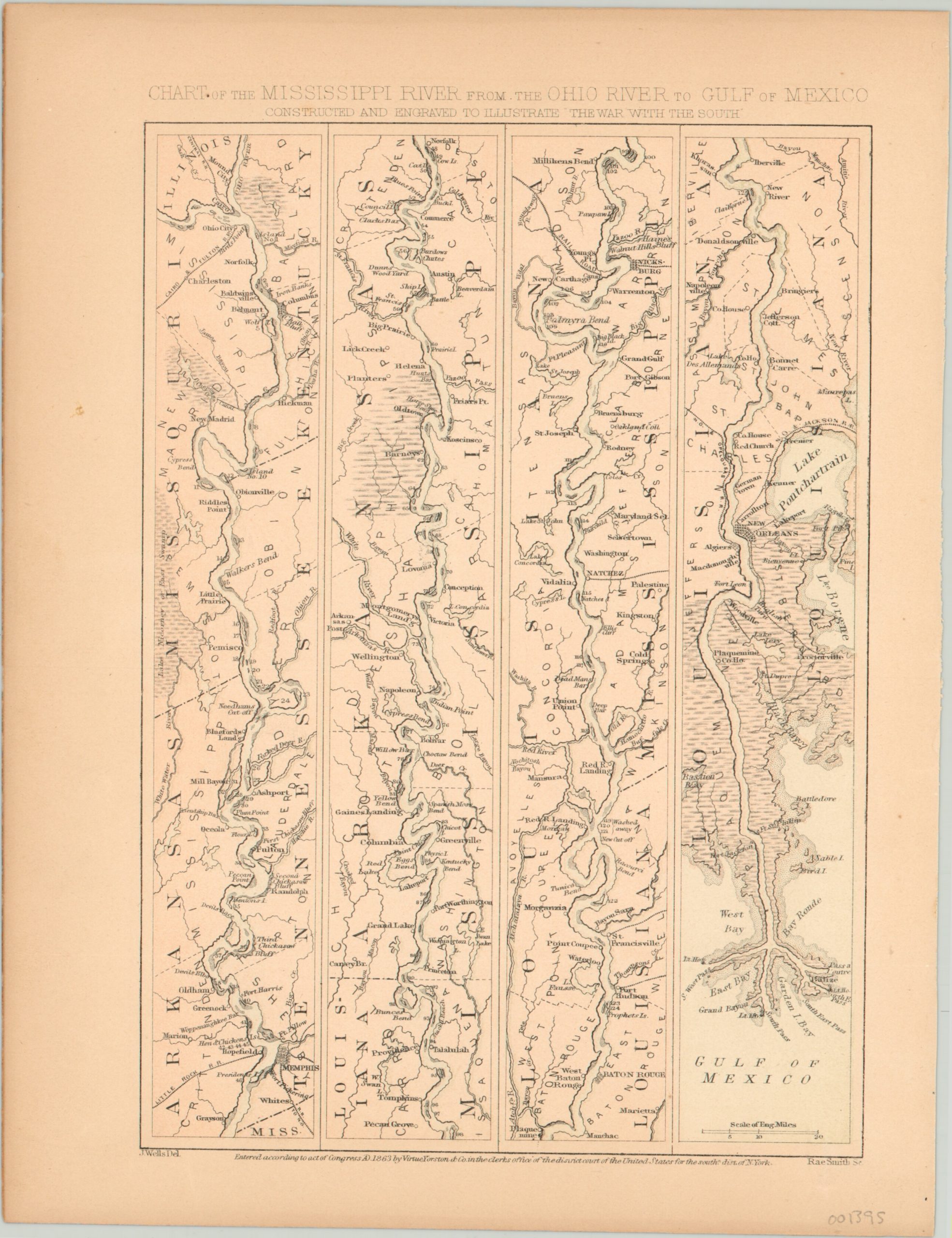
Civil War era chart of the critically important Mississippi River.
1 in stock
Description
This interesting map uses four separate panels to show the course of the Mississippi River as it travels from Cairo, Illinois at the confluence of the Ohio to its mouth at New Orleans on the Gulf of Mexico. Apart from geographic features and prominent settlements, the image also provides distance markers, the locations of bluffs, overhands and rapids, topographic detail and more.
The banks of the Mississippi were home to several major engagements in the western theater during the Civil War, including Vicksburg and Port Hudson – both captured by Union forces the same year of publication (1863). The map was drawn by J. Wells and engraved by Rae Smith to illustrate Virtue Yorston’s “The War with the South” published in New York.
Map Details
Publication Date: 1863
Author: Virtue Yorston & Co.
Sheet Width (in): 8.25
Sheet Height (in): 11.00
Condition: A-
Condition Description: The paper is slightly faded and toned from age, including moderate discoloration along the outer edges.
$75.00
1 in stock