
Chart of the Antarctic Ocean
The discoveries of the Discovery in Antarctica.
Out of stock
Description
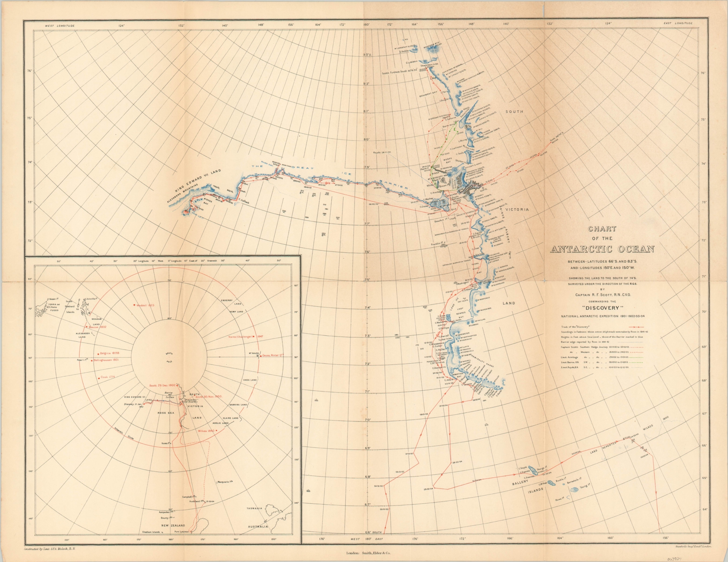
This interesting map shows the recent discoveries across a portion of Antarctica explored by the members of the British National Antarctic Expedition of 1901-1904. Alternatively known as the Discovery Expedition after the ship in which the party traveled, the group of fewer than sixty men was led by Robert Falcon Scott and included the likes of Ernest Shackleton, Tom Crean, and Edward Wilson. It was the first major British Antarctic expedition since the 1839-43 voyage of James Clark Ross and part of the global Heroic Age of Antarctic Exploration.
The primary image shows the track of the Discovery along the coast of South Victoria Land, with soundings and heights above sea level noted where available. The legend below the title block shows the lines used to indicate overland sled journeys and an inset in the lower left shows the broader outline of Antarctica with notable exploratory points highlighted and labeled in red.
The map was designed by Lieutenant G.F.A. Mulock and published in London by Smith, Elder & Co. in 1905 as part of The Voyage of the “Discovery”.
Map Details
Publication Date: 1905
Author: G.F.A Mulock
Sheet Width (in): 20.4
Sheet Height (in): 15.6
Condition: B
Condition Description: Creased and toned along originally issued fold lines. About 4" of separation along fold lines and a few spots at the fold intersections have been repaired on the verso with archival tape.
Out of stock