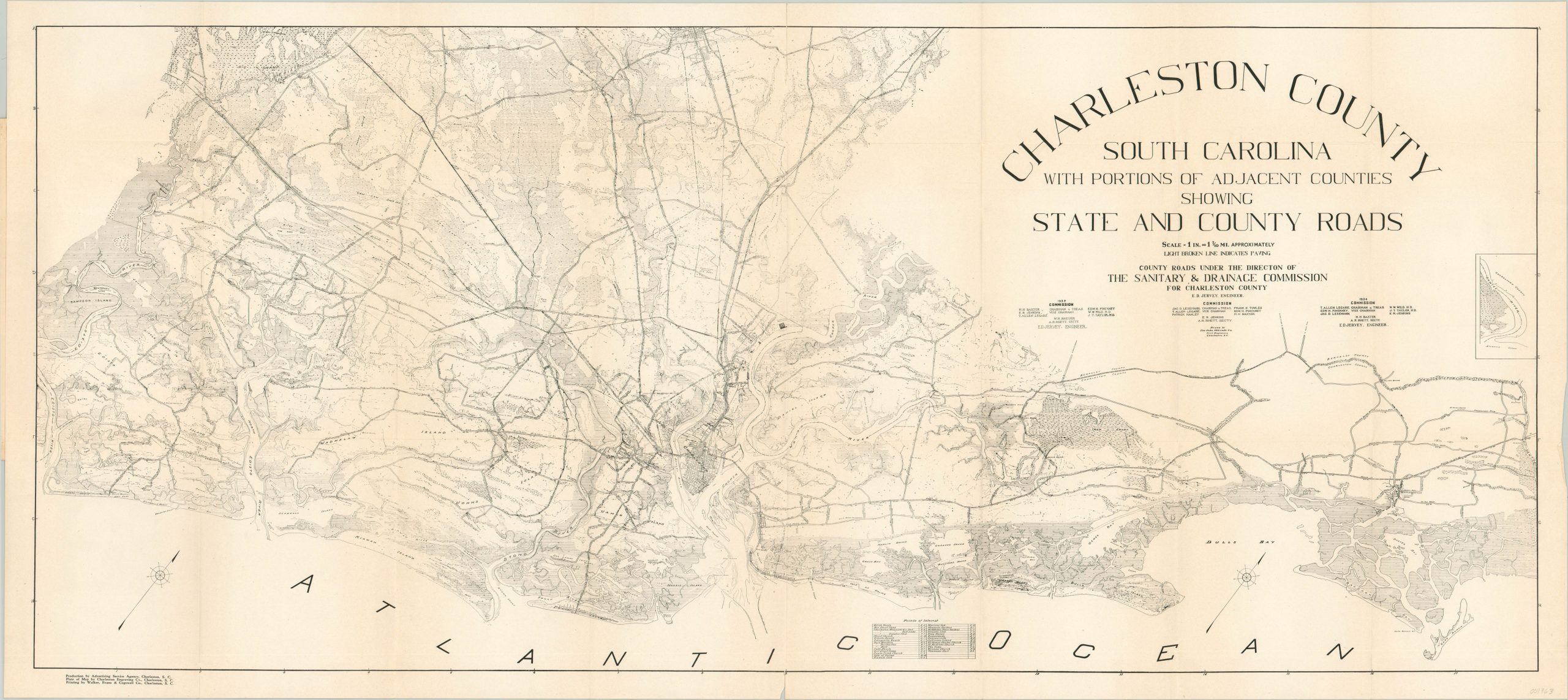
Charleston County South Carolina with Portions of Adjacent Counties Showing State and County Roads
Detailed topographic map of Charleston County, South Carolina published shortly before the outbreak of World War II.
Out of stock
Description
This precisely drawn map of Charleston County, South Carolina shows the various roads under the direction of the local Sanitary and Drainage Commission. As such, it includes a wealth of information on regional topography and geographic features.
The dense, but surprisingly legible, image includes an interesting mix of pictorial elements, concise labeling and notable landmarks. Thirty points of interest (churches, historical sites, and public buildings) are identified in a table at the bottom corresponding to the grid border.
The map was drawn by the civil engineering firm John McGrady Co. and engraved by the Charleston Engraving Company. Printing was performed by the Walker, Evans, and Cogswell Company on behalf of the Charleston County Sanitary and Drainage Commission, under the direction of Chief Engineer E.D. Jervey.
Map Details
Publication Date: 1940
Author: The John McGrady Co.
Sheet Width (in): 40.75
Sheet Height (in): 18.4
Condition: A-
Condition Description: Pocket map issued folded into 24 segments. Creasing and minor wear along fold lines, including about 4" of separation that has been repaired on the verso. The image is clean and bright and includes the original paper covers, in similarly good condition.
Out of stock

