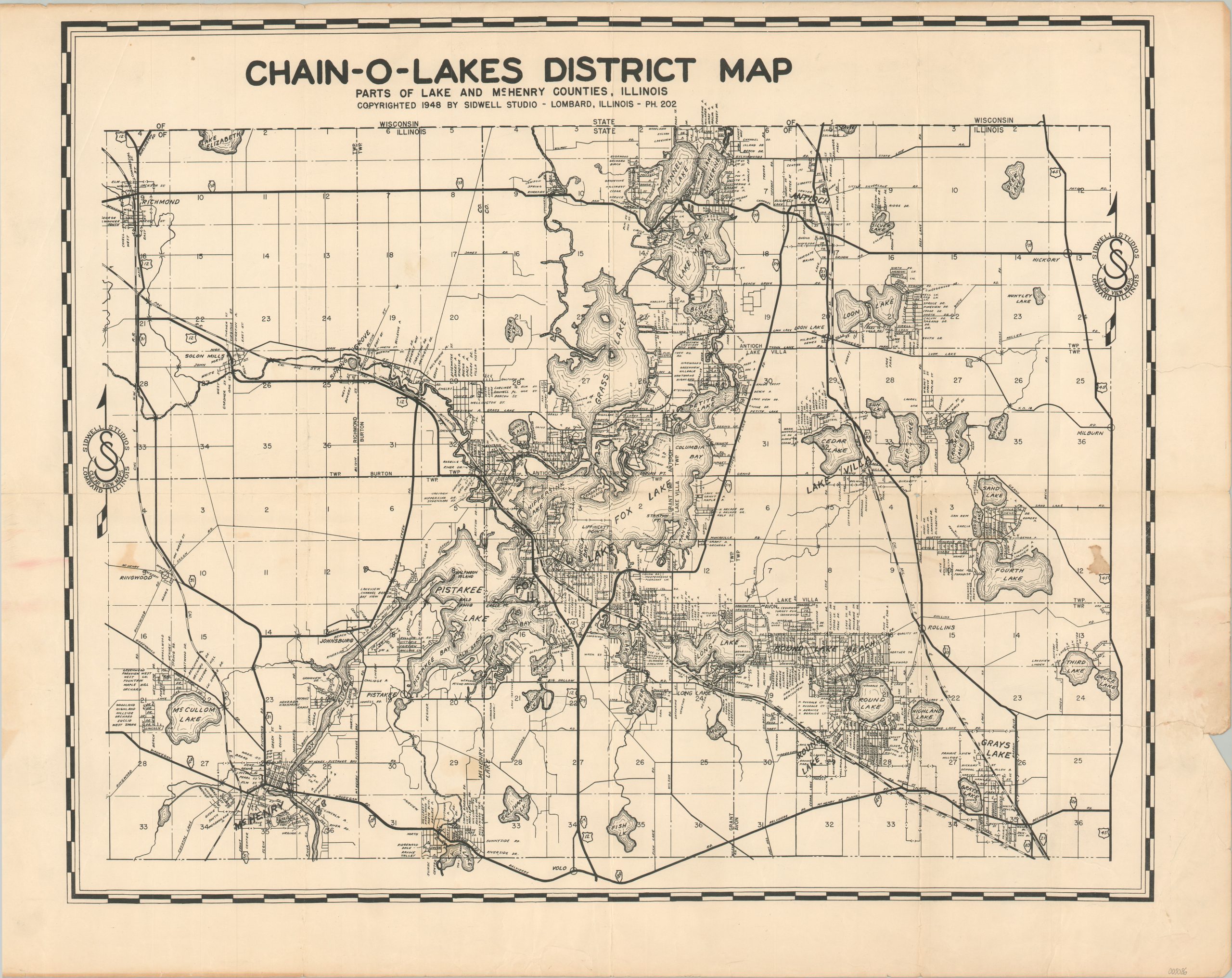
Chain-O-Lakes District Map
The largest concentration of natural lakes in Illinois.
Out of stock
Description
This uncommon map of the Chain-O-Lakes District provides a detailed overview of the popular recreational area in northern Illinois in the years immediately following World War I. Neighborhoods, streets, railroads, geographic features (notably lakes), and townships are labeled throughout.
Copyrighted 1948 by Sidwell Studios of Lombard, Illinois. One of several editions, with a 1956 example described by the Sidwell Maps website as follows:
In 1956, our founder Joe Sidwell hand-drafted a Chain-O-Lakes Illinois District Map. This reproduction is available exclusively through The Sidwell Company. Chain-O-Lakes was officially designated a state park by the State of Illinois in 1945. Located in both McHenry and Lake counties, in the northeastern corner of Illinois, the park boasts nearly 6,500 acres of water and 488 miles of shoreline. It is a major water recreation area.
Source: Sidwell Maps;
Map Details
Publication Date: 1948
Author: Joe Sidwell
Sheet Width (in): 28
Sheet Height (in): 22
Condition: B+
Condition Description: 4" closed tear in the lower right corner that has been repaired on the verso with archival tape. Creased and light wear along old fold lines. Several areas of light spotting visible on the left and right sides. About good condition overall.
Out of stock

