
Central Park Quadrangle
$75.00
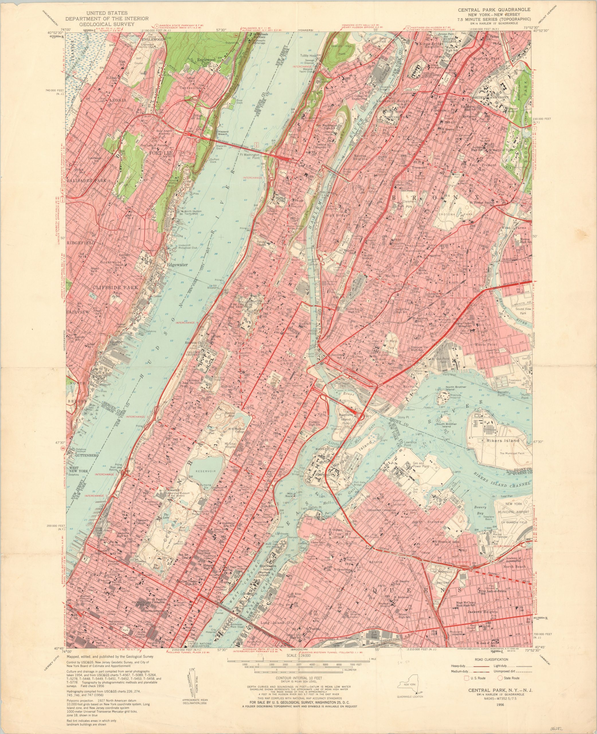
Manhattan and the Bronx in the mid-1950s.
1 in stock
Description
This fabulously detailed map covers portions of the New York boroughs of Manhattan, Queens, and the Bronx, as well as as the New Jersey coast around Fort Lee. Four classes of roads are shown according to the legend in the lower right, including a handful of dirt routes. Schools, churches, medical facilities, and transportation depots are labeled throughout. Notable locations of interest within the image include Central Park, La Guardia Airport, Rikers Island, Yankee Stadium, and Columbia University.
Published in 1956 by the United States Geological Survey. That same year, the New York Yankees defeated the Brooklyn Dodgers in the World Series – the last time the Subway Series would coincide with the Fall Classic until 2000.
Map Details
Publication Date: 1956
Author: United States Geological Survey
Sheet Width (in): 22
Sheet Height (in): 27
Condition: B
Condition Description: Heavily worn in the margins, including creasing, numerous small tears, and scattered soiling. Soft creasing along old fold. About good condition overall.
$75.00
1 in stock