Carte Pour l’Intelligence des Voiages d’Abraham
$145.00
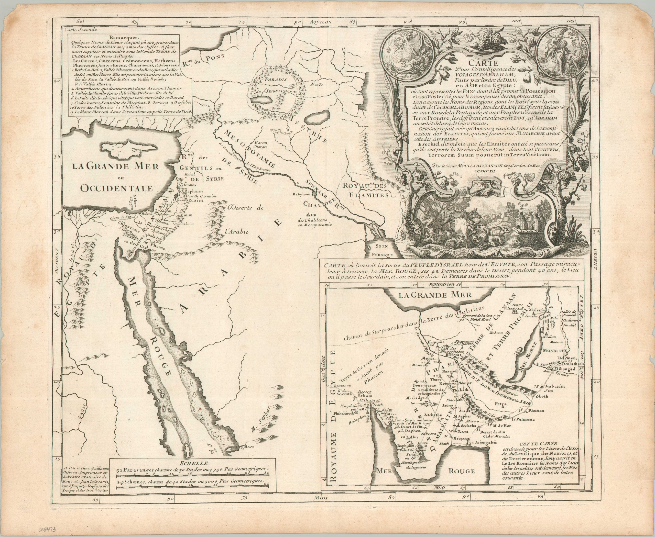
An early 18th century map of the Travels of Abraham.
1 in stock
Description
This interesting composite image of the Near East and Egypt outlines the Biblical journeys of Abraham. The larger map shows the area around the Eastern Mediterranean and Red Sea, featuring an interesting variety of settlements and geographic features. The second plan, lower right, provides a rough approximation of the Sinai Peninsula, with the route of the Israelites and their 40 years of wandering after the Exodus. The decorative cartouche reflects the Promised Land of Milk and Honey (plus wine).
The map was published in Paris around 1712 by Pierre Moullart-Sanson. Pierre-Moullart inherited the plates of his grandfather (and renowned Royal French Geographer) Nicholas Sanson, added the surname, and tried his professional hand at cartography. He was unsuccessful, making his imprints rather uncommon on the market.
Map Details
Publication Date: c. 1712
Author: Pierre Moullart-Sanson
Sheet Width (in): 18.50
Sheet Height (in): 15.25
Condition: A-
Condition Description: Copperplate engraved map on a sheet of laid, watermarked paper. Moderate marginal toning and wear, including some discoloration and chipped edges. Discoloration in the title cartouche, likely from the original plate strike. Good condition overall.
$145.00
1 in stock