
Carte Pour Contribuer a Indiquer la Connaissance des Premiers Principes des Fortifications, Ainsi que L’Ordre de L’Attaque et de la Defence…
$150.00
The pinnacle of military science in the early 18th century.
1 in stock
Description
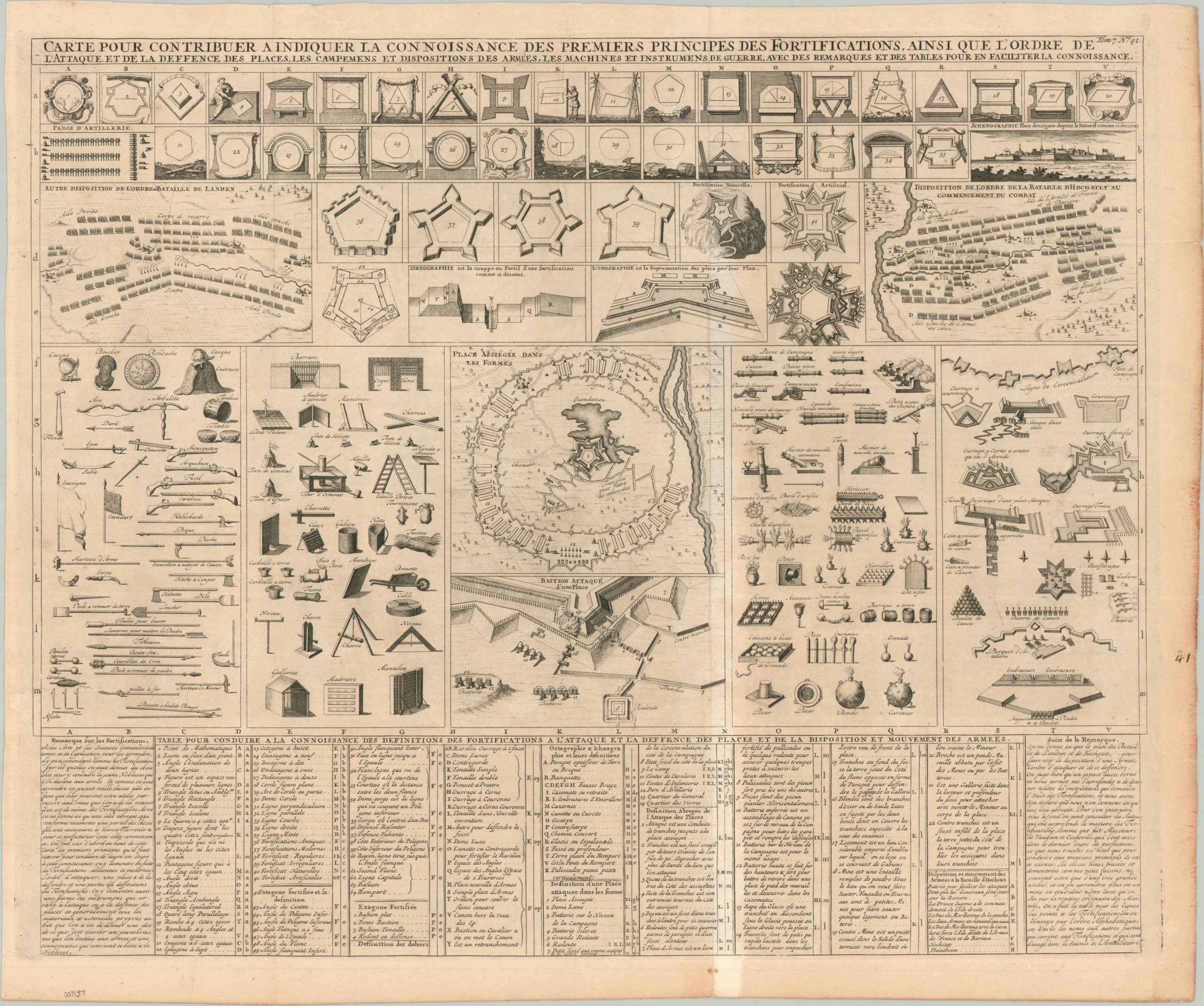
“Map to Contribute to Indicate the Knowledge of the First Principles of Fortifications, as well as the Order of Attack and Defense” – Approximate title translation.
The days of the gallant knight laying siege to tall castle walls filled with archers were long gone by the time this interesting diagram was published around 1720. Trebuchets and catapults had been replaced by cannons and mortars, and the imposing fortifications of a medieval town gave way to angled ramparts designed to deflect cannonballs, rather than absorb them, and offer maximum angles of fire for the defenders inside. This gradual process took place over centuries – a continuation of the perpetual struggle between offensive weaponry and defensive capabilities – and gave the attackers a decided advantage.
The image presents a comprehensive overview of the science of military fortifications in the first decades of the 18th century, shortly after the French engineer Vauban revolutionized the field. Various fortification designs are presented, generally following a ‘star’ pattern that offered the greatest field of fire. Weapons of war, including siege implements, personal armaments, and cannons are all depicted; presenting a fascinating snapshot of the immense variety used at the time. Slings, pikes, and arbalests (large crossbows) are shown in the same method as hand grenades and flintlock muskets. These are juxtaposed against numerous means of defense like armor, trenches, and wooden gabions. Three diagrams show recommended troop dispositions for different types of engagements, including a siege and land battle, while a detailed key at the bottom of the page identifies the dozens of elements illustrated throughout the sheet.
The copperplate-engraved sheet was originally published in Paris as part of Henri Abraham Chatelain’s important Atlas Historique. This monumental seven-volume set was first issued in Amsterdam between 1705 and 1720, but was reprinted until the late 1730s. The scholarly, but approachable, work was aimed at a broad audience, eager for new information during the Age of Enlightenment. The breadth of content offers a nuanced synthesis of geography, cosmography, history, religion, ethnology, and political science. The descriptive text (in French) and skillfully engraved maps, diagrams, and illustrations provide a fascinating window into the world of the early 18th century.
Sources: University of Michigan; David Rumsey Map Collection;
Map Details
Publication Date: c. 1720
Author: Henri Abraham Chatelain
Sheet Width (in): 25.1
Sheet Height (in): 21
Condition: B+
Condition Description: Copperplate engraved sheet with a dark impression on a sheet of folding (as issued) laid paper. Visible lightening along the vertical centerfold (see scan) and moderate wear and toning visible in the margins. Some creasing along old folds and a small hole in the upper center repaired on verso with very minor loss. Good condition overall.
$150.00
1 in stock