Carte Marine de la Mer Caspiene
$150.00
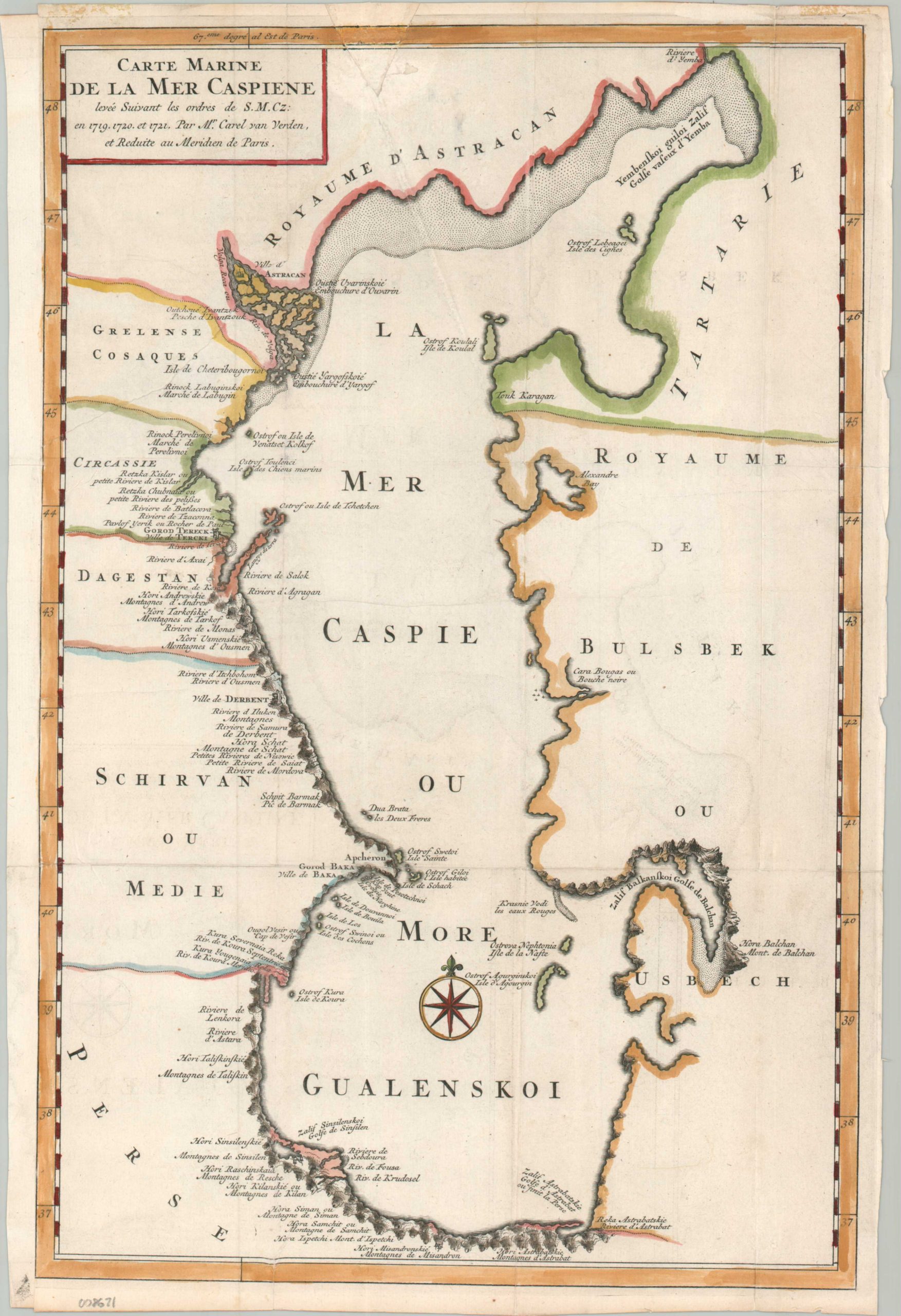
An uncommon variant of an important map of the Caspian Sea.
1 in stock
Description
In 1719, Peter the Great dispatched a scientific expedition led by Dutch sailor Carl Van Verden to chart the Caspian Sea, marking a shift from medieval guesswork to modern cartography. Utilizing advanced surveying techniques, the team corrected centuries of geographical error by proving the sea was an elongated oval rather than the wide, rectangular basin depicted on previous maps. This specific French variant, published circa 1730, represents the immediate European dissemination of these findings, which effectively opened the region to Western trade and strategic diplomacy.
A finely engraved image provides a reasonably accurate outline of the Caspian Sea, noting surrounding kingdoms like Astracan, the Uzbeks, and Tartary. Pictorial topography highlights the rugged coastline in several areas, while the Volga Delta is depicted as a series of small islands. Numerous toponyms in French and transliterated Russian label geographic features, settlements, and more.
Map Details
Publication Date: c. 1730
Author: Karl Van Verden
Sheet Width (in): 10.90
Sheet Height (in): 16.10
Condition: B+
Condition Description: A nice impression on a sheet that shows several professional repairs, including a new left margin and closed tears. A V-shaped chip in along the top edge has been expertly infilled and there is some light offsetting and creasing along old folds. About good condition overall.
$150.00
1 in stock