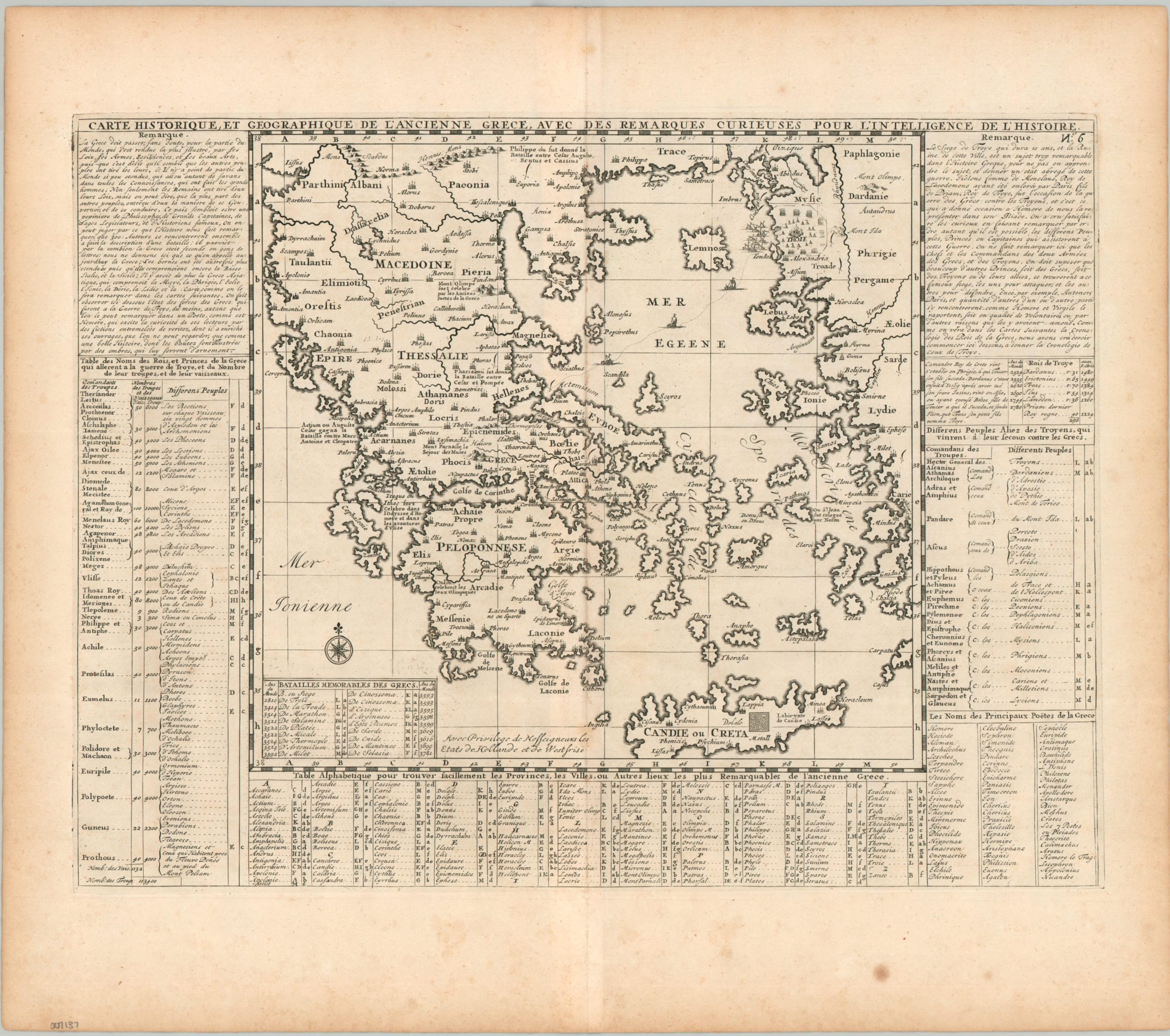
Carte Historique, et Géographique de L’Ancienne Grece, Avec des Remarques Curieuses Pour L’Intelligence de L’Histoire
$95.00
Ancient Greece through the eyes of an 18th-century French scholar.
1 in stock
Description
Historical and Geographical Map of Ancient Greece, With Curious Remarks for the Understanding of History – Approximate title translation.
This interesting antique map of Greece presents the geography of the Mediterranean nation as it was understood from Classical sources. Toponyms identify a broad variety of places pertaining to Greek and Roman history, with small pictorial elements noting the Trojan War, Mount Olympus, and the Labyrinth on Crete. Tables on either side list Greek poets, famous battles, important places, and more.
The copperplate-engraved sheet was originally published in Paris as part of Henri Abraham Chatelain’s important Atlas Historique. This monumental seven-volume set was first issued in Amsterdam between 1705 and 1720, but was reprinted until the late 1730s. The scholarly, but approachable, work was aimed at a broad audience, eager for new information during the Age of Enlightenment. The breadth of content offers a nuanced synthesis of geography, cosmography, history, religion, ethnology, and political science. The descriptive text (in French) and skillfully engraved maps, diagrams, and illustrations provide a fascinating window into the world of the early 18th century.
Map Details
Publication Date: c. 1720
Author: Henri Abraham Chatelain
Sheet Width (in): 19.6
Sheet Height (in): 17.4
Condition: B+
Condition Description: Copperplate engraved sheet with a nice impression on a strong sheet of laid paper. Scattered foxing and toning visible, mostly in the margins, but also along the centerfold within the image. Good condition overall.
$95.00
1 in stock