Carte Géographique, Statistique et Historique Des Possessions Russes
$375.00
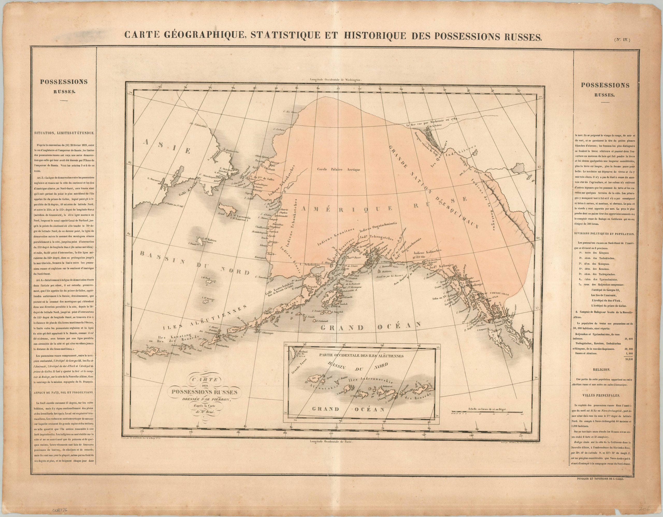
An interesting map of ‘Russian America’ issued decades before the Alaska Purchase.
1 in stock
Description
This highly significant, beautifully composed map is one of the earliest commercial atlas plates to focus entirely on the territory that would become Alaska. Published in Paris for Jean-Alexandre Buchon’s monumental Deux-Amériques, this map holds a unique place in North American cartography. While Buchon’s atlas was largely a French translation of Carey & Lea’s groundbreaking 1822 Complete Historical, Chronological, and Geographical American Atlas, Carey & Lea did not include a standalone map of Russian America in their own editions. Recognizing the intense European interest in the Pacific Northwest fur trade, Buchon specially created this plate for his French audience, making it a scarce, uniquely European contribution to the mapping of the region.
Presented in striking original hand color, the map depicts a remarkably advanced and reasonably accurate coastline, stretching from the icy waters of the Arctic Ocean south to Queen Charlotte’s Island in modern-day British Columbia. While the extreme interior remains largely uncharted—reflecting the contemporary limits of European exploration – the map excels at pinpointing the scattered, vital coastal outposts of the Russian-American Company, anchored by a detailed inset map at the lower left masterfully delineating the sweeping arc of the Aleutian Islands.
The extensive, crisply printed French text flanking the geography serves as an invaluable historical census of the colony under Governor Matvey Muravyov, capturing the immense, lonely scale of Russia’s imperial footprint in the New World. The statistics note that across this vast, rugged wilderness, a sparse population of only roughly 50,000 inhabitants was spread across the region, a mere 1,000 of whom were ethnic Russians. The capital of the territory, New Archangel (modern-day Sitka), is meticulously described as the bustling hub of the fur trade, boasting a population of roughly 1,000 people and sixty permanent, fortified timber buildings
Map Details
Publication Date: 1825
Author: Jean Alexandre Buchon
Sheet Width (in): 27.20
Sheet Height (in): 21.40
Condition: B
Condition Description: Scarce map of Alaska published 42 years prior to its acquisition by the United States.
$375.00
1 in stock