Carte Geographique, Statistique et Historique de L’Ohio.
Original price was: $200.00.$145.00Current price is: $145.00.
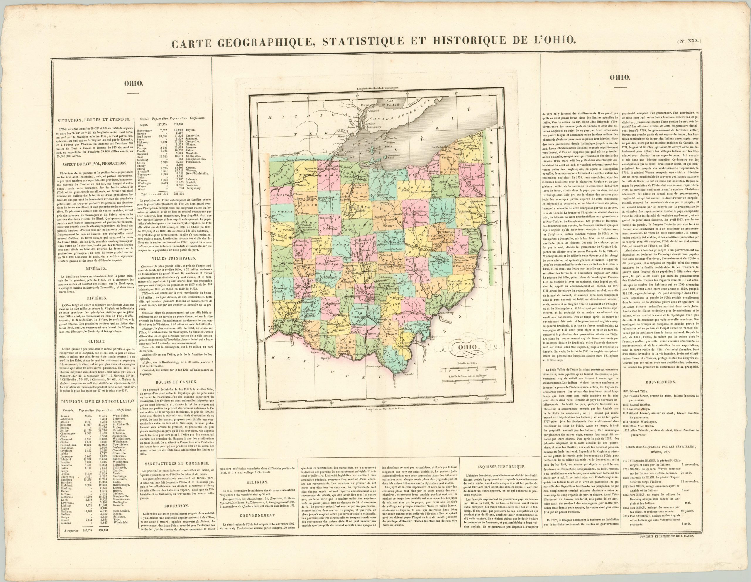
The French version of Carey & Lea’s important map of Ohio.
1 in stock
Description
This map of Ohio was published in Jean Alexandre Buchon’s Atlas Geographique, Statistique, Historique et Chronologique; the French edition of Carey & Lea’s atlas of the United States. It depicts the political organization of the Buckeye State in the first quarter of the 19th century and shows an interesting mix of frontier America and increasing urbanization resulting from transportation innovations and the Industrial Revolution.
Native American reservations and military forts can be seen interspersed between a rapidly developing network of roads, towns, canals, and rivers. The ongoing northern boundary dispute with Michigan, which would ultimately evolve into the bloodless Toledo War, can be seen adjacent to Lake Erie. Surrounding the map are dense columns of text, tables of statistics, and lists of dates that relate the history, geography, industry and culture of Ohio.
Map Details
Publication Date: 1825
Author: Jean Alexandre Buchon
Sheet Width (in): 27.00
Sheet Height (in): 21.10
Condition: A
Condition Description: The map is in fine condition, with lovely old hand color on a thick, strong sheet.
Original price was: $200.00.$145.00Current price is: $145.00.
1 in stock