Carte Ecclesiastique de L’Afrique
Original price was: $450.00.$375.00Current price is: $375.00.
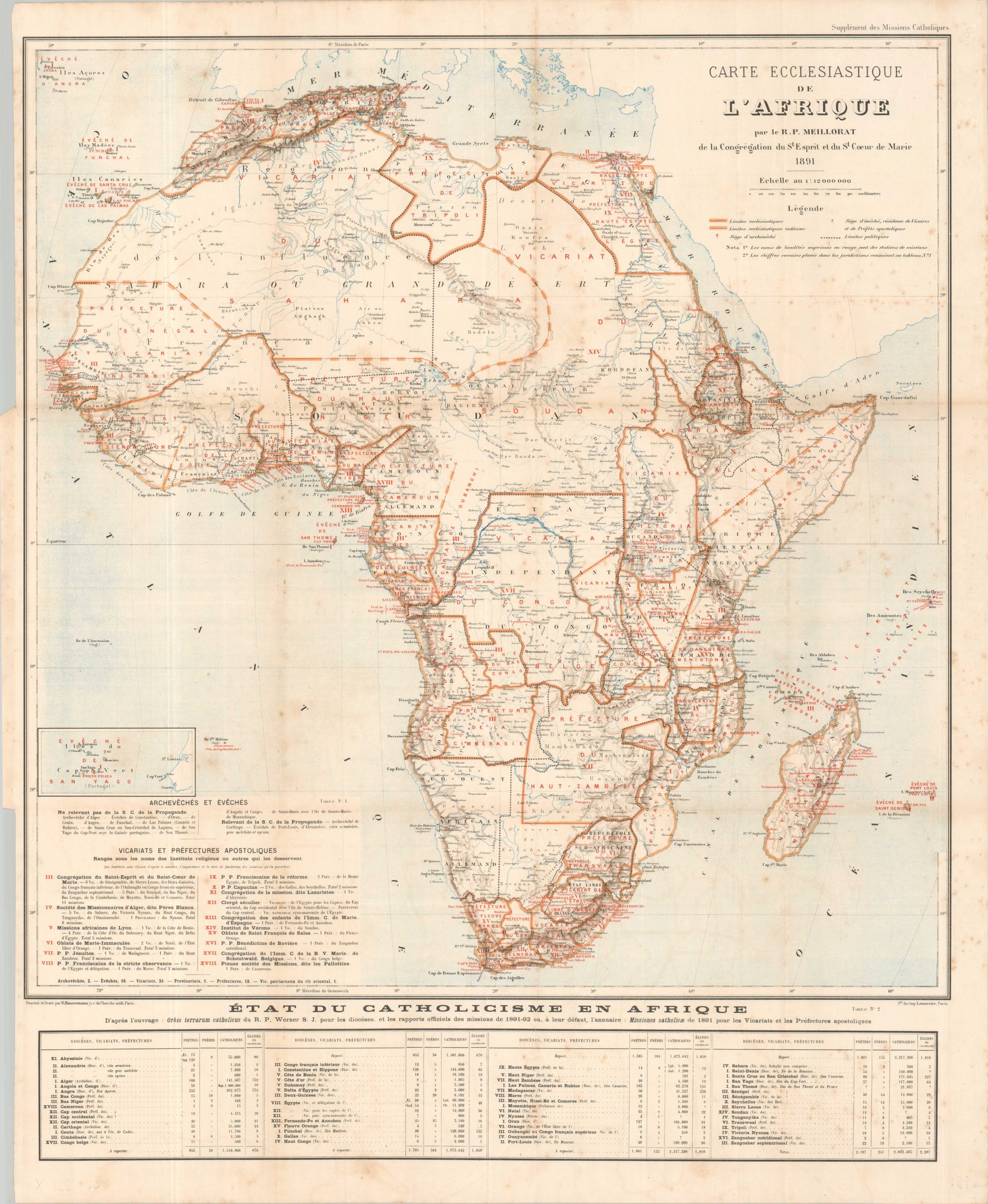
Mapping widespread efforts to convert Africans to Catholicism in the late 19th century.
1 in stock
Description
This fascinating map presents the ‘State of Catholicism in Africa’, according to the Congregation of the Holy Spirit and the Holy Heart of Mary, a French religious congregation known for its missionary work in Africa during the 19th century. The image offers an outline of the continent’s ministerial organization, outlining known and unknown ecclesiastical boundaries, political borders, and the locations of bishoprics and archbishoprics. Tables along the bottom of the page list vicariates and apostolic prefectures, along with the numbers of priests, brothers, churches, and adherents of each.
At the time of publication, there were 2,207 Catholic churches ministering to just over 2.8 million followers of the faith. Of notable political interest is the apparent lack of outreach efforts in Liberia and German Southwest Africa (modern-day Namibia).
The map, dated 1891, was drawn and engraved by R. Hausermann under the authority of R.P. Meillorat of the Congregation of the Holy Spirit and the Holy Heart of Mary. Published in Paris as an annual supplement to the Catholic Missions.
Map Details
Publication Date: 1891
Author: R.P. Meillorat
Sheet Width (in): 28.75
Sheet Height (in): 35.5
Condition: B
Condition Description: Color lithograph map on a somewhat thin sheet, softly creased along originally issued fold lines. Scattered foxing throughout (see scan) and light discoloration/wrinkling along the folds. Minor edge wear (mostly wrinkling) and a narrow left margin, where previously bound. Good condition overall.
Original price was: $450.00.$375.00Current price is: $375.00.
1 in stock