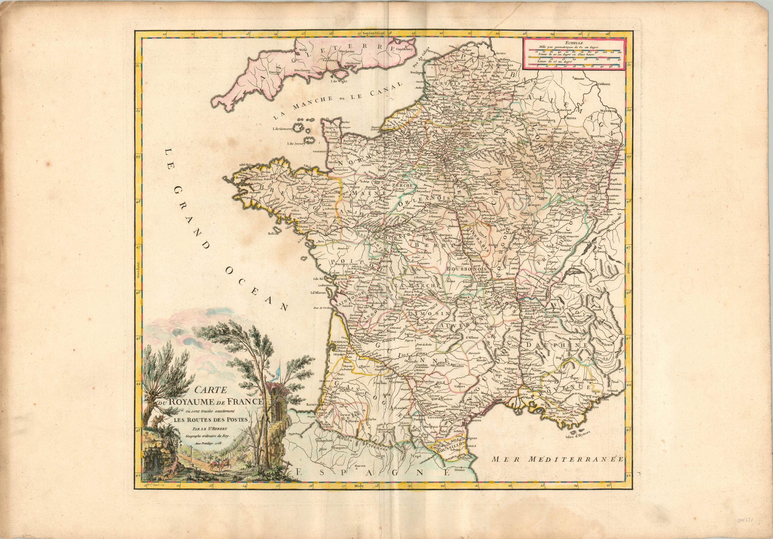
Carte du Royaume de France oui sont tracees exactement les Routes de Postes
$250.00
Beautiful map of France highlighting the complex networks of post roads across the country.
1 in stock
Description
Mounted mail delivery had been a fundamental component of royal French administration from as early as the 16th century. Permanent roadhouses built on well traveled routes, generally emanating from Paris, allowed for the exchange of fresh horses that facilitated the speedy delivery of information. The 18th century saw the most rapid expansion of this network of royal post roads, growing from 10,400 km in 1708 to 26,500 km by 1790.
This map was issued in the midst of that tremendous growth, and the vast web of dotted lines contain numerous red dots, each of which represents a town or stop along the route. The decorative cartouche reinforces the theme with a scene along a post road in the French countryside, complete with riders, a roadhouse, signs, and roadside spring. The map was published in Paris by Robert de Vaugondy for inclusion in his Atlas Universel.
References: Nicolas Verdier, Anne Bretagnolle. Expanding the Network of Postal Routes in France 1708-1833.histoire des réseaux postaux en Europe du XVIIIe au XXIe siècle, May 2007, Paris, France. pp.159-175.
Map Details
Publication Date: 1758
Author: Robert de Vaugondy
Sheet Width (in): 31.25
Sheet Height (in): 21.80
Condition: B+
Condition Description: Moderate creasing, some extraneous, visible along the vertical centerfold. Several dark spots within the image, most noticeably along the English Channel and in the Champagne region. The upper and lower margins are similarly toned. Features nice hand color on thick watermarked paper.
$250.00
1 in stock