Carte du Kamchatka
$60.00
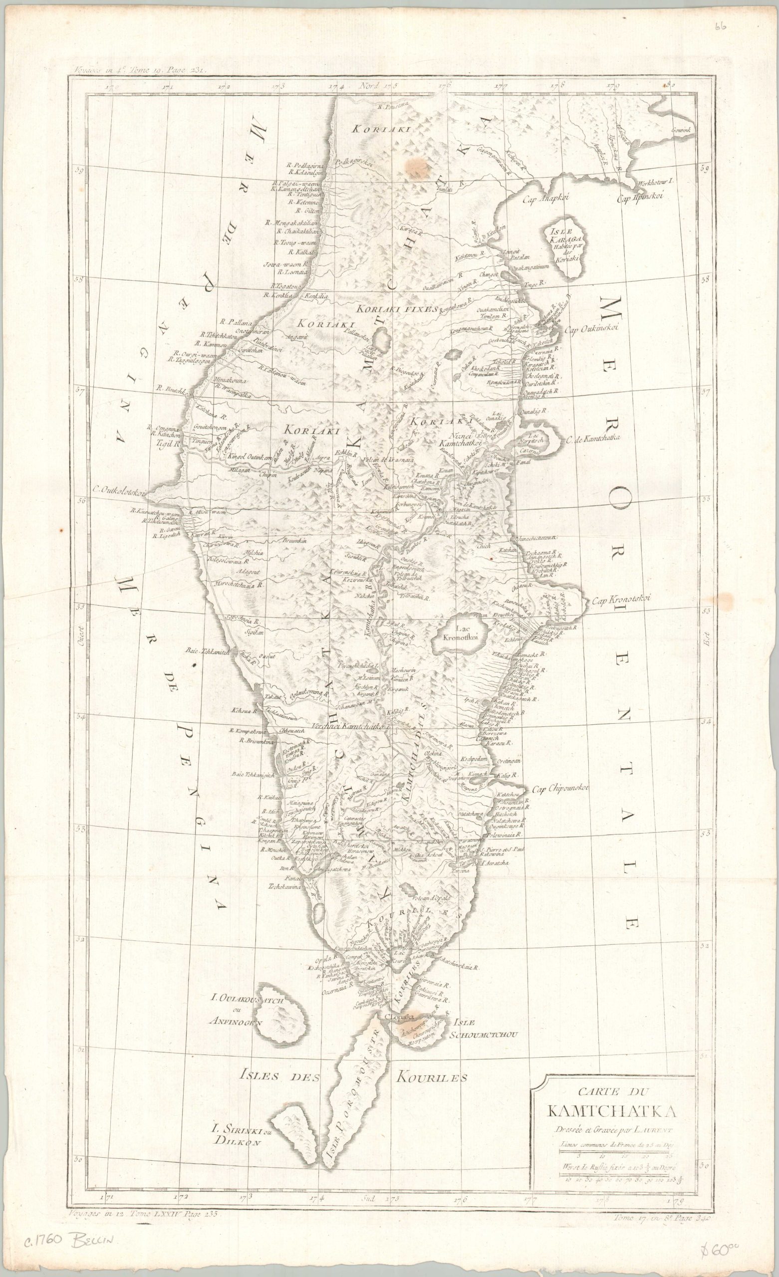
Russia’s remote Kamchatka Peninsula
1 in stock
Description
This striking mid-18th-century French map shows the Kamchatka Peninsula, which at the time was the absolute edge of the known world. Engraved by Laurent for Jacques-Nicholas Bellin’s famous travel books, this sheet served as the primary visual guide to a region that was vital to Russian imperial expansion. Kamchatka was more than just a remote wilderness; it was the essential jumping-off point for Vitus Bering’s historic voyages across the North Pacific, which eventually led to the European discovery of Alaska.
Rather than filling the empty interior with sea monsters or made-up mountain ranges, Bellin used the latest, hard-won survey data derived from Vitus Bering’s historic Second Kamchatka Expedition. The map focuses on practical, scientific details like clean coastal outlines, depth soundings, and early Russian frontier outposts (ostrogs), including the administrative hub of Bolcheretsk and the strategic harbor at Port de Avatcha. Pictorial topography gives the audience a general impression of the unforgiving, rugged terrain—a landscape far better suited to the lucrative maritime fur trade than agricultural pursuits.
Map Details
Publication Date: c. 1760
Author: Jacques Nicholas Bellin
Sheet Width (in): 13.90
Sheet Height (in): 22.60
Condition: B
Condition Description: A faded copperplate impression on a sheet with a sharp crease in the center left. About four spots of foxing clearly visible (see scan). About good condition overall.
$60.00
1 in stock