
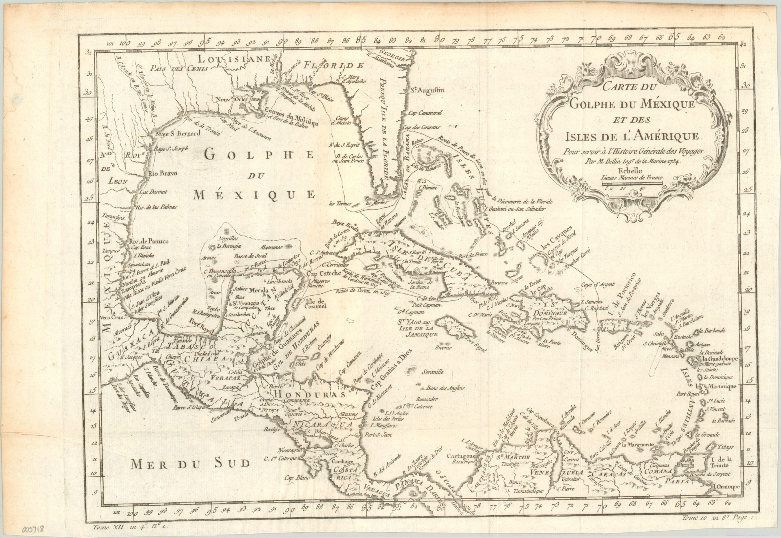
Carte du Golphe du Mexique et des Isles de L’Amerique
Bellin’s map of the Gulf of Mexico designed to accompany l’Abbe Prévost’s Histoire Generale des Voyages.
Out of stock
Description
Jacques Nicholas Bellin was one of the most important cartographers of the 18th century. He was appointed chief cartographer to the French Navy at age 18, and became Official Hydrographer of the French king twenty years later. In that role, Bellin revolutionized the production of sea charts and atlases; setting a high standard of craftsmanship and accuracy that set the bar for European geography.
This map was created to accompany a monumental history of exploration, issued in 15 volumes between by 1746-1759 by Abbé Prévost. This may explain the somewhat dated outline of the Florida peninsula, as well as the decision to include the voyages of some of the region’s famous explorers/conquistadors, including Ponce de Leon and Hernan Cortez. Extensive interior detail is provided for much of Mexico, the Caribbean and South America, but the United States (including much of French territory of Louisiana) is largely blank.
Map Details
Publication Date: 1754
Author: Jacques-Nicholas Bellin
Sheet Width (in): 17.10
Sheet Height (in): 11.60
Condition: A-
Condition Description: Very faint discoloration around the extreme edges of the sheet, and minor creasing along originally issued fold lines. Otherwise excellent.
Out of stock