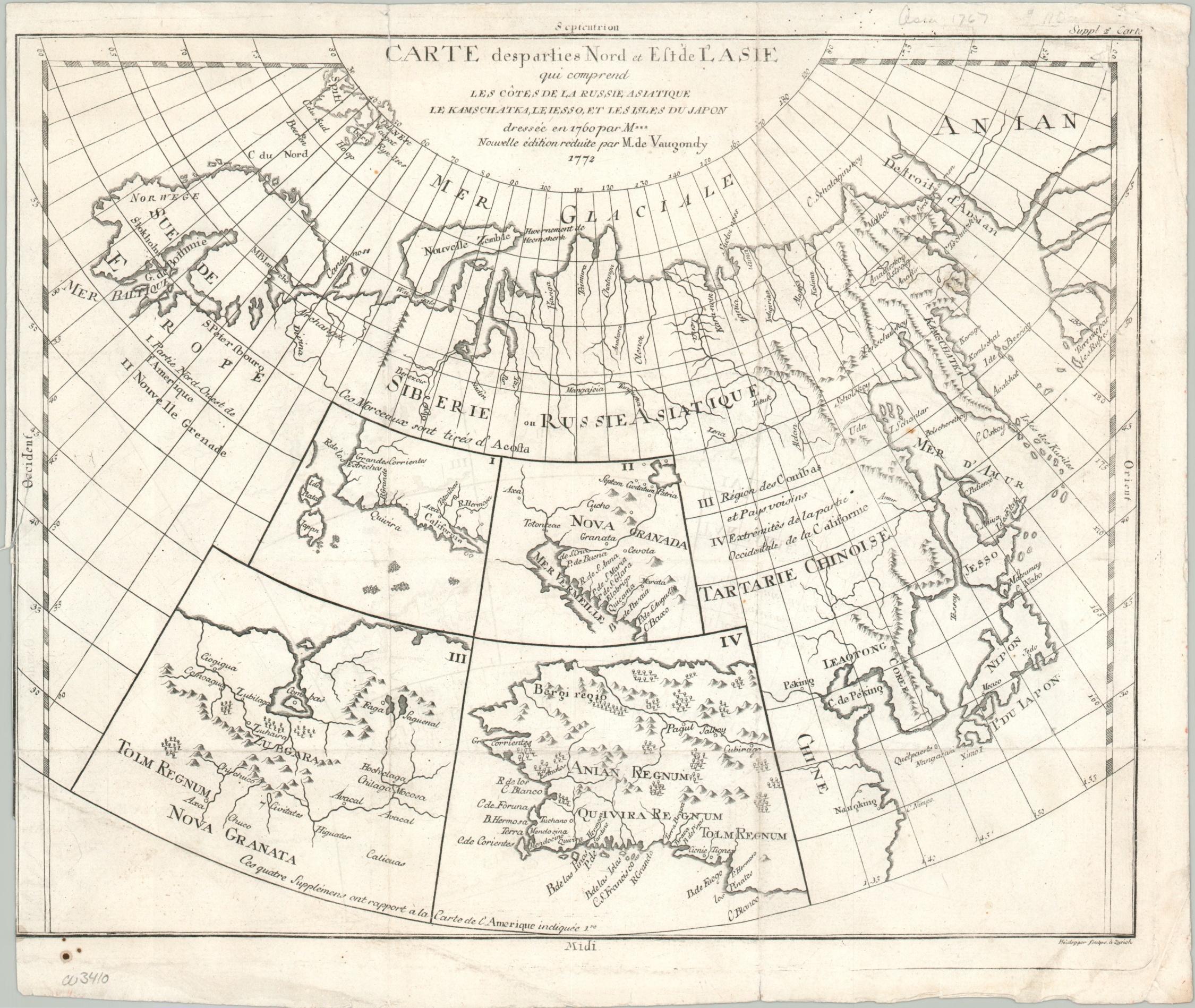
Carte desparties Nort et Est de L’Asie
$150.00
Fascinating map showing the mythical Northwest Passage to Asia.
1 in stock
Description
Covering a huge territory between Scandinavia (upper left) to the largely theoretical coast of Alaska (upper right), this map presents a wealth of information about contemporary and historical cartography. It was compiled by Robert de Vaugondy in 1772 for inclusion in Diderot’s monumental Encyclopedie, a foundational publication of the Enlightenment era.
Geographic details and place names are relatively sparse, but the image provides a broader context to the potential value of the mythical Northwest Passage, apparently accessible by sailing through the Strait of Anian. Four inset maps in the center of the map showcase the historical cartography of Cornelius Wyfliet, who published the first printed atlas dedicated to the Americas in 1597.
Apart from the aforementioned Anian, the insets reference Quivira and the Seven Cities of Gold; two other popular cartographic legends originating from early Spanish explorations on the west coast of North America.
Map Details
Publication Date: 1772
Author: Robert de Vaugondy
Sheet Width (in): 15.20
Sheet Height (in): 12.80
Condition: B+
Condition Description: Minor offsetting within the image and some wear along former fold lines. Uneven margins, spotted in the lower left with a short tear in the center left that's been closed on the verso.
$150.00
1 in stock