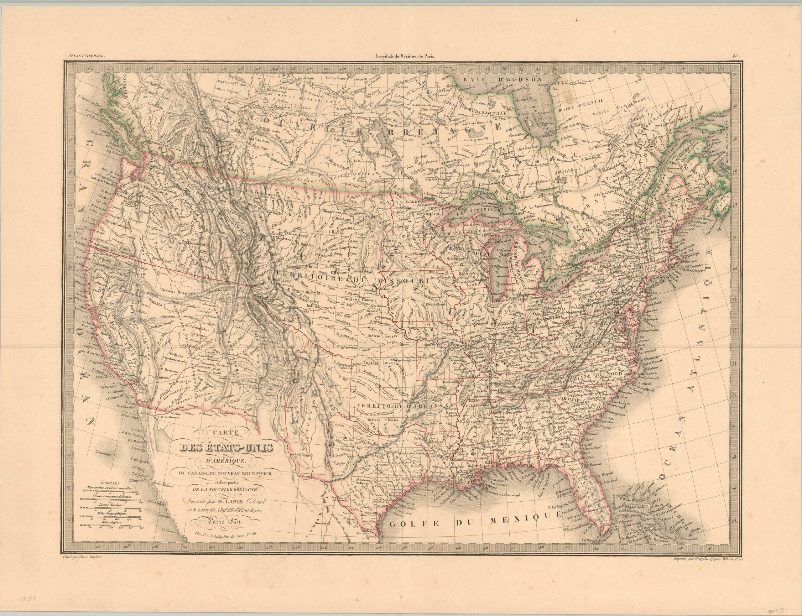
Carte des Etats-Unis D’Amerique
$245.00
A short-lived overview of the United States between the Mexican Cession and the Compromise of 1850.
1 in stock
Description
This incredibly detailed map of the United States and southern Canada was issued as part of Alexandre Lapie’s Atlas Universel de Geographie ancienne et moderne in 1851. Published shortly after the conclusion of the Mexican-American War, the image has yet to incorporate the organizational updates included with the Compromise of 1850 and retains an unresolved border Texan border and no defined boundaries for the new state of California (admitted in 1850).
Finely engraved topographic hachures, significant east/west transportation routes, large territorial designations, labeled geographic landmarks, and numerous Native American tribes reflect the intensive period of westward expansion following the California Gold Rush of 1849. The eastern United States is depicted as fully settled and organized, having enjoyed the prosperity resulting from the Industrial Revolution and significant economic investment in infrastructure projects like railroads and canals.
But the peace and prosperity would not last, and although the Compromise of 1850 was designed to diffuse ongoing political tension between free and slave states, it was a temporary fix that could not withstand the diverging interests of North and South. War would erupt less than a decade after publication.
Map Details
Publication Date: 1851
Author: Alexandre Lapie
Sheet Width (in): 25.25
Sheet Height (in): 19.25
Condition: A-
Condition Description: A few faint spots visible in the lower right margins and Gulf of Mexico/Atlantic Ocean. One smudge is also evident near Hudson's Bay. Otherwise the map is in very good condition, with a bold impression and original outline color.
$245.00
1 in stock

