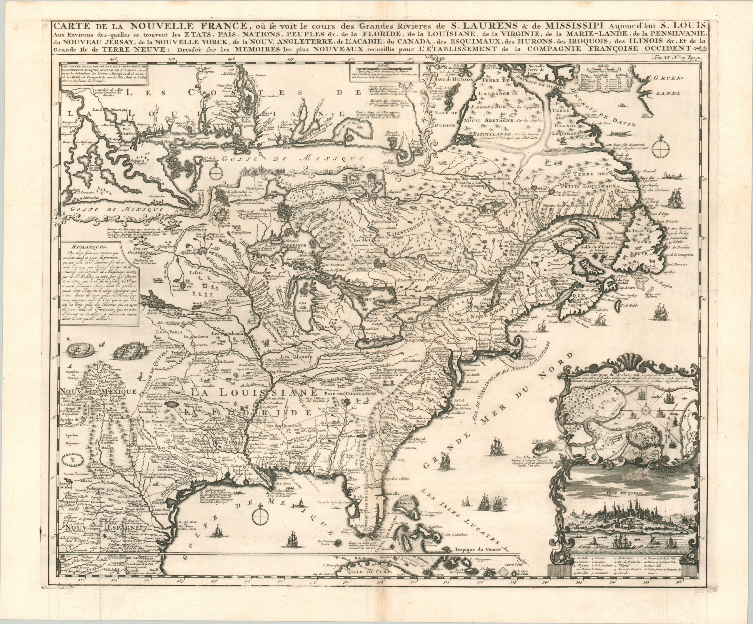
Carte de la Nouvelle France…
Spectacular visual overview of colonial America in the early 18th century.
Out of stock
Description
This stunning map of North America is based largely on a four-sheet wall map published in 1718 by Nicholas de Fer. As a reduction of such a large publication, the map is able to impart a vast amount of information condensed into a skillfully engraved image. Political organization, colonial settlements, geographic features, and Native American villages are labeled throughout, providing a detailed overview of the contemporary cartography
. A variety of small vignettes show further the indigenous people, flora, and fauna across the continent, plus a large variety of nautical vessels ranging from canoes to tall ships. Two insets in the lower right show a bird’s eye view and plan of the capital of New France at Quebec, while a further inset in the upper left shows greater detail along the Gulf of Mexico between the mouth of the Mississippi and the Bay of St. Joseph. Though New Orleans had been founded the year prior to the map’s publication, it is not labeled here.
Numerous annotations provide additional information of interest, especially when confirming French territorial claims. One example to the left identifies the ‘two famous rivers that flow through the country’ (the St. Lawrence and the Mississippi) and recites their history of French exploration.
The map was published in Amsterdam in 1719 as part of Henri Abraham Chatelain’s impressive Atlas Historique. The monumental seven-volume Enlightenment-era work was published between 1705 and 1720 (up to 1739) and functioned as an encyclopedia, atlas, travel book, and historical reference aimed at the wealthy general public. Information on the latest discoveries in the Americas, China, Africa, and the Middle East were constantly updated throughout the publication run, making the work a fascinating window into the geographical excitement of the early 18th century.
Sources: Kershaw #332, Verner and Stuart-Stubbs #11, McCorkle 719.4.
Map Details
Publication Date: 1719
Author: Henri Chatelain
Sheet Width (in): 21.60
Sheet Height (in): 17.90
Condition: A-
Condition Description: Light creasing, wear, and a bit of faint discoloration along former fold lines, though most evident along the vertical centerfold. Some inking from the plate strike along the outer edges of the plate line. Very good overall. A crisp impression on a clean sheet.
Out of stock

