Carte de Duche de Luxembourg
Elaborate mid-18th century French map of the Duchy of Luxemborg.
Out of stock
Description
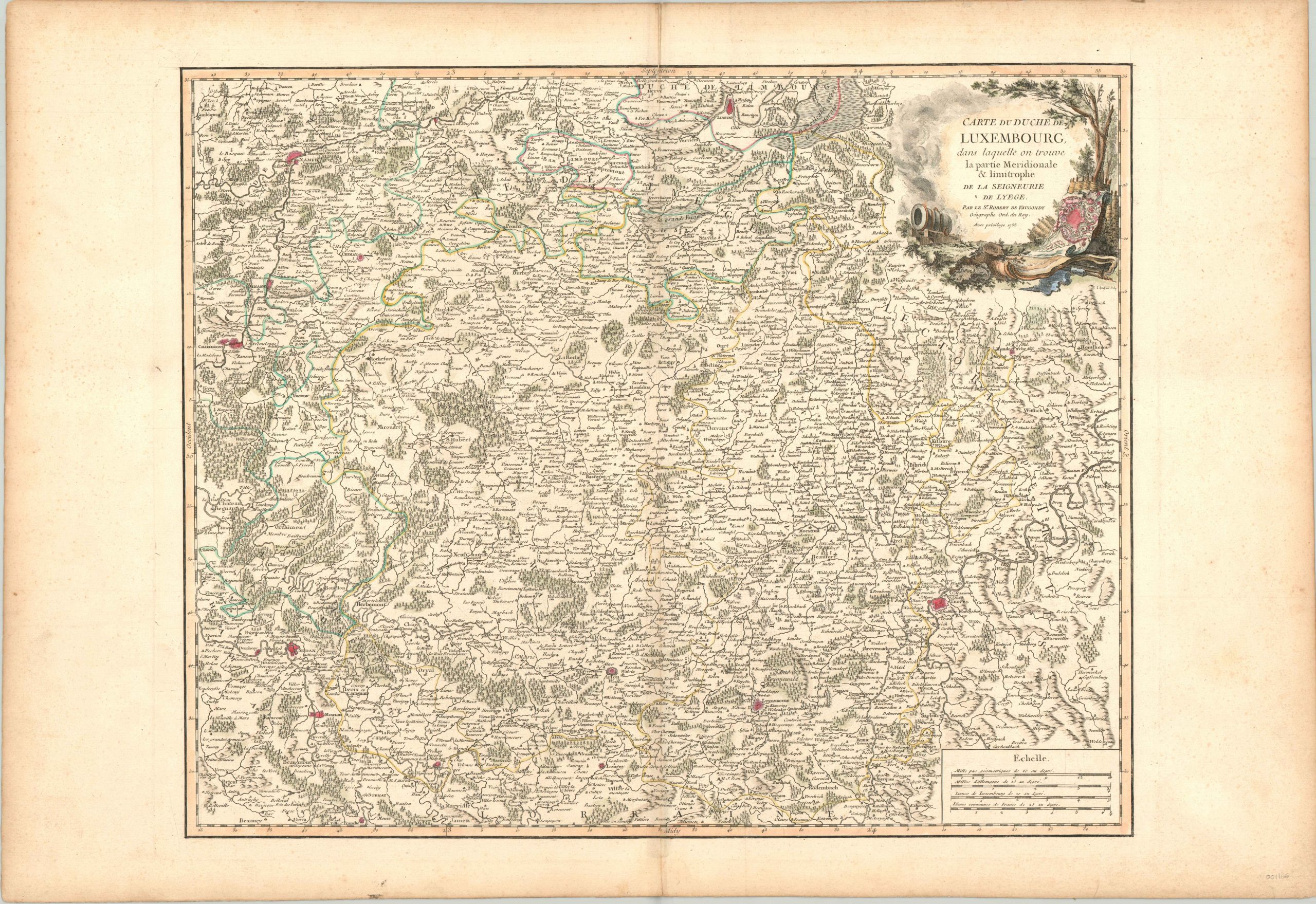
Despite its diminutive stature, the Grade Duchy of Luxembourg has played a pivotal role in the history of European politics. Beginning as a fortress built on Roman ruins in the 10th century, the region would eventually become a fief in the Holy Roman Empire before it was promoted to Duchy status in 1354. Situated at an important intersection of roads leading throughout France, Germany, and the Netherlands, Luxembourg’s fortifications would lead it to become known as “The Gibraltar of the North.”
This map, published by Robert de Vaugondy in 1753, shows the duchy during its rule under the Hapsburg Monarchy of Austria. Fortified towns and cities are highlighted in bright red while faint touches of accent color around the trees and pictorial relief add vibrancy to the image. The decorative cartouche also reference the legendary defensive structures, featuring a large mortar used in siege warfare and a plan of the city’s walls.
Map Details
Publication Date: 1753
Author: Robert de Vaugondy
Sheet Width (in): 32
Sheet Height (in): 22
Condition: A-
Condition Description: Minor wear along centerfold and faint soiling in the margins. Lovely hand color, with a bold impression on a strong sheet.
Out of stock