Captain Bryan’s Pacific War Atlas
A 1942 Pacific War Atlas published in Honolulu.
Out of stock

Description
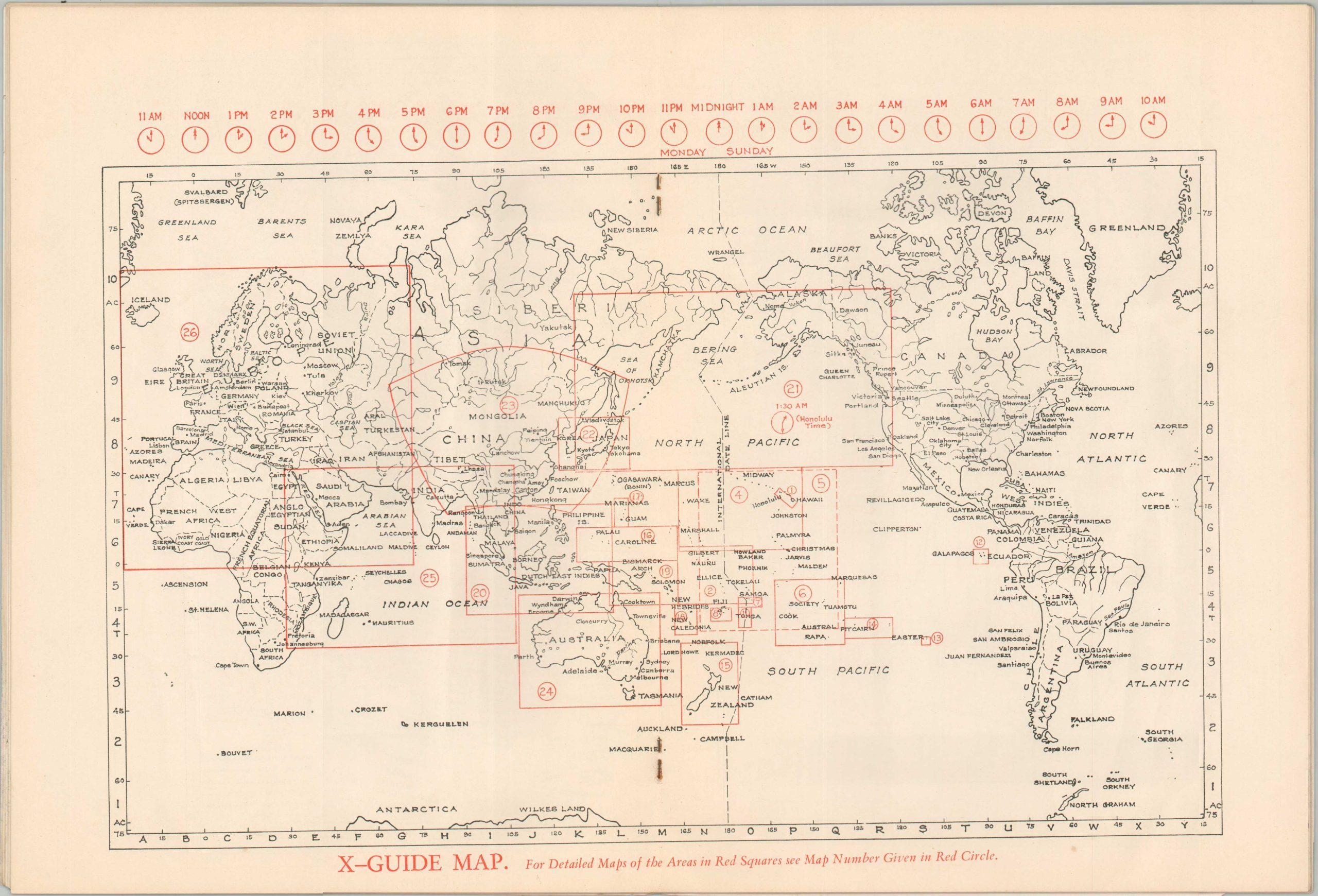
“Special care has been given to the Pacific and Oriental regions because (1) these are least known to American readers, (2) detail maps of other regions are more readily available, and (3) we believe that war activities soon will be confined to these areas.” – Preface.
This fascinating WWII atlas was published in Honolulu, Hawaii by the Tongg Publishing Company in 1942. It was compiled by local scholar and Bishop Museum curator Edwin H. Bryan, Jr.
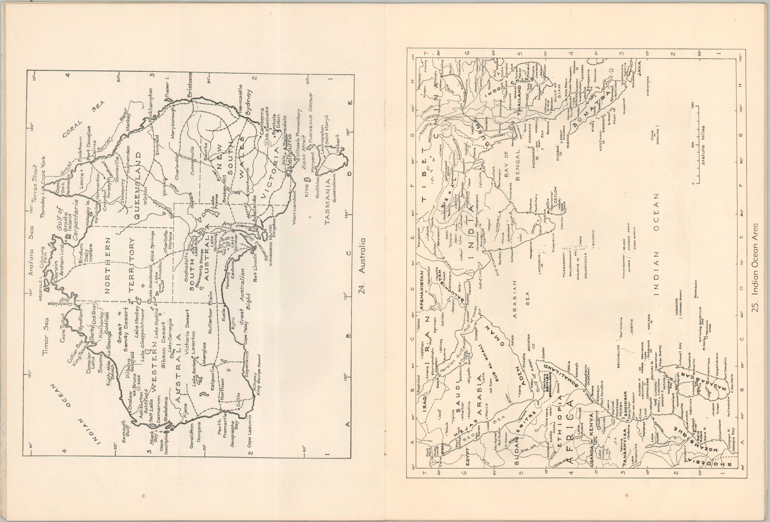
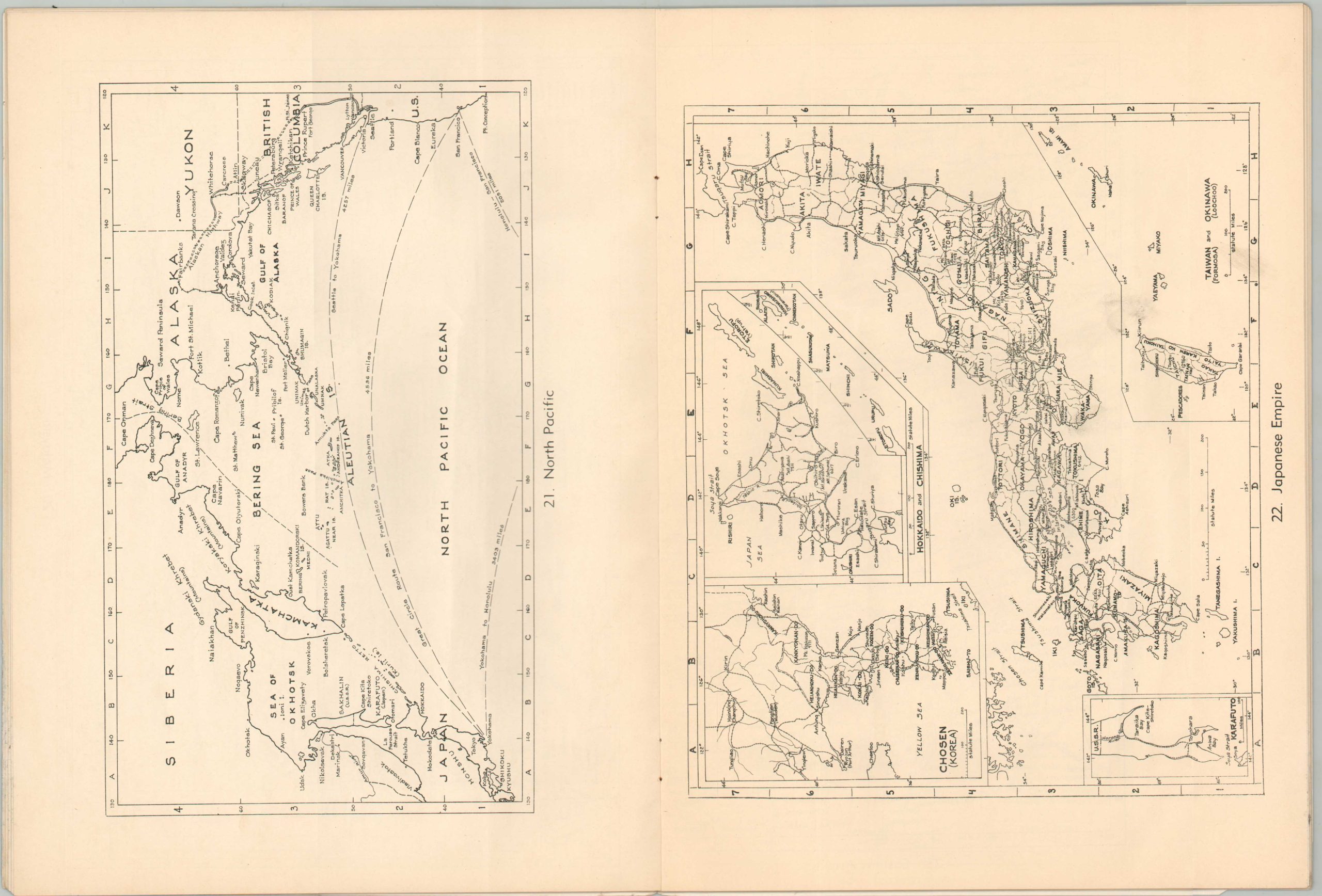
The contents include twenty-six numbered maps (some of which are composites of smaller plans, totaling 75 maps in all) that cover various strategic areas across the Pacific (one shows Europe and North Africa). A comprehensive index pinpoints the location of over 5,000 place names – a handy reference for those family members anxious to know more about their loved ones serving overseas.
Map Details
Publication Date: 1942
Author: Edwin H. Bryan, Jr.
Sheet Width (in): 9
Sheet Height (in): 12
Condition: B+
Condition Description: Unpaginated, but approximately 40 pp. atlas bound with staples in original illustrated paper wraps. The first six sheets are affected by dampstaining/mold (now inert) in the lower right corner. Scattered creasing, dirty fingerprints, and other signs of age and use. Good condition overall.
Out of stock