
Candrain’s Double Indexed Street Number Guide of San Francisco with Car-O-Grams and New Map
$180.00
San Francisco during the Interwar Period.
1 in stock


Description
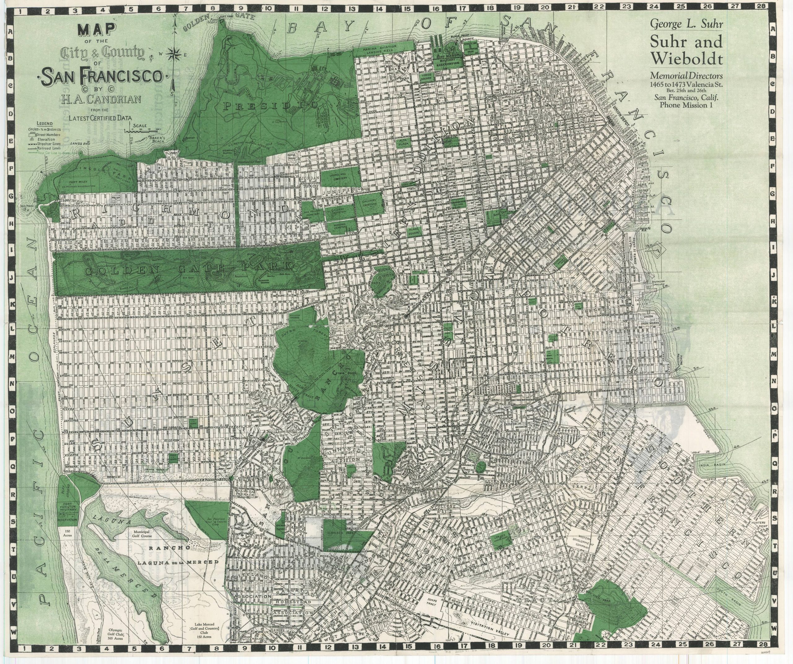
Herman Anton Candrian (1862-1928) created street maps, guidebooks, and reference publications for his hometown of San Francisco as early as 1903. In 1917, he introduced a novel way of depicting the routes of electric streetcar lines that he called ‘Car-O-Grams’. Similar to the later AAA strip maps of auto highways, these simple graphical representations provided valuable information for travelers in a succinct, easy-to-comprehend style.
This is a nice example of Candrian’s 1925 guidebook and map of San Francisco. The 96 pages include a comprehensive street index, over 3 dozen ‘Car-O-Grams’, and numerous contemporary advertisements. A large lithographed folding city plan is also included. Park areas, ranchos, and public spaces are highlighted in green while railroads, streetcar lines, and the ‘new’ car line between St. Francis Circle and Oceanview are shown according to the legend in the upper left.
Map Details
Publication Date: c. 1925
Author: H.A. Candrian
Sheet Width (in): 26.4
Sheet Height (in): 22
Condition: B+
Condition Description: 96 pp. guidebook with stapled binding and original blue stiff paper wraps. Covers are scuffed and soiled and the contents show light toning, consistent with age and use. Includes disbound folding map with separation along fold lines and at fold intersections, repaired on verso. Two holes in the center from where roughly disbound, but otherwise in good condition.
$180.00
1 in stock