
Canada’s Ice-Field Highway
$40.00
Postwar tourist map of Canada’s rugged Ice Field Highway.
1 in stock
Description
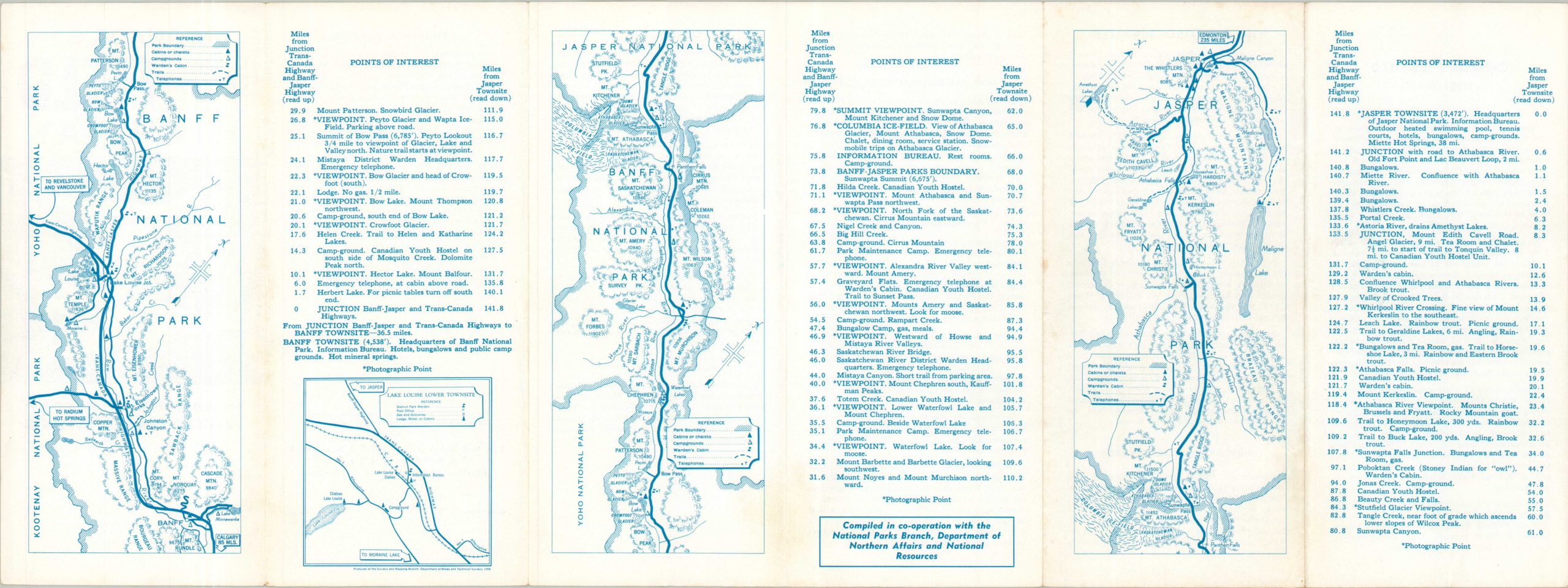
This straightforward map presents the ~ 142-mile route of the Ice Field Highway, connecting the popular Alberta resort towns of Banff and Jasper through Canada’s Rocky Mountains. The National Parks of the same name are prominently outlined, with lightly hachured topography giving only the faintest impression of the rugged landscape. An inset of Lake Louise shows details about one of the most popular destinations along the route. Descriptive text can be found on the verso.
The map was compiled by the Surveys and Mapping Branch, Department of Mines and Technical Surveys. Published in 1959 by the Canadian Government Travel Bureau, under the Minister of Northern Affairs and National Resources, Walter Dinsdale.
Map Details
Publication Date: 1959
Author: Surveys and Mapping Branch, Department of Mines and Technical Surveys
Sheet Width (in): 23.90
Sheet Height (in): 8.90
Condition: A-
Condition Description: Double-sided folding brochure with minor toning along folds and along the outer edges of the sheet. A bit of light spotting. Good to very good overall.
$40.00
1 in stock