Campus Map University of Alabama
Aerial view of the University of Alabama from 1970.
Out of stock
Description
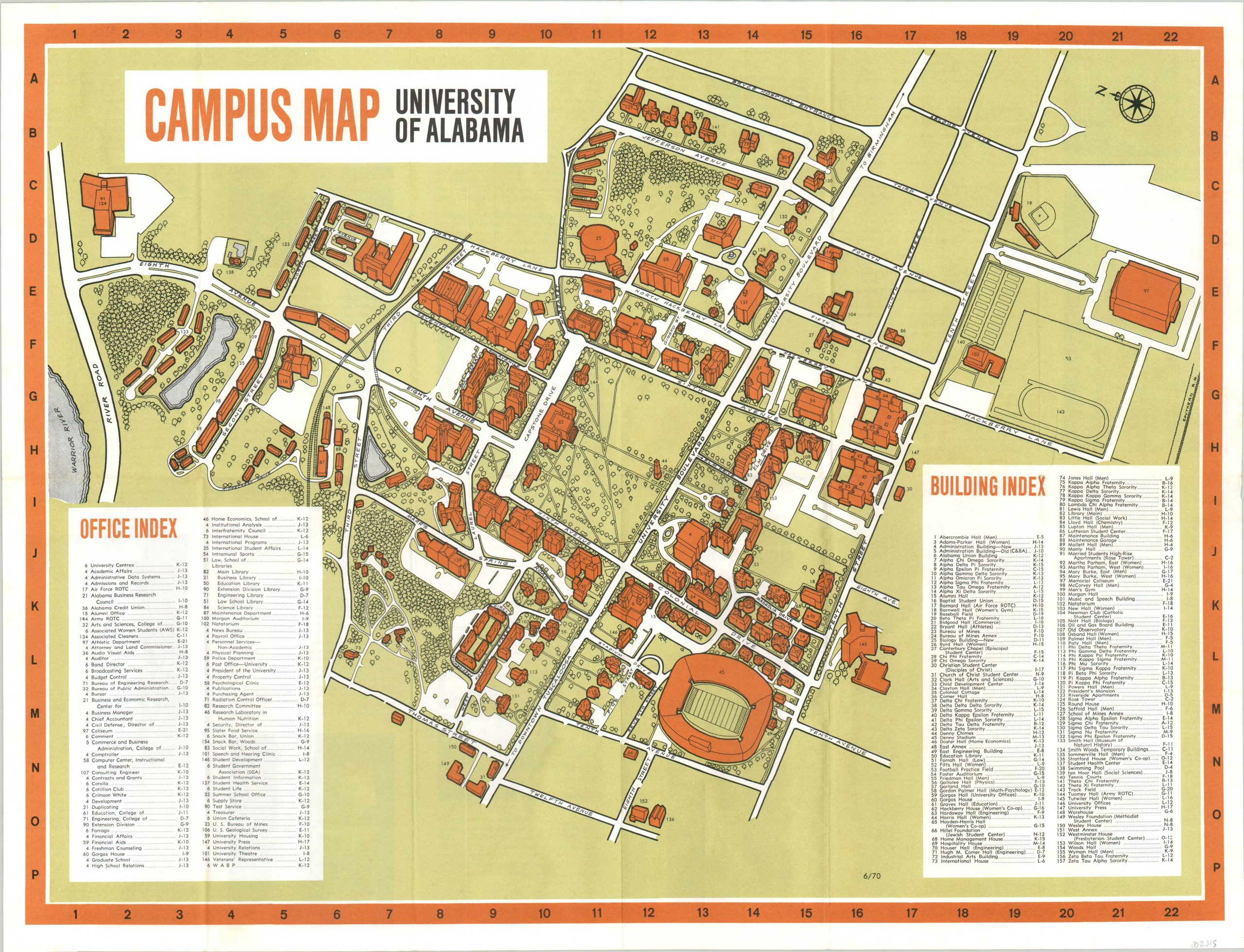
This detailed plan of the University of Alabama in Tuscaloosa was published by the school as a campus guide in 1970. Angled profile views of the major buildings are numbered in labeled in the corresponding indices in the lower corners.
Transportation routes, parking lots, trees, and athletic fields are also illustrated. Text on the verso provides a wealth of information on the institution since it’s official opening in 1831.
Map Details
Publication Date: 1970
Author: University of Alabama
Sheet Width (in): 23.50
Sheet Height (in):
Condition: A-
Condition Description: Light wear and a bit of extraneous creasing along originally issued fold lines. A small pinhole at the fold intersection on the right side, above the Building Index, but overall in very good to near fine condition.
Out of stock