Campus Map University of Alabama
1966 campus guide to the University of Alabama.
Out of stock
Description
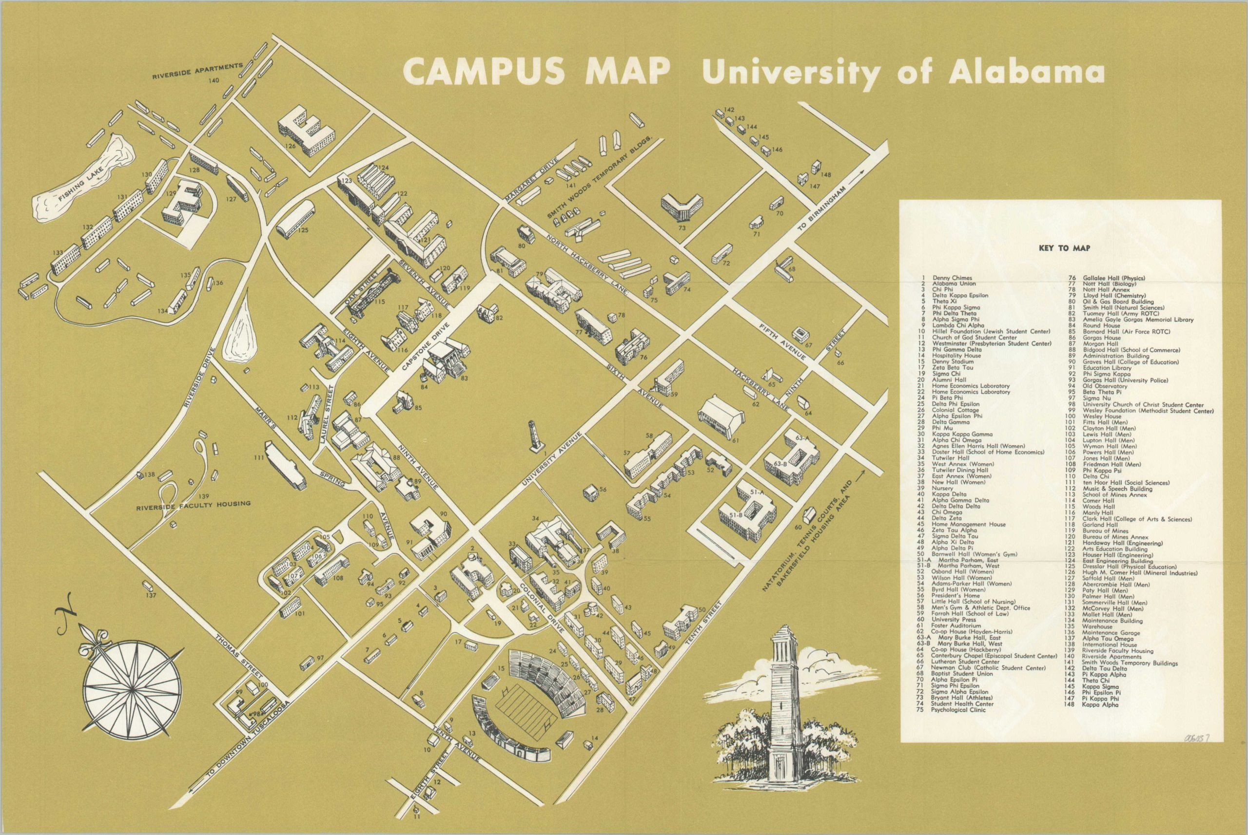
Nearly 150 different buildings – dormitories, fraternities, athletic facilities, labs, classrooms, and more – are identified on this 1966 campus plan of the University of Alabama. An aerial perspective, oriented with northeast at the top of the page, provides an easy-to-read reference for visitors and students alike.
Streets are labeled, along with several residential areas. Of interest is Smith Woods, noted as temporary structures. Printed text, photographs, and a university telephone directory are provided on the verso
Map Details
Publication Date: 1966
Author: University of Alabama
Sheet Width (in): 17.8
Sheet Height (in): 11.8
Condition: A
Condition Description: Creasing and light wear along originally issued fold lines. Near fine condition overall.
Out of stock