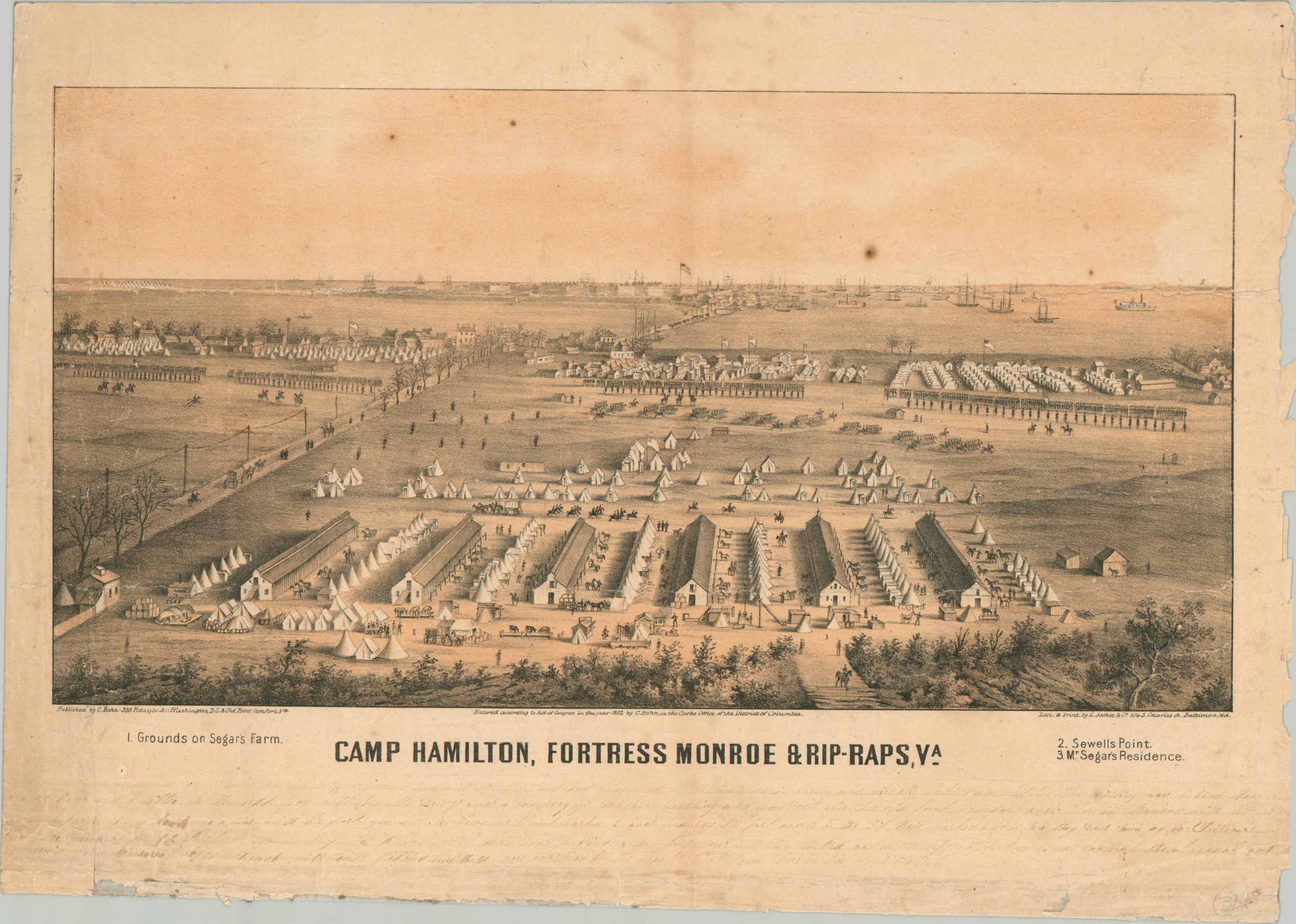
Camp Hamilton, Fortress Monroe & Rip-Raps, VA
An interesting view of Fort Monroe during the American Civil War.
Out of stock
Description
This detailed Civil War-era view presents an aerial perspective of the strategically important Fort Monroe, situated at the tip of the Virginia Peninsula to guard the water approach to Hampton Roads. If my understanding of local geography is correct, the fort sits in the background, with the Federal fleet anchored off Norfolk. The foreground is occupied by Camp Hamilton, situated across Mill Creek and constructed in 1861 due to overcrowding at the fort.
The camp was the first Army post erected on Confederate soil, on grounds belonging to a farmer named Segar. His residence is among 3 landmarks noted within the image. Also of interest is several lines of faint manuscript writing along the lower margin. Though barely legible, the old cursive script appears to offer a physical description of the area.
The view was drawn and lithographed by the Baltimore-based firm of Edward Sachse. Published by Casimir Bohn in Washington, D.C. in 1862.
Sources: Chrysler Museum; Historical Marker Database;
Map Details
Publication Date: 1862
Author: Edward Sachse
Sheet Width (in): 17.9
Sheet Height (in): 12.75
Condition: B
Condition Description: Tinted lithographed expertly conserved and mounted onto linen, with a few visible closed tears and wrinkles upon close inspection. Heavy wear along the edges, especially on the right side, including numerous chips and minor paper loss. Several dark spots of foxing within the image, as well as a vertical seam of discoloration near the center. Old ink writing, hardly legible, near the bottom of the page. About good condition overall
Out of stock