Camp D’Israel
The wilderness encampment of the Tribes of Israel.
Out of stock
Description
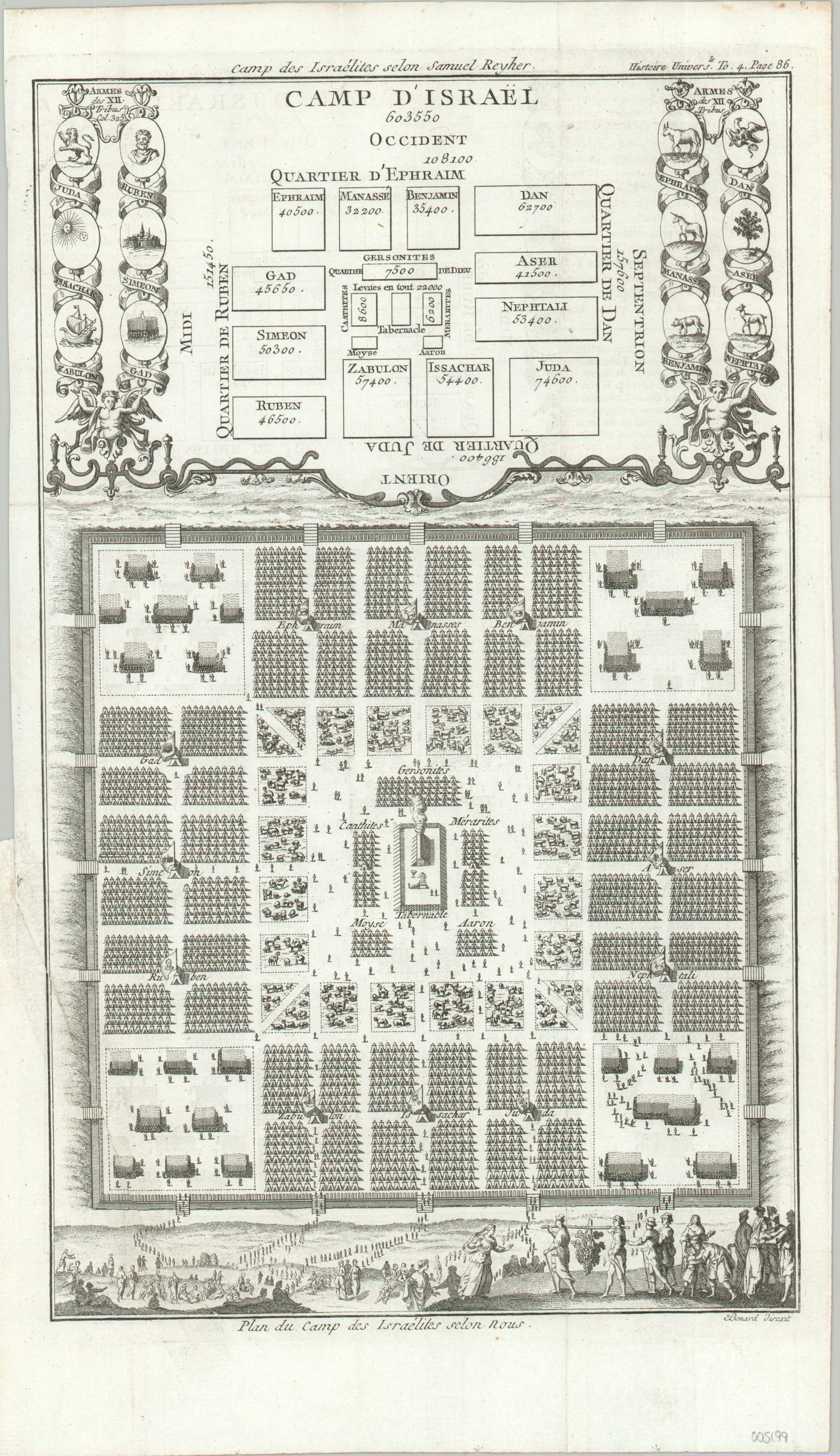
This fascinating diagram was engraved under the direction of Robert Benard and originally published in a French edition of An Universal History from the Earliest Account of Time to the Present. The image is based on information available in the Old Testament, was well as the scholarship of mathematician and theologian Samuel Reyher (1635 – 1714).
It shows a schematic and pictorial representation of the Twelve Tribes of Israel, situated around the Tabernacle after the Exodus from Egypt. The upper half presents the coats of arms (assigned around the 12th century), as well as the respective population of each tribe – totaling about 600,000 Israelites. The lower portion of the sheet shows an illustrated perspective of the encampment, with a few artistic liberties taken in the depiction of livestock enclosures, an encircling wall/ditch, and what appear to be groups of soldiers.
Map Details
Publication Date: c. 1780
Author: Robert Benard
Sheet Width (in): 9.2
Sheet Height (in): 15.9
Condition: B+
Condition Description: Large 6" tear on the left side where previously bound, closed and repaired on the verso with archival tape. Soft creasing along originally issued fold lines. Good to very good overall.
Out of stock